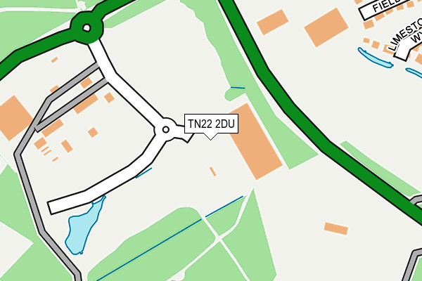
TN22 2DU is located in the Maresfield electoral ward, within the local authority district of Wealden and the English Parliamentary constituency of Wealden. The Sub Integrated Care Board (ICB) Location is NHS Sussex ICB - 97R and the police force is Sussex. This postcode has been in use since October 2016.


GetTheData
Source: OS OpenMap – Local (Ordnance Survey)
Source: OS VectorMap District (Ordnance Survey)
Licence: Open Government Licence (requires attribution)
| Easting | 545831 |
| Northing | 123571 |
| Latitude | 50.993064 |
| Longitude | 0.076641 |
GetTheData
Source: Open Postcode Geo
Licence: Open Government Licence
| Country | England |
| Postcode District | TN22 |
| ➜ TN22 open data dashboard ➜ See where TN22 is on a map | |
GetTheData
Source: Land Registry Price Paid Data
Licence: Open Government Licence
Elevation or altitude of TN22 2DU as distance above sea level:
| Metres | Feet | |
|---|---|---|
| Elevation | 40m | 131ft |
Elevation is measured from the approximate centre of the postcode, to the nearest point on an OS contour line from OS Terrain 50, which has contour spacing of ten vertical metres.
➜ How high above sea level am I? Find the elevation of your current position using your device's GPS.
GetTheData
Source: Open Postcode Elevation
Licence: Open Government Licence
| Ward | Maresfield |
| Constituency | Wealden |
GetTheData
Source: ONS Postcode Database
Licence: Open Government Licence
| June 2022 | Public order | On or near A272 | 242m |
| June 2022 | Violence and sexual offences | On or near Forest Park | 476m |
| June 2022 | Vehicle crime | On or near Forest Park | 476m |
| ➜ Get more crime data in our Crime section | |||
GetTheData
Source: data.police.uk
Licence: Open Government Licence
| Nutley Road (A22) | Maresfield | 325m |
| Parklands (Batts Bridge Road) | Maresfield | 507m |
| Parklands (Batts Bridge Rd) | Maresfield | 610m |
| Church (Batts Bridge Rd) | Maresfield | 867m |
| Church (Batts Bridge Rd) | Maresfield | 880m |
| Uckfield Station | 3km |
| Buxted Station | 3.9km |
GetTheData
Source: NaPTAN
Licence: Open Government Licence
GetTheData
Source: ONS Postcode Database
Licence: Open Government Licence


➜ Get more ratings from the Food Standards Agency
GetTheData
Source: Food Standards Agency
Licence: FSA terms & conditions
| Last Collection | |||
|---|---|---|---|
| Location | Mon-Fri | Sat | Distance |
| Maresfield Post Office | 17:15 | 10:45 | 933m |
| Hempstead Road | 17:00 | 09:00 | 1,058m |
| Nursery | 16:45 | 10:00 | 1,149m |
GetTheData
Source: Dracos
Licence: Creative Commons Attribution-ShareAlike
| Facility | Distance |
|---|---|
| Maresfield Lawn Tennis Club Batts Bridge Road, Maresfield, Uckfield Outdoor Tennis Courts | 321m |
| Wealden Bowls Centre Batts Bridge Road, Maresfield, Uckfield Indoor Bowls | 323m |
| Oakwood Park Polo Club Maresfield By Pass, Maresfield, Uckfield Grass Pitches | 331m |
GetTheData
Source: Active Places
Licence: Open Government Licence
| School | Phase of Education | Distance |
|---|---|---|
| Bonners CofE School School Hill, Maresfield, Uckfield, TN22 2EG | Primary | 1.1km |
| Rocks Park Primary School Lashbrooks Road, Uckfield, TN22 2AY | Primary | 2.4km |
| Uckfield College Downsview Crescent, Uckfield, TN22 3DJ | Secondary | 2.7km |
GetTheData
Source: Edubase
Licence: Open Government Licence
The below table lists the International Territorial Level (ITL) codes (formerly Nomenclature of Territorial Units for Statistics (NUTS) codes) and Local Administrative Units (LAU) codes for TN22 2DU:
| ITL 1 Code | Name |
|---|---|
| TLJ | South East (England) |
| ITL 2 Code | Name |
| TLJ2 | Surrey, East and West Sussex |
| ITL 3 Code | Name |
| TLJ22 | East Sussex CC |
| LAU 1 Code | Name |
| E07000065 | Wealden |
GetTheData
Source: ONS Postcode Directory
Licence: Open Government Licence
The below table lists the Census Output Area (OA), Lower Layer Super Output Area (LSOA), and Middle Layer Super Output Area (MSOA) for TN22 2DU:
| Code | Name | |
|---|---|---|
| OA | E00107421 | |
| LSOA | E01021146 | Wealden 013A |
| MSOA | E02004415 | Wealden 013 |
GetTheData
Source: ONS Postcode Directory
Licence: Open Government Licence
| TN22 2HX | Queens Drive | 422m |
| TN22 2DF | Limestone Way | 445m |
| TN22 2HL | Batts Bridge Road | 455m |
| TN22 2DJ | Field End | 459m |
| TN22 2DP | Bloomery Way | 469m |
| TN22 2DN | Bellows Close | 496m |
| TN22 2NA | Forest Park | 529m |
| TN22 2HU | Parklands | 530m |
| TN22 2HR | Parklands | 533m |
| TN22 2BF | Rolling Mill | 537m |
GetTheData
Source: Open Postcode Geo; Land Registry Price Paid Data
Licence: Open Government Licence