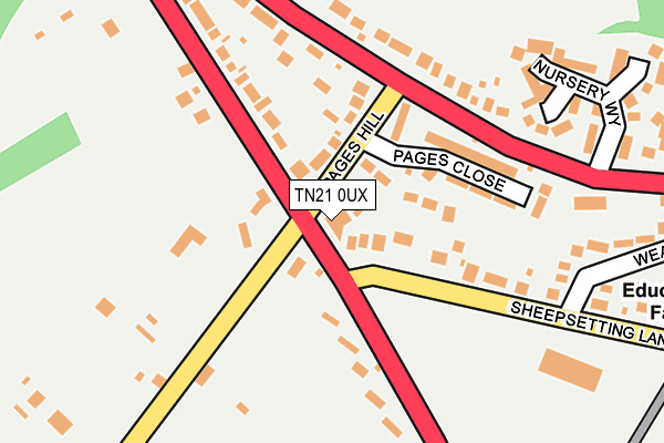
TN21 0UX is located in the Heathfield North electoral ward, within the local authority district of Wealden and the English Parliamentary constituency of Bexhill and Battle. The Sub Integrated Care Board (ICB) Location is NHS Sussex ICB - 97R and the police force is Sussex. This postcode has been in use since January 1980.


GetTheData
Source: OS OpenMap – Local (Ordnance Survey)
Source: OS VectorMap District (Ordnance Survey)
Licence: Open Government Licence (requires attribution)
| Easting | 557178 |
| Northing | 121276 |
| Latitude | 50.969461 |
| Longitude | 0.237182 |
GetTheData
Source: Open Postcode Geo
Licence: Open Government Licence
| Country | England |
| Postcode District | TN21 |
| ➜ TN21 open data dashboard ➜ See where TN21 is on a map ➜ Where is Heathfield? | |
GetTheData
Source: Land Registry Price Paid Data
Licence: Open Government Licence
Elevation or altitude of TN21 0UX as distance above sea level:
| Metres | Feet | |
|---|---|---|
| Elevation | 150m | 492ft |
Elevation is measured from the approximate centre of the postcode, to the nearest point on an OS contour line from OS Terrain 50, which has contour spacing of ten vertical metres.
➜ How high above sea level am I? Find the elevation of your current position using your device's GPS.
GetTheData
Source: Open Postcode Elevation
Licence: Open Government Licence
| Ward | Heathfield North |
| Constituency | Bexhill And Battle |
GetTheData
Source: ONS Postcode Database
Licence: Open Government Licence
| June 2022 | Criminal damage and arson | On or near Park/Open Space | 261m |
| June 2022 | Violence and sexual offences | On or near Park/Open Space | 261m |
| June 2022 | Violence and sexual offences | On or near Nursery Way | 273m |
| ➜ Get more crime data in our Crime section | |||
GetTheData
Source: data.police.uk
Licence: Open Government Licence
| Pages Hill (Cross In Hand Road) | Heathfield | 130m |
| Pages Hill (Cross In Hand Road) | Heathfield | 145m |
| Little London Road (Cross In Hand Road) | Heathfield | 210m |
| Little London Road (Cross In Hand Road) | Heathfield | 223m |
| Fire Station (High Street) | Heathfield | 571m |
GetTheData
Source: NaPTAN
Licence: Open Government Licence
GetTheData
Source: ONS Postcode Database
Licence: Open Government Licence


➜ Get more ratings from the Food Standards Agency
GetTheData
Source: Food Standards Agency
Licence: FSA terms & conditions
| Last Collection | |||
|---|---|---|---|
| Location | Mon-Fri | Sat | Distance |
| Tilsmore Corner | 17:00 | 09:00 | 731m |
| Station House | 16:45 | 09:00 | 903m |
| Heathfield Post Office | 17:30 | 11:30 | 952m |
GetTheData
Source: Dracos
Licence: Creative Commons Attribution-ShareAlike
| Facility | Distance |
|---|---|
| Sheepsetting Lane Recreation Ground Sheepsetting Lane, Cross In Hand, Heathfield Grass Pitches | 221m |
| Hardy Roberts Playing Field Cross In Hand, Heathfield Grass Pitches, Outdoor Tennis Courts | 958m |
| Isenhurst Health Club (Cross In Hand) Mayfield Road, Cross In Hand, Heathfield Swimming Pool, Health and Fitness Gym, Studio | 986m |
GetTheData
Source: Active Places
Licence: Open Government Licence
| School | Phase of Education | Distance |
|---|---|---|
| Cross-in-Hand Church of England Primary School Sheepsetting Lane, Cross in Hand, Heathfield, TN21 0XG | Primary | 403m |
| Virtue Therapeutic School Sussex VTSS Oak View, Mayfield Flat, Cross-in-Hand, Heathfield, TN21 0TU | Not applicable | 2.1km |
| Parkside Community Primary School Beechwood Lane, Heathfield, TN21 8QQ | Primary | 2.1km |
GetTheData
Source: Edubase
Licence: Open Government Licence
The below table lists the International Territorial Level (ITL) codes (formerly Nomenclature of Territorial Units for Statistics (NUTS) codes) and Local Administrative Units (LAU) codes for TN21 0UX:
| ITL 1 Code | Name |
|---|---|
| TLJ | South East (England) |
| ITL 2 Code | Name |
| TLJ2 | Surrey, East and West Sussex |
| ITL 3 Code | Name |
| TLJ22 | East Sussex CC |
| LAU 1 Code | Name |
| E07000065 | Wealden |
GetTheData
Source: ONS Postcode Directory
Licence: Open Government Licence
The below table lists the Census Output Area (OA), Lower Layer Super Output Area (LSOA), and Middle Layer Super Output Area (MSOA) for TN21 0UX:
| Code | Name | |
|---|---|---|
| OA | E00107433 | |
| LSOA | E01021150 | Wealden 010A |
| MSOA | E02004412 | Wealden 010 |
GetTheData
Source: ONS Postcode Directory
Licence: Open Government Licence
| TN21 0UU | Pages Hill | 97m |
| TN21 0UY | Sheepsetting Lane | 100m |
| TN21 0UZ | Pages Close | 123m |
| TN21 0UT | Cross In Hand Road | 165m |
| TN21 0LS | 233m | |
| TN21 0LT | 242m | |
| TN21 0UW | Nursery Way | 261m |
| TN21 0LU | 293m | |
| TN21 0XA | Wealdview Road | 325m |
| TN21 0UR | Cross In Hand Road | 330m |
GetTheData
Source: Open Postcode Geo; Land Registry Price Paid Data
Licence: Open Government Licence