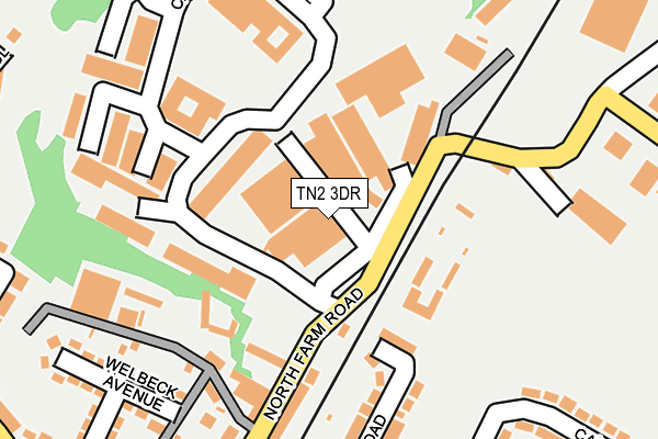
TN2 3DR is located in the Southborough and High Brooms electoral ward, within the local authority district of Tunbridge Wells and the English Parliamentary constituency of Tunbridge Wells. The Sub Integrated Care Board (ICB) Location is NHS Kent and Medway ICB - 91Q and the police force is Kent. This postcode has been in use since January 1980.


GetTheData
Source: OS OpenMap – Local (Ordnance Survey)
Source: OS VectorMap District (Ordnance Survey)
Licence: Open Government Licence (requires attribution)
| Easting | 559531 |
| Northing | 141716 |
| Latitude | 51.152467 |
| Longitude | 0.279698 |
GetTheData
Source: Open Postcode Geo
Licence: Open Government Licence
| Country | England |
| Postcode District | TN2 |
| ➜ TN2 open data dashboard ➜ See where TN2 is on a map ➜ Where is Southborough? | |
GetTheData
Source: Land Registry Price Paid Data
Licence: Open Government Licence
Elevation or altitude of TN2 3DR as distance above sea level:
| Metres | Feet | |
|---|---|---|
| Elevation | 80m | 262ft |
Elevation is measured from the approximate centre of the postcode, to the nearest point on an OS contour line from OS Terrain 50, which has contour spacing of ten vertical metres.
➜ How high above sea level am I? Find the elevation of your current position using your device's GPS.
GetTheData
Source: Open Postcode Elevation
Licence: Open Government Licence
| Ward | Southborough And High Brooms |
| Constituency | Tunbridge Wells |
GetTheData
Source: ONS Postcode Database
Licence: Open Government Licence
| January 2024 | Violence and sexual offences | On or near Caley Road | 343m |
| January 2024 | Violence and sexual offences | On or near Caley Road | 343m |
| December 2023 | Violence and sexual offences | On or near Caley Road | 343m |
| ➜ Get more crime data in our Crime section | |||
GetTheData
Source: data.police.uk
Licence: Open Government Licence
| High Brooms Railway Station (North Farm Road) | High Brooms | 374m |
| Lamberts Road (Longfield Road) | North Farm | 383m |
| Barnetts Way | High Brooms | 394m |
| High Brooms Railway Station (North Farm Road) | High Brooms | 395m |
| High Brooms Post Office (High Brooms Road) | High Brooms | 406m |
| High Brooms Station | 0.4km |
| Tunbridge Wells Station | 2.7km |
| Tonbridge Station | 4.4km |
GetTheData
Source: NaPTAN
Licence: Open Government Licence
Estimated total energy consumption in TN2 3DR by fuel type, 2015.
| Consumption (kWh) | 164,039 |
|---|---|
| Meter count | 7 |
| Mean (kWh/meter) | 23,434 |
| Median (kWh/meter) | 23,329 |
GetTheData
Source: Postcode level gas estimates: 2015 (experimental)
Source: Postcode level electricity estimates: 2015 (experimental)
Licence: Open Government Licence
GetTheData
Source: ONS Postcode Database
Licence: Open Government Licence


➜ Get more ratings from the Food Standards Agency
GetTheData
Source: Food Standards Agency
Licence: FSA terms & conditions
| Last Collection | |||
|---|---|---|---|
| Location | Mon-Fri | Sat | Distance |
| Greenway | 17:45 | 12:15 | 750m |
| Salisbury Gardens | 17:30 | 12:00 | 1,040m |
| Yew Tree Road | 18:00 | 12:00 | 1,101m |
GetTheData
Source: Dracos
Licence: Creative Commons Attribution-ShareAlike
| Facility | Distance |
|---|---|
| Energie Fitness (Tunbridge Wells) North Farm Road, Tunbridge Wells Health and Fitness Gym | 56m |
| Colebrook Recreation Ground Apple Tree Lane, Royal Tunbridge Wells Grass Pitches | 351m |
| Gymnastics Club Kent (Closed) Tunbridge Wells Trade Park, Longfield Road, Tunbridge Wells Health and Fitness Gym, Sports Hall, Studio | 424m |
GetTheData
Source: Active Places
Licence: Open Government Licence
| School | Phase of Education | Distance |
|---|---|---|
| St Matthew's High Brooms Church of England Voluntary Controlled Primary School Powder Mill Lane, High Brooms, Tunbridge Wells, TN4 9DY | Primary | 610m |
| St John's Church of England Primary School Cunningham Road, St John's Cep, Tunbridge Wells, TN4 9EW | Primary | 905m |
| Skinners' Kent Primary School The Avenue, Knights Wood, Tunbridge Wells, TN2 3GS | Primary | 925m |
GetTheData
Source: Edubase
Licence: Open Government Licence
The below table lists the International Territorial Level (ITL) codes (formerly Nomenclature of Territorial Units for Statistics (NUTS) codes) and Local Administrative Units (LAU) codes for TN2 3DR:
| ITL 1 Code | Name |
|---|---|
| TLJ | South East (England) |
| ITL 2 Code | Name |
| TLJ4 | Kent |
| ITL 3 Code | Name |
| TLJ46 | West Kent |
| LAU 1 Code | Name |
| E07000116 | Tunbridge Wells |
GetTheData
Source: ONS Postcode Directory
Licence: Open Government Licence
The below table lists the Census Output Area (OA), Lower Layer Super Output Area (LSOA), and Middle Layer Super Output Area (MSOA) for TN2 3DR:
| Code | Name | |
|---|---|---|
| OA | E00126104 | |
| LSOA | E01024843 | Tunbridge Wells 005D |
| MSOA | E02005166 | Tunbridge Wells 005 |
GetTheData
Source: ONS Postcode Directory
Licence: Open Government Licence
| TN2 3BW | North Farm Road | 55m |
| TN2 3XF | Orchard Business Centre | 65m |
| TN2 3AS | Clifton Cottages | 131m |
| TN2 3EF | Chapman Way | 195m |
| TN2 3DH | The Close | 207m |
| TN2 3AU | Clifton Road | 221m |
| TN2 3DW | North Farm Road | 281m |
| TN4 9BD | Welbeck Avenue | 304m |
| TN2 3BL | Caley Road | 304m |
| TN2 3AT | Clifton Road | 319m |
GetTheData
Source: Open Postcode Geo; Land Registry Price Paid Data
Licence: Open Government Licence