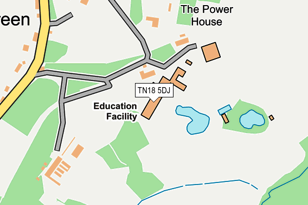
TN18 5DJ is located in the Hawkhurst and Sandhurst electoral ward, within the local authority district of Tunbridge Wells and the English Parliamentary constituency of Tunbridge Wells. The Sub Integrated Care Board (ICB) Location is NHS Kent and Medway ICB - 91Q and the police force is Kent. This postcode has been in use since January 1980.


GetTheData
Source: OS OpenMap – Local (Ordnance Survey)
Source: OS VectorMap District (Ordnance Survey)
Licence: Open Government Licence (requires attribution)
| Easting | 577788 |
| Northing | 130774 |
| Latitude | 51.048799 |
| Longitude | 0.535074 |
GetTheData
Source: Open Postcode Geo
Licence: Open Government Licence
| Country | England |
| Postcode District | TN18 |
| ➜ TN18 open data dashboard ➜ See where TN18 is on a map | |
GetTheData
Source: Land Registry Price Paid Data
Licence: Open Government Licence
Elevation or altitude of TN18 5DJ as distance above sea level:
| Metres | Feet | |
|---|---|---|
| Elevation | 50m | 164ft |
Elevation is measured from the approximate centre of the postcode, to the nearest point on an OS contour line from OS Terrain 50, which has contour spacing of ten vertical metres.
➜ How high above sea level am I? Find the elevation of your current position using your device's GPS.
GetTheData
Source: Open Postcode Elevation
Licence: Open Government Licence
| Ward | Hawkhurst And Sandhurst |
| Constituency | Tunbridge Wells |
GetTheData
Source: ONS Postcode Database
Licence: Open Government Licence
| May 2022 | Burglary | On or near Sports/Recreation Area | 269m |
| September 2021 | Other theft | On or near Sports/Recreation Area | 269m |
| September 2021 | Violence and sexual offences | On or near Sports/Recreation Area | 269m |
| ➜ Get more crime data in our Crime section | |||
GetTheData
Source: data.police.uk
Licence: Open Government Licence
| Tudor Hall (Rye Road) | Hawkhurst | 817m |
| Fir Tree Cottages (Rye Road) | Hawkhurst | 849m |
| Fir Tree Cottages (Rye Road) | Hawkhurst | 857m |
| Tudor Hall (Rye Road) | Hawkhurst | 860m |
| Foxhole Lane (Rye Road) | Hawkhurst | 968m |
GetTheData
Source: NaPTAN
Licence: Open Government Licence
GetTheData
Source: ONS Postcode Database
Licence: Open Government Licence


➜ Get more ratings from the Food Standards Agency
GetTheData
Source: Food Standards Agency
Licence: FSA terms & conditions
| Last Collection | |||
|---|---|---|---|
| Location | Mon-Fri | Sat | Distance |
| Gun Green | 16:00 | 09:00 | 351m |
| Four Throws Old Post Office | 17:00 | 09:30 | 998m |
| Field Green | 17:00 | 10:00 | 1,469m |
GetTheData
Source: Dracos
Licence: Creative Commons Attribution-ShareAlike
| Facility | Distance |
|---|---|
| St Ronans School Water Lane, Hawkhurst, Cranbrook Sports Hall, Artificial Grass Pitch, Grass Pitches | 0m |
| United Lawn Tennis Club (Hawkhurst) Rye Road, Hawkhurst, Cranbrook Outdoor Tennis Courts | 832m |
| Conghurst Lane Conghurst Lane, Hawkhurst, Cranbrook Grass Pitches | 1.9km |
GetTheData
Source: Active Places
Licence: Open Government Licence
| School | Phase of Education | Distance |
|---|---|---|
| St Ronan's School Water Lane, Hawkhurst, Cranbrook, TN18 5DJ | Not applicable | 35m |
| Hawkhurst Church of England Primary School Fowlers Park, Rye Road, Hawkhurst, Cranbrook, TN18 4JJ | Primary | 1.3km |
| Marlborough House School Hawkhurst, Cranbrook, TN18 4PY | Not applicable | 2.4km |
GetTheData
Source: Edubase
Licence: Open Government Licence
The below table lists the International Territorial Level (ITL) codes (formerly Nomenclature of Territorial Units for Statistics (NUTS) codes) and Local Administrative Units (LAU) codes for TN18 5DJ:
| ITL 1 Code | Name |
|---|---|
| TLJ | South East (England) |
| ITL 2 Code | Name |
| TLJ4 | Kent |
| ITL 3 Code | Name |
| TLJ46 | West Kent |
| LAU 1 Code | Name |
| E07000116 | Tunbridge Wells |
GetTheData
Source: ONS Postcode Directory
Licence: Open Government Licence
The below table lists the Census Output Area (OA), Lower Layer Super Output Area (LSOA), and Middle Layer Super Output Area (MSOA) for TN18 5DJ:
| Code | Name | |
|---|---|---|
| OA | E00125918 | |
| LSOA | E01024810 | Tunbridge Wells 014E |
| MSOA | E02005175 | Tunbridge Wells 014 |
GetTheData
Source: ONS Postcode Directory
Licence: Open Government Licence
| TN18 5DH | Water Lane | 123m |
| TN18 5DL | Water Lane | 259m |
| TN18 5DE | Water Lane | 468m |
| TN18 5DS | Tongs Wood Drive | 538m |
| TN18 5BA | Water Lane | 570m |
| TN18 5DF | Water Lane | 630m |
| TN18 5DN | Rye Road | 658m |
| TN18 5NJ | Foxhole Lane | 669m |
| TN18 5DB | Rye Road | 732m |
| TN18 5DW | Rye Road | 831m |
GetTheData
Source: Open Postcode Geo; Land Registry Price Paid Data
Licence: Open Government Licence