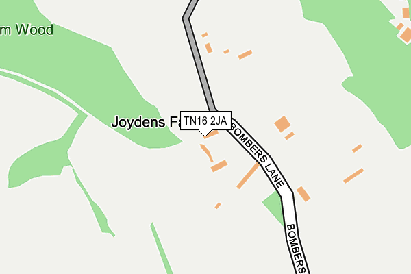
TN16 2JA lies on Bombers Lane in Westerham. TN16 2JA is located in the Darwin electoral ward, within the London borough of Bromley and the English Parliamentary constituency of Orpington. The Sub Integrated Care Board (ICB) Location is NHS South East London ICB - 72Q and the police force is Metropolitan Police. This postcode has been in use since January 1980.


GetTheData
Source: OS OpenMap – Local (Ordnance Survey)
Source: OS VectorMap District (Ordnance Survey)
Licence: Open Government Licence (requires attribution)
| Easting | 544882 |
| Northing | 157448 |
| Latitude | 51.297730 |
| Longitude | 0.076721 |
GetTheData
Source: Open Postcode Geo
Licence: Open Government Licence
| Street | Bombers Lane |
| Town/City | Westerham |
| Country | England |
| Postcode District | TN16 |
| ➜ TN16 open data dashboard ➜ See where TN16 is on a map | |
GetTheData
Source: Land Registry Price Paid Data
Licence: Open Government Licence
Elevation or altitude of TN16 2JA as distance above sea level:
| Metres | Feet | |
|---|---|---|
| Elevation | 220m | 722ft |
Elevation is measured from the approximate centre of the postcode, to the nearest point on an OS contour line from OS Terrain 50, which has contour spacing of ten vertical metres.
➜ How high above sea level am I? Find the elevation of your current position using your device's GPS.
GetTheData
Source: Open Postcode Elevation
Licence: Open Government Licence
| Ward | Darwin |
| Constituency | Orpington |
GetTheData
Source: ONS Postcode Database
Licence: Open Government Licence
| May 2022 | Anti-social behaviour | On or near Grays Road | 491m |
| February 2022 | Burglary | On or near Grays Road | 491m |
| February 2022 | Burglary | On or near Grays Road | 491m |
| ➜ Bombers Lane crime map and outcomes | |||
GetTheData
Source: data.police.uk
Licence: Open Government Licence
| Scotts Lodge (Main Road) | Knockholt | 736m |
| Scotts Lodge (Main Road) | Knockholt | 774m |
| Horns Green Glenfield Farm | Cudham | 960m |
| Burlings Lane (Main Road) | Knockholt | 1,084m |
| Tally Ho (Main Road) | Knockholt | 1,181m |
GetTheData
Source: NaPTAN
Licence: Open Government Licence
| Percentage of properties with Next Generation Access | 0.0% |
| Percentage of properties with Superfast Broadband | 0.0% |
| Percentage of properties with Ultrafast Broadband | 0.0% |
| Percentage of properties with Full Fibre Broadband | 0.0% |
Superfast Broadband is between 30Mbps and 300Mbps
Ultrafast Broadband is > 300Mbps
| Percentage of properties unable to receive 2Mbps | 20.0% |
| Percentage of properties unable to receive 5Mbps | 100.0% |
| Percentage of properties unable to receive 10Mbps | 100.0% |
| Percentage of properties unable to receive 30Mbps | 100.0% |
GetTheData
Source: Ofcom
Licence: Ofcom Terms of Use (requires attribution)
GetTheData
Source: ONS Postcode Database
Licence: Open Government Licence


➜ Get more ratings from the Food Standards Agency
GetTheData
Source: Food Standards Agency
Licence: FSA terms & conditions
| Last Collection | |||
|---|---|---|---|
| Location | Mon-Fri | Sat | Distance |
| Viewlands Avenue | 16:00 | 09:00 | 543m |
| The Grays | 16:00 | 09:00 | 678m |
| Royal Oak | 16:15 | 09:00 | 1,159m |
GetTheData
Source: Dracos
Licence: Creative Commons Attribution-ShareAlike
| Facility | Distance |
|---|---|
| Cherry Lodge Golf Club Jail Lane, Biggin Hill, Westerham Golf | 2.1km |
| Cudham Recreation Ground Cudham Lane South, Cudham, Sevenoaks Grass Pitches, Outdoor Tennis Courts | 2.4km |
| Brasted Recreation Ground Westerham Road, Brasted Grass Pitches, Outdoor Tennis Courts | 3km |
GetTheData
Source: Active Places
Licence: Open Government Licence
| School | Phase of Education | Distance |
|---|---|---|
| St Katharine's Knockholt Church of England Voluntary Aided Primary School Main Road, Knockholt, Sevenoaks, TN14 7LS | Primary | 2.3km |
| Cudham Church of England Primary School Jail Lane, Biggin Hill, Westerham, TN16 3AX | Primary | 2.4km |
| Charles Darwin School Jail Lane, Biggin Hill, Westerham, TN16 3AU | Secondary | 2.9km |
GetTheData
Source: Edubase
Licence: Open Government Licence
The below table lists the International Territorial Level (ITL) codes (formerly Nomenclature of Territorial Units for Statistics (NUTS) codes) and Local Administrative Units (LAU) codes for TN16 2JA:
| ITL 1 Code | Name |
|---|---|
| TLI | London |
| ITL 2 Code | Name |
| TLI6 | Outer London - South |
| ITL 3 Code | Name |
| TLI61 | Bromley |
| LAU 1 Code | Name |
| E09000006 | Bromley |
GetTheData
Source: ONS Postcode Directory
Licence: Open Government Licence
The below table lists the Census Output Area (OA), Lower Layer Super Output Area (LSOA), and Middle Layer Super Output Area (MSOA) for TN16 2JA:
| Code | Name | |
|---|---|---|
| OA | E00003655 | |
| LSOA | E01000748 | Bromley 042C |
| MSOA | E02006789 | Bromley 042 |
GetTheData
Source: ONS Postcode Directory
Licence: Open Government Licence
| TN16 2HU | Grays Road | 394m |
| TN16 2JB | Grays Road | 498m |
| TN16 2HY | Silverstead Lane | 521m |
| TN16 2JD | Grays Road | 628m |
| TN16 2JE | Viewlands Avenue | 658m |
| TN14 7NX | Main Road | 955m |
| TN14 7PA | Cudham Lane South | 973m |
| TN14 7NZ | Cudham Lane South | 980m |
| TN16 2HS | Buckhurst Road | 1084m |
| TN14 7PB | Burlings Lane | 1096m |
GetTheData
Source: Open Postcode Geo; Land Registry Price Paid Data
Licence: Open Government Licence