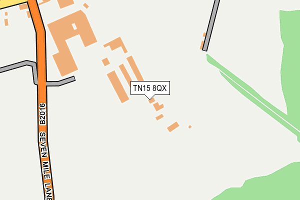
TN15 8QX is located in the East Malling, West Malling & Offham electoral ward, within the local authority district of Tonbridge and Malling and the English Parliamentary constituency of Tonbridge and Malling. The Sub Integrated Care Board (ICB) Location is NHS Kent and Medway ICB - 91Q and the police force is Kent. This postcode has been in use since January 1980.


GetTheData
Source: OS OpenMap – Local (Ordnance Survey)
Source: OS VectorMap District (Ordnance Survey)
Licence: Open Government Licence (requires attribution)
| Easting | 564192 |
| Northing | 156736 |
| Latitude | 51.286097 |
| Longitude | 0.353130 |
GetTheData
Source: Open Postcode Geo
Licence: Open Government Licence
| Country | England |
| Postcode District | TN15 |
| ➜ TN15 open data dashboard ➜ See where TN15 is on a map | |
GetTheData
Source: Land Registry Price Paid Data
Licence: Open Government Licence
Elevation or altitude of TN15 8QX as distance above sea level:
| Metres | Feet | |
|---|---|---|
| Elevation | 110m | 361ft |
Elevation is measured from the approximate centre of the postcode, to the nearest point on an OS contour line from OS Terrain 50, which has contour spacing of ten vertical metres.
➜ How high above sea level am I? Find the elevation of your current position using your device's GPS.
GetTheData
Source: Open Postcode Elevation
Licence: Open Government Licence
| Ward | East Malling, West Malling & Offham |
| Constituency | Tonbridge And Malling |
GetTheData
Source: ONS Postcode Database
Licence: Open Government Licence
| October 2021 | Other theft | On or near Seven Mile Lane | 258m |
| June 2021 | Burglary | On or near Seven Mile Lane | 258m |
| June 2021 | Other theft | On or near Seven Mile Lane | 258m |
| ➜ Get more crime data in our Crime section | |||
GetTheData
Source: data.police.uk
Licence: Open Government Licence
| Seven Mile Lane | Wrotham Heath | 1,313m |
| Seven Mile Lane (London Road) | Wrotham Heath | 1,405m |
| The Vineyard (Ford Lane) | Wrotham Heath | 1,481m |
| Royal Oak (London Road) | Wrotham Heath | 1,535m |
| Royal Oak (London Road) | Wrotham Heath | 1,544m |
| Borough Green & Wrotham Station | 3.4km |
| West Malling Station | 4.6km |
| Wateringbury Station | 6.3km |
GetTheData
Source: NaPTAN
Licence: Open Government Licence
GetTheData
Source: ONS Postcode Database
Licence: Open Government Licence


➜ Get more ratings from the Food Standards Agency
GetTheData
Source: Food Standards Agency
Licence: FSA terms & conditions
| Last Collection | |||
|---|---|---|---|
| Location | Mon-Fri | Sat | Distance |
| Crowhill | 16:30 | 10:45 | 911m |
| Aldon Lane | 16:00 | 09:00 | 1,360m |
| Rose Terrace | 16:15 | 09:00 | 1,544m |
GetTheData
Source: Dracos
Licence: Creative Commons Attribution-ShareAlike
| Facility | Distance |
|---|---|
| Wrotham Heath Golf Club Seven Mile Lane, Borough Green, Sevenoaks Golf | 794m |
| Spirit Health Club (Maidstone) London Road, Wrotham Heath, Sevenoaks Swimming Pool, Health and Fitness Gym | 1.9km |
| Platt Church Of England Primary School (Closed) Maidstone Road, Maidstone Road, Platt, Sevenoaks Grass Pitches | 2km |
GetTheData
Source: Active Places
Licence: Open Government Licence
| School | Phase of Education | Distance |
|---|---|---|
| Platt Church of England Voluntary Aided Primary School Platinum Way, St Mary's Platt, Sevenoaks, TN15 8FH | Primary | 2km |
| Offham Primary School Church Road, Offham, West Malling, ME19 5NX | Primary | 2km |
| Borough Green Primary School School Approach, Borough Green, Sevenoaks, TN15 8JZ | Primary | 3.2km |
GetTheData
Source: Edubase
Licence: Open Government Licence
The below table lists the International Territorial Level (ITL) codes (formerly Nomenclature of Territorial Units for Statistics (NUTS) codes) and Local Administrative Units (LAU) codes for TN15 8QX:
| ITL 1 Code | Name |
|---|---|
| TLJ | South East (England) |
| ITL 2 Code | Name |
| TLJ4 | Kent |
| ITL 3 Code | Name |
| TLJ46 | West Kent |
| LAU 1 Code | Name |
| E07000115 | Tonbridge and Malling |
GetTheData
Source: ONS Postcode Directory
Licence: Open Government Licence
The below table lists the Census Output Area (OA), Lower Layer Super Output Area (LSOA), and Middle Layer Super Output Area (MSOA) for TN15 8QX:
| Code | Name | |
|---|---|---|
| OA | E00125572 | |
| LSOA | E01032620 | Tonbridge and Malling 014E |
| MSOA | E02006833 | Tonbridge and Malling 014 |
GetTheData
Source: ONS Postcode Directory
Licence: Open Government Licence
| TN15 8QT | Comp Lane | 644m |
| ME19 5PP | Comp Lane | 695m |
| TN15 8QZ | Seven Mile Lane | 745m |
| TN15 8QY | Seven Mile Lane | 901m |
| TN15 8QS | Comp Lane | 1119m |
| ME19 5PF | Teston Road | 1144m |
| TN15 7SY | Windmill Park | 1190m |
| ME19 5PW | Quarry View | 1229m |
| TN15 7SA | Seven Mile Lane | 1249m |
| TN15 8QR | Windmill Hill | 1319m |
GetTheData
Source: Open Postcode Geo; Land Registry Price Paid Data
Licence: Open Government Licence