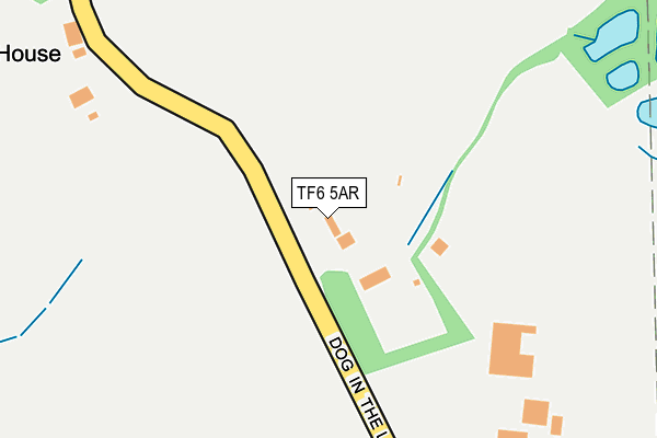
TF6 5AR is located in the Wrockwardine electoral ward, within the unitary authority of Telford and Wrekin and the English Parliamentary constituency of The Wrekin. The Sub Integrated Care Board (ICB) Location is NHS Shropshire, Telford and Wrekin ICB - M2L0M and the police force is West Mercia. This postcode has been in use since January 1980.


GetTheData
Source: OS OpenMap – Local (Ordnance Survey)
Source: OS VectorMap District (Ordnance Survey)
Licence: Open Government Licence (requires attribution)
| Easting | 366096 |
| Northing | 307502 |
| Latitude | 52.664181 |
| Longitude | -2.502737 |
GetTheData
Source: Open Postcode Geo
Licence: Open Government Licence
| Country | England |
| Postcode District | TF6 |
| ➜ TF6 open data dashboard ➜ See where TF6 is on a map | |
GetTheData
Source: Land Registry Price Paid Data
Licence: Open Government Licence
Elevation or altitude of TF6 5AR as distance above sea level:
| Metres | Feet | |
|---|---|---|
| Elevation | 200m | 656ft |
Elevation is measured from the approximate centre of the postcode, to the nearest point on an OS contour line from OS Terrain 50, which has contour spacing of ten vertical metres.
➜ How high above sea level am I? Find the elevation of your current position using your device's GPS.
GetTheData
Source: Open Postcode Elevation
Licence: Open Government Licence
| Ward | Wrockwardine |
| Constituency | The Wrekin |
GetTheData
Source: ONS Postcode Database
Licence: Open Government Licence
| February 2021 | Anti-social behaviour | On or near Dog In The Lane | 63m |
| ➜ Get more crime data in our Crime section | |||
GetTheData
Source: data.police.uk
Licence: Open Government Licence
| Coalmoor Lane (Coalmoor Road) | Horsehay | 427m |
| Coalmoor Lane (Coalmoor Road) | Horsehay | 456m |
| Huntington T Junction (Unclassified) | Little Wenlock | 642m |
| Huntington T Junction (Unclassified) | Little Wenlock | 666m |
| New Works Lane (Church Hill Lane) | Little Wenlock | 933m |
| Wellington (Shropshire) Station | 4.2km |
| Telford Central Station | 4.6km |
| Oakengates Station | 4.8km |
GetTheData
Source: NaPTAN
Licence: Open Government Licence
GetTheData
Source: ONS Postcode Database
Licence: Open Government Licence


➜ Get more ratings from the Food Standards Agency
GetTheData
Source: Food Standards Agency
Licence: FSA terms & conditions
| Last Collection | |||
|---|---|---|---|
| Location | Mon-Fri | Sat | Distance |
| Little Wenlock | 17:00 | 08:00 | 1,358m |
| Sunnyside | 15:45 | 08:15 | 2,343m |
| Lawley | 17:30 | 11:00 | 2,363m |
GetTheData
Source: Dracos
Licence: Creative Commons Attribution-ShareAlike
| Facility | Distance |
|---|---|
| Horsehay Golf And Fitness Centre Wellington Road, Horsehay, Telford Golf, Health and Fitness Gym | 849m |
| Fitness Factory Telford Bridges Business Park, Bridge Road, Horsehay, Telford Health and Fitness Gym | 1.3km |
| Little Wenlock Playing Field Little Wenlock, Telford Grass Pitches, Outdoor Tennis Courts | 1.3km |
GetTheData
Source: Active Places
Licence: Open Government Licence
| School | Phase of Education | Distance |
|---|---|---|
| The Seeds School Unit 6, The Bridges Business Park, Horsehay, Telford, Shropshire, TF4 3EE | Not applicable | 1.2km |
| Lightmoor Village Primary School Lightmoor Way, Lightmoor Village, Telford, TF4 3EG | Primary | 1.8km |
| Lawley Primary School Off Arleston Lane, Lawley, Telford, TF4 2PR | Primary | 1.9km |
GetTheData
Source: Edubase
Licence: Open Government Licence
The below table lists the International Territorial Level (ITL) codes (formerly Nomenclature of Territorial Units for Statistics (NUTS) codes) and Local Administrative Units (LAU) codes for TF6 5AR:
| ITL 1 Code | Name |
|---|---|
| TLG | West Midlands (England) |
| ITL 2 Code | Name |
| TLG2 | Shropshire and Staffordshire |
| ITL 3 Code | Name |
| TLG21 | Telford and Wrekin |
| LAU 1 Code | Name |
| E06000020 | Telford and Wrekin |
GetTheData
Source: ONS Postcode Directory
Licence: Open Government Licence
The below table lists the Census Output Area (OA), Lower Layer Super Output Area (LSOA), and Middle Layer Super Output Area (MSOA) for TF6 5AR:
| Code | Name | |
|---|---|---|
| OA | E00071701 | |
| LSOA | E01014202 | Telford and Wrekin 010D |
| MSOA | E02002937 | Telford and Wrekin 010 |
GetTheData
Source: ONS Postcode Directory
Licence: Open Government Licence
| TF6 5AS | Coalmoor Road | 445m |
| TF4 3QB | Coalmoor Lane | 776m |
| TF4 2PX | Moreton Coppice | 786m |
| TF6 5BW | 854m | |
| TF4 2LD | Ashtree Park | 879m |
| TF6 5AP | 880m | |
| TF4 2PA | Simpsons Walk | 953m |
| TF6 5BP | 955m | |
| TF6 5AX | 958m | |
| TF4 3BP | Wellington Road | 1002m |
GetTheData
Source: Open Postcode Geo; Land Registry Price Paid Data
Licence: Open Government Licence