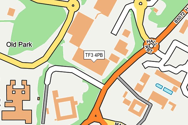
TF3 4PB is located in the Malinslee & Dawley Bank electoral ward, within the unitary authority of Telford and Wrekin and the English Parliamentary constituency of Telford. The Sub Integrated Care Board (ICB) Location is NHS Shropshire, Telford and Wrekin ICB - M2L0M and the police force is West Mercia. This postcode has been in use since February 1990.


GetTheData
Source: OS OpenMap – Local (Ordnance Survey)
Source: OS VectorMap District (Ordnance Survey)
Licence: Open Government Licence (requires attribution)
| Easting | 369303 |
| Northing | 309169 |
| Latitude | 52.679358 |
| Longitude | -2.455477 |
GetTheData
Source: Open Postcode Geo
Licence: Open Government Licence
| Country | England |
| Postcode District | TF3 |
| ➜ TF3 open data dashboard ➜ See where TF3 is on a map ➜ Where is Telford? | |
GetTheData
Source: Land Registry Price Paid Data
Licence: Open Government Licence
Elevation or altitude of TF3 4PB as distance above sea level:
| Metres | Feet | |
|---|---|---|
| Elevation | 180m | 591ft |
Elevation is measured from the approximate centre of the postcode, to the nearest point on an OS contour line from OS Terrain 50, which has contour spacing of ten vertical metres.
➜ How high above sea level am I? Find the elevation of your current position using your device's GPS.
GetTheData
Source: Open Postcode Elevation
Licence: Open Government Licence
| Ward | Malinslee & Dawley Bank |
| Constituency | Telford |
GetTheData
Source: ONS Postcode Database
Licence: Open Government Licence
| January 2024 | Criminal damage and arson | On or near Parking Area | 329m |
| January 2024 | Drugs | On or near Parking Area | 329m |
| January 2024 | Other crime | On or near Parking Area | 329m |
| ➜ Get more crime data in our Crime section | |||
GetTheData
Source: data.police.uk
Licence: Open Government Licence
| Park Lane (Colliers Way) | Telford Town Centre | 153m |
| Thomas Telford School (Caledonia Way) | Telford Town Centre | 227m |
| Park Lane (Colliers Way) | Telford Town Centre | 231m |
| Bridge Retail Park (Colliers Way) | Telford Town Centre | 251m |
| Bridge Retail Park (Colliers Way) | Telford Town Centre | 277m |
| Telford Central Station | 1km |
| Oakengates Station | 1.6km |
| Wellington (Shropshire) Station | 4.8km |
GetTheData
Source: NaPTAN
Licence: Open Government Licence
| Median download speed | 6.9Mbps |
| Average download speed | 22.7Mbps |
| Maximum download speed | 64.97Mbps |
| Median upload speed | 1.1Mbps |
| Average upload speed | 5.8Mbps |
| Maximum upload speed | 20.00Mbps |
GetTheData
Source: Ofcom
Licence: Ofcom Terms of Use (requires attribution)
GetTheData
Source: ONS Postcode Database
Licence: Open Government Licence


➜ Get more ratings from the Food Standards Agency
GetTheData
Source: Food Standards Agency
Licence: FSA terms & conditions
| Last Collection | |||
|---|---|---|---|
| Location | Mon-Fri | Sat | Distance |
| Old Park | 15:15 | 11:00 | 447m |
| Marks And Spencer | 17:30 | 12:00 | 550m |
| Telford Centre Post Office | 17:30 | 12:15 | 740m |
GetTheData
Source: Dracos
Licence: Creative Commons Attribution-ShareAlike
| Facility | Distance |
|---|---|
| Thomas Telford School Old Park, Telford Swimming Pool, Artificial Grass Pitch, Sports Hall, Health and Fitness Gym, Grass Pitches, Studio, Outdoor Tennis Courts | 262m |
| Nuffield Health (Telford) Telford Forge Retail Park, Colliers Way, Old Park, Telford Swimming Pool, Health and Fitness Gym, Studio | 361m |
| Dw Fitness First (Telford) (Closed) Telford Forge Retail Park, Colliers Way, Old Park, Telford Swimming Pool, Health and Fitness Gym, Studio | 467m |
GetTheData
Source: Active Places
Licence: Open Government Licence
| School | Phase of Education | Distance |
|---|---|---|
| Thomas Telford School Old Park, Telford, TF3 4NW | Not applicable | 280m |
| Lantern Academy Yates Way, Ketley Bank, Telford, TF2 0AZ | Primary | 693m |
| Old Park Primary School Brunel Road, Malinslee, Telford, TF3 2BF | Primary | 759m |
GetTheData
Source: Edubase
Licence: Open Government Licence
The below table lists the International Territorial Level (ITL) codes (formerly Nomenclature of Territorial Units for Statistics (NUTS) codes) and Local Administrative Units (LAU) codes for TF3 4PB:
| ITL 1 Code | Name |
|---|---|
| TLG | West Midlands (England) |
| ITL 2 Code | Name |
| TLG2 | Shropshire and Staffordshire |
| ITL 3 Code | Name |
| TLG21 | Telford and Wrekin |
| LAU 1 Code | Name |
| E06000020 | Telford and Wrekin |
GetTheData
Source: ONS Postcode Directory
Licence: Open Government Licence
The below table lists the Census Output Area (OA), Lower Layer Super Output Area (LSOA), and Middle Layer Super Output Area (MSOA) for TF3 4PB:
| Code | Name | |
|---|---|---|
| OA | E00071494 | |
| LSOA | E01014158 | Telford and Wrekin 016E |
| MSOA | E02002943 | Telford and Wrekin 016 |
GetTheData
Source: ONS Postcode Directory
Licence: Open Government Licence
| TF3 4TG | Park Lane | 337m |
| TF3 4TF | The Coppice | 367m |
| TF3 4TE | Park Lane | 439m |
| TF4 2AX | Park Road | 493m |
| TF3 4TJ | The Crest | 500m |
| TF3 2JD | Coachwell Close | 512m |
| TF3 4TD | Park Lane | 537m |
| TF3 2JU | Prince Edward Crescent | 545m |
| TF3 2JE | Coachwell Close | 558m |
| TF3 2JB | Coachwell Close | 586m |
GetTheData
Source: Open Postcode Geo; Land Registry Price Paid Data
Licence: Open Government Licence