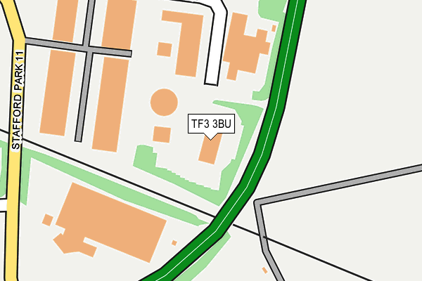
TF3 3BU is located in the The Nedge electoral ward, within the unitary authority of Telford and Wrekin and the English Parliamentary constituency of Telford. The Sub Integrated Care Board (ICB) Location is NHS Shropshire, Telford and Wrekin ICB - M2L0M and the police force is West Mercia. This postcode has been in use since October 2003.


GetTheData
Source: OS OpenMap – Local (Ordnance Survey)
Source: OS VectorMap District (Ordnance Survey)
Licence: Open Government Licence (requires attribution)
| Easting | 372303 |
| Northing | 308449 |
| Latitude | 52.673033 |
| Longitude | -2.411045 |
GetTheData
Source: Open Postcode Geo
Licence: Open Government Licence
| Country | England |
| Postcode District | TF3 |
| ➜ TF3 open data dashboard ➜ See where TF3 is on a map ➜ Where is Telford? | |
GetTheData
Source: Land Registry Price Paid Data
Licence: Open Government Licence
Elevation or altitude of TF3 3BU as distance above sea level:
| Metres | Feet | |
|---|---|---|
| Elevation | 130m | 427ft |
Elevation is measured from the approximate centre of the postcode, to the nearest point on an OS contour line from OS Terrain 50, which has contour spacing of ten vertical metres.
➜ How high above sea level am I? Find the elevation of your current position using your device's GPS.
GetTheData
Source: Open Postcode Elevation
Licence: Open Government Licence
| Ward | The Nedge |
| Constituency | Telford |
GetTheData
Source: ONS Postcode Database
Licence: Open Government Licence
| June 2022 | Criminal damage and arson | On or near Parking Area | 91m |
| June 2022 | Other theft | On or near Stafford Park 10 | 260m |
| June 2022 | Other theft | On or near Stafford Park 10 | 260m |
| ➜ Get more crime data in our Crime section | |||
GetTheData
Source: data.police.uk
Licence: Open Government Licence
| Naird Roundabout (Stafford Park 11) | Stafford Park | 292m |
| Kwik Fit (Stafford Park 11) | Stafford Park | 314m |
| Naird Roundabout (Stafford Park 11) | Stafford Park | 320m |
| Kwik Fit (Stafford Park 11) | Stafford Park | 322m |
| Business Development Centre (Stafford Park 4) | Stafford Park | 549m |
| Telford Central Station | 2.2km |
| Shifnal Station | 2.8km |
| Oakengates Station | 3.5km |
GetTheData
Source: NaPTAN
Licence: Open Government Licence
GetTheData
Source: ONS Postcode Database
Licence: Open Government Licence


➜ Get more ratings from the Food Standards Agency
GetTheData
Source: Food Standards Agency
Licence: FSA terms & conditions
| Last Collection | |||
|---|---|---|---|
| Location | Mon-Fri | Sat | Distance |
| Stafford Park 4 Meter Box | 18:15 | 915m | |
| Stafford Park 4 | 18:15 | 11:30 | 923m |
| Stafford Park 17 | 18:15 | 11:30 | 996m |
GetTheData
Source: Dracos
Licence: Creative Commons Attribution-ShareAlike
| Facility | Distance |
|---|---|
| Ricoh Uk Products Ltd Football Pitch Priorslee, Telford Grass Pitches | 1.2km |
| Holy Trinity Academy Teece Drive, Priorslee, Telford Sports Hall, Health and Fitness Gym, Grass Pitches, Studio, Outdoor Tennis Courts, Artificial Grass Pitch | 1.3km |
| Priorslee Playing Field Gough Close, Priorslee, Telford Grass Pitches | 1.4km |
GetTheData
Source: Active Places
Licence: Open Government Licence
| School | Phase of Education | Distance |
|---|---|---|
| Holy Trinity Academy Teece Drive, Priorslee, Telford, TF2 9SQ | Secondary | 1.4km |
| Priorslee Academy Priorslee Avenue, Priorslee, Telford, TF2 9RS | Primary | 1.8km |
| Hollinswood Primary School Dale Acre Way, Hollinswood, Telford, TF3 2EP | Primary | 1.8km |
GetTheData
Source: Edubase
Licence: Open Government Licence
The below table lists the International Territorial Level (ITL) codes (formerly Nomenclature of Territorial Units for Statistics (NUTS) codes) and Local Administrative Units (LAU) codes for TF3 3BU:
| ITL 1 Code | Name |
|---|---|
| TLG | West Midlands (England) |
| ITL 2 Code | Name |
| TLG2 | Shropshire and Staffordshire |
| ITL 3 Code | Name |
| TLG21 | Telford and Wrekin |
| LAU 1 Code | Name |
| E06000020 | Telford and Wrekin |
GetTheData
Source: ONS Postcode Directory
Licence: Open Government Licence
The below table lists the Census Output Area (OA), Lower Layer Super Output Area (LSOA), and Middle Layer Super Output Area (MSOA) for TF3 3BU:
| Code | Name | |
|---|---|---|
| OA | E00071666 | |
| LSOA | E01014192 | Telford and Wrekin 018B |
| MSOA | E02002945 | Telford and Wrekin 018 |
GetTheData
Source: ONS Postcode Directory
Licence: Open Government Licence
| TF3 3AY | Stafford Park 11 | 231m |
| TF11 9PQ | 376m | |
| TF3 3AT | Stafford Park 6 | 584m |
| TF3 3BJ | Stafford Park 12 | 700m |
| TF3 3BA | Stafford Park 4 | 736m |
| TF3 3BN | Stafford Park 18 | 768m |
| TF3 3DN | Queensway Link Industrial Estate | 901m |
| TF3 3BB | Stafford Park 15 | 1242m |
| TF3 2DH | Doddington | 1288m |
| TF11 9PG | Knowles Bank | 1299m |
GetTheData
Source: Open Postcode Geo; Land Registry Price Paid Data
Licence: Open Government Licence