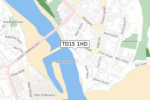
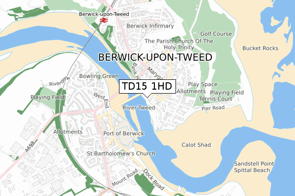
TD15 1HD is located in the Berwick North electoral ward, within the unitary authority of Northumberland and the English Parliamentary constituency of Berwick-upon-Tweed. The Sub Integrated Care Board (ICB) Location is NHS North East and North Cumbria ICB - 00L and the police force is Northumbria. This postcode has been in use since May 1993.


GetTheData
Source: OS Open Zoomstack (Ordnance Survey)
Licence: Open Government Licence (requires attribution)
Attribution: Contains OS data © Crown copyright and database right 2024
Source: Open Postcode Geo
Licence: Open Government Licence (requires attribution)
Attribution: Contains OS data © Crown copyright and database right 2024; Contains Royal Mail data © Royal Mail copyright and database right 2024; Source: Office for National Statistics licensed under the Open Government Licence v.3.0
| Easting | 399770 |
| Northing | 652748 |
| Latitude | 55.768074 |
| Longitude | -2.005234 |
GetTheData
Source: Open Postcode Geo
Licence: Open Government Licence
| Country | England |
| Postcode District | TD15 |
| ➜ TD15 open data dashboard ➜ See where TD15 is on a map ➜ Where is Berwick-upon-Tweed? | |
GetTheData
Source: Land Registry Price Paid Data
Licence: Open Government Licence
Elevation or altitude of TD15 1HD as distance above sea level:
| Metres | Feet | |
|---|---|---|
| Elevation | 10m | 33ft |
Elevation is measured from the approximate centre of the postcode, to the nearest point on an OS contour line from OS Terrain 50, which has contour spacing of ten vertical metres.
➜ How high above sea level am I? Find the elevation of your current position using your device's GPS.
GetTheData
Source: Open Postcode Elevation
Licence: Open Government Licence
| Ward | Berwick North |
| Constituency | Berwick-upon-tweed |
GetTheData
Source: ONS Postcode Database
Licence: Open Government Licence
| June 2022 | Public order | On or near Pedestrian Subway | 55m |
| June 2022 | Theft from the person | On or near West Street | 140m |
| June 2022 | Criminal damage and arson | On or near Parking Area | 142m |
| ➜ Get more crime data in our Crime section | |||
GetTheData
Source: data.police.uk
Licence: Open Government Licence
| Bridge Street | Berwick-upon-tweed | 57m |
| Hide Hill | Berwick-upon-tweed | 158m |
| Golden Square | Berwick-upon-tweed | 212m |
| Golden Square | Berwick-upon-tweed | 213m |
| Marygate | Berwick-upon-tweed | 215m |
| Berwick-upon-Tweed Station | 0.8km |
GetTheData
Source: NaPTAN
Licence: Open Government Licence
GetTheData
Source: ONS Postcode Database
Licence: Open Government Licence


➜ Get more ratings from the Food Standards Agency
GetTheData
Source: Food Standards Agency
Licence: FSA terms & conditions
| Last Collection | |||
|---|---|---|---|
| Location | Mon-Fri | Sat | Distance |
| Marygate | 17:45 | 12:45 | 271m |
| Tweedmouth Post Office | 17:30 | 11:45 | 400m |
| Barracks | 16:15 | 11:30 | 476m |
GetTheData
Source: Dracos
Licence: Creative Commons Attribution-ShareAlike
| Facility | Distance |
|---|---|
| The Stanks Parade, Berwick-upon-tweed Grass Pitches | 605m |
| Berwick Cricket Club Pier Road, Berwick-upon-tweed Grass Pitches | 662m |
| Pier Field Pier Road, Berwick-upon-tweed Outdoor Tennis Courts, Grass Pitches | 816m |
GetTheData
Source: Active Places
Licence: Open Government Licence
| School | Phase of Education | Distance |
|---|---|---|
| St Cuthberts Catholic First School, Berwick Prince Edward Road, Tweedmouth, Berwick-upon-Tweed, TD15 2EX | Primary | 462m |
| Tweedmouth West First School Osborne Road, Berwick-upon-Tweed, TD15 2HS | Primary | 636m |
| Holy Trinity Church of England First School Bell Tower Place, Berwick-upon-Tweed, TD15 1NB | Primary | 766m |
GetTheData
Source: Edubase
Licence: Open Government Licence
The below table lists the International Territorial Level (ITL) codes (formerly Nomenclature of Territorial Units for Statistics (NUTS) codes) and Local Administrative Units (LAU) codes for TD15 1HD:
| ITL 1 Code | Name |
|---|---|
| TLC | North East (England) |
| ITL 2 Code | Name |
| TLC2 | Northumberland, and Tyne and Wear |
| ITL 3 Code | Name |
| TLC21 | Northumberland |
| LAU 1 Code | Name |
| E06000057 | Northumberland |
GetTheData
Source: ONS Postcode Directory
Licence: Open Government Licence
The below table lists the Census Output Area (OA), Lower Layer Super Output Area (LSOA), and Middle Layer Super Output Area (MSOA) for TD15 1HD:
| Code | Name | |
|---|---|---|
| OA | E00139321 | |
| LSOA | E01027377 | Northumberland 001B |
| MSOA | E02005706 | Northumberland 001 |
GetTheData
Source: ONS Postcode Directory
Licence: Open Government Licence
| TD15 1EZ | Sallyport | 28m |
| TD15 1HB | Quay Walls | 51m |
| TD15 1ES | Bridge Street | 52m |
| TD15 1HA | Bridge End | 52m |
| TD15 1AQ | Bridge Street | 71m |
| TD15 1AL | Bridge End | 72m |
| TD15 1AW | Bridge Terrace | 89m |
| TD15 1DT | Easter Wynd | 94m |
| TD15 1AR | Love Lane | 104m |
| TD15 1AP | Love Lane | 118m |
GetTheData
Source: Open Postcode Geo; Land Registry Price Paid Data
Licence: Open Government Licence