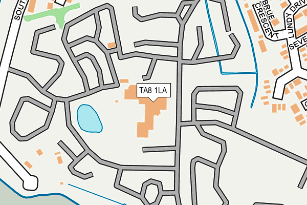
TA8 1LA is located in the Highbridge & Burnham South electoral ward, within the unitary authority of Somerset and the English Parliamentary constituency of Wells. The Sub Integrated Care Board (ICB) Location is NHS Somerset ICB - 11X and the police force is Avon and Somerset. This postcode has been in use since January 1980.


GetTheData
Source: OS OpenMap – Local (Ordnance Survey)
Source: OS VectorMap District (Ordnance Survey)
Licence: Open Government Licence (requires attribution)
| Easting | 330450 |
| Northing | 148179 |
| Latitude | 51.228544 |
| Longitude | -2.997435 |
GetTheData
Source: Open Postcode Geo
Licence: Open Government Licence
| Country | England |
| Postcode District | TA8 |
➜ See where TA8 is on a map ➜ Where is Burnham-on-Sea? | |
GetTheData
Source: Land Registry Price Paid Data
Licence: Open Government Licence
Elevation or altitude of TA8 1LA as distance above sea level:
| Metres | Feet | |
|---|---|---|
| Elevation | 10m | 33ft |
Elevation is measured from the approximate centre of the postcode, to the nearest point on an OS contour line from OS Terrain 50, which has contour spacing of ten vertical metres.
➜ How high above sea level am I? Find the elevation of your current position using your device's GPS.
GetTheData
Source: Open Postcode Elevation
Licence: Open Government Licence
| Ward | Highbridge & Burnham South |
| Constituency | Wells |
GetTheData
Source: ONS Postcode Database
Licence: Open Government Licence
| Burnham Haven Holiday Centre | Burnham-on-sea | 211m |
| Channel Court (Marine Drive) | Burnham-on-sea | 398m |
| Channel Court (Marine Drive) | Burnham-on-sea | 400m |
| Holiday Village (Marine Road) | Burnham-on-sea | 434m |
| Holiday Village (Marine Drive) | Burnham-on-sea | 444m |
| Highbridge & Burnham-on-Sea Station | 2.1km |
GetTheData
Source: NaPTAN
Licence: Open Government Licence
GetTheData
Source: ONS Postcode Database
Licence: Open Government Licence


➜ Get more ratings from the Food Standards Agency
GetTheData
Source: Food Standards Agency
Licence: FSA terms & conditions
| Last Collection | |||
|---|---|---|---|
| Location | Mon-Fri | Sat | Distance |
| Burnham Post Office | 17:30 | 12:30 | 1,151m |
| Colony | 16:45 | 12:00 | 1,832m |
| Love Lane | 17:00 | 12:00 | 1,998m |
GetTheData
Source: Dracos
Licence: Creative Commons Attribution-ShareAlike
| Risk of TA8 1LA flooding from rivers and sea | Low |
| ➜ TA8 1LA flood map | |
GetTheData
Source: Open Flood Risk by Postcode
Licence: Open Government Licence
The below table lists the International Territorial Level (ITL) codes (formerly Nomenclature of Territorial Units for Statistics (NUTS) codes) and Local Administrative Units (LAU) codes for TA8 1LA:
| ITL 1 Code | Name |
|---|---|
| TLK | South West (England) |
| ITL 2 Code | Name |
| TLK2 | Dorset and Somerset |
| ITL 3 Code | Name |
| TLK23 | Somerset CC |
| LAU 1 Code | Name |
| E07000188 | Sedgemoor |
GetTheData
Source: ONS Postcode Directory
Licence: Open Government Licence
The below table lists the Census Output Area (OA), Lower Layer Super Output Area (LSOA), and Middle Layer Super Output Area (MSOA) for TA8 1LA:
| Code | Name | |
|---|---|---|
| OA | E00148376 | |
| LSOA | E01029133 | Sedgemoor 005D |
| MSOA | E02006065 | Sedgemoor 005 |
GetTheData
Source: ONS Postcode Directory
Licence: Open Government Licence
| TA8 1DH | Maple Drive | 229m |
| TA8 1LR | Brue Crescent | 251m |
| TA8 1NF | Atlantic Crescent | 259m |
| TA8 1BX | Margaret Crescent | 278m |
| TA8 1DJ | Sycamore Close | 307m |
| TA8 1NG | Lundy Drive | 308m |
| TA8 1DL | South Esplanade | 336m |
| TA8 1NH | Severn Grove | 339m |
| TA8 1NE | Channel Court | 342m |
| TA8 1AA | Steart Drive | 349m |
GetTheData
Source: Open Postcode Geo; Land Registry Price Paid Data
Licence: Open Government Licence