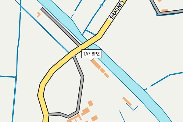
TA7 8PZ is located in the Bridgwater East & Bawdrip electoral ward, within the unitary authority of Somerset and the English Parliamentary constituency of Bridgwater and West Somerset. The Sub Integrated Care Board (ICB) Location is NHS Somerset ICB - 11X and the police force is Avon and Somerset. This postcode has been in use since January 1980.


GetTheData
Source: OS OpenMap – Local (Ordnance Survey)
Source: OS VectorMap District (Ordnance Survey)
Licence: Open Government Licence (requires attribution)
| Easting | 333995 |
| Northing | 139188 |
| Latitude | 51.148130 |
| Longitude | -2.945018 |
GetTheData
Source: Open Postcode Geo
Licence: Open Government Licence
| Country | England |
| Postcode District | TA7 |
| ➜ TA7 open data dashboard ➜ See where TA7 is on a map | |
GetTheData
Source: Land Registry Price Paid Data
Licence: Open Government Licence
Elevation or altitude of TA7 8PZ as distance above sea level:
| Metres | Feet | |
|---|---|---|
| Elevation | 10m | 33ft |
Elevation is measured from the approximate centre of the postcode, to the nearest point on an OS contour line from OS Terrain 50, which has contour spacing of ten vertical metres.
➜ How high above sea level am I? Find the elevation of your current position using your device's GPS.
GetTheData
Source: Open Postcode Elevation
Licence: Open Government Licence
| Ward | Bridgwater East & Bawdrip |
| Constituency | Bridgwater And West Somerset |
GetTheData
Source: ONS Postcode Database
Licence: Open Government Licence
| December 2021 | Violence and sexual offences | On or near Shaws Orchard | 479m |
| November 2021 | Violence and sexual offences | On or near Greenfield Lane | 393m |
| September 2021 | Anti-social behaviour | On or near Greenfield Lane | 393m |
| ➜ Get more crime data in our Crime section | |||
GetTheData
Source: data.police.uk
Licence: Open Government Licence
| St Michaels Church | Bawdrip | 398m |
| St. Michaels Church | Bawdrip | 400m |
| Chapel Cottage (Bradney Lane) | Bradney | 525m |
| Chapel Cottage (Bradney Lane) | Bradney | 527m |
| Knowle Inn (Bath Road) | Bawdrip | 850m |
| Bridgwater Station | 3.9km |
GetTheData
Source: NaPTAN
Licence: Open Government Licence
GetTheData
Source: ONS Postcode Database
Licence: Open Government Licence


➜ Get more ratings from the Food Standards Agency
GetTheData
Source: Food Standards Agency
Licence: FSA terms & conditions
| Last Collection | |||
|---|---|---|---|
| Location | Mon-Fri | Sat | Distance |
| Bawdrip | 12:00 | 11:00 | 476m |
| Bradney | 11:00 | 11:00 | 553m |
| Horsey | 12:00 | 11:15 | 1,391m |
GetTheData
Source: Dracos
Licence: Creative Commons Attribution-ShareAlike
| Facility | Distance |
|---|---|
| Chezdoy Playing Field Pig Lane, Chedzoy, Bridgwater Grass Pitches | 1.3km |
| Woolavington Playing Field Sedgemoor Way, Woolavington, Bridgwater Grass Pitches | 1.7km |
| Morganians Rfc Chedzoy Lane, Bridgwater Grass Pitches | 1.8km |
GetTheData
Source: Active Places
Licence: Open Government Licence
| School | Phase of Education | Distance |
|---|---|---|
| Kingsmoor Primary School Bawdrip, Bridgwater, TA7 8PY | Primary | 367m |
| Woolavington Village Primary School Higher Road, Woolavington, Bridgwater, TA7 8EA | Primary | 2.4km |
| Willowdown Primary School Kings Drive, Bridgwater, TA6 4FU | Primary | 2.4km |
GetTheData
Source: Edubase
Licence: Open Government Licence
The below table lists the International Territorial Level (ITL) codes (formerly Nomenclature of Territorial Units for Statistics (NUTS) codes) and Local Administrative Units (LAU) codes for TA7 8PZ:
| ITL 1 Code | Name |
|---|---|
| TLK | South West (England) |
| ITL 2 Code | Name |
| TLK2 | Dorset and Somerset |
| ITL 3 Code | Name |
| TLK23 | Somerset CC |
| LAU 1 Code | Name |
| E07000188 | Sedgemoor |
GetTheData
Source: ONS Postcode Directory
Licence: Open Government Licence
The below table lists the Census Output Area (OA), Lower Layer Super Output Area (LSOA), and Middle Layer Super Output Area (MSOA) for TA7 8PZ:
| Code | Name | |
|---|---|---|
| OA | E00148410 | |
| LSOA | E01029137 | Sedgemoor 012B |
| MSOA | E02006072 | Sedgemoor 012 |
GetTheData
Source: ONS Postcode Directory
Licence: Open Government Licence
| TA7 8QD | Bradney Lane | 215m |
| TA7 8QE | Stone Drove | 303m |
| TA7 8QA | South View | 342m |
| TA7 8PY | Church Road | 383m |
| TA7 8PX | Greenfield Lane | 404m |
| TA7 8PB | Shaw's Orchard | 432m |
| TA7 8PU | Church Road | 434m |
| TA7 8PA | Church Road | 449m |
| TA7 8PD | Church Road | 475m |
| TA7 8PS | Bawdrip Lane | 642m |
GetTheData
Source: Open Postcode Geo; Land Registry Price Paid Data
Licence: Open Government Licence