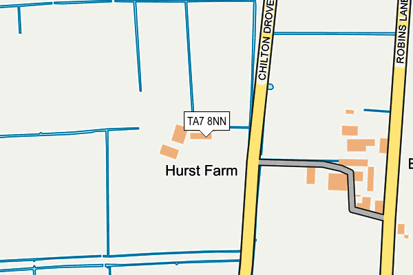
TA7 8NN is located in the King Alfred electoral ward, within the unitary authority of Somerset and the English Parliamentary constituency of Bridgwater and West Somerset. The Sub Integrated Care Board (ICB) Location is NHS Somerset ICB - 11X and the police force is Avon and Somerset. This postcode has been in use since January 1980.


GetTheData
Source: OS OpenMap – Local (Ordnance Survey)
Source: OS VectorMap District (Ordnance Survey)
Licence: Open Government Licence (requires attribution)
| Easting | 338624 |
| Northing | 143857 |
| Latitude | 51.190625 |
| Longitude | -2.879647 |
GetTheData
Source: Open Postcode Geo
Licence: Open Government Licence
| Country | England |
| Postcode District | TA7 |
| ➜ TA7 open data dashboard ➜ See where TA7 is on a map | |
GetTheData
Source: Land Registry Price Paid Data
Licence: Open Government Licence
Elevation or altitude of TA7 8NN as distance above sea level:
| Metres | Feet | |
|---|---|---|
| Elevation | 10m | 33ft |
Elevation is measured from the approximate centre of the postcode, to the nearest point on an OS contour line from OS Terrain 50, which has contour spacing of ten vertical metres.
➜ How high above sea level am I? Find the elevation of your current position using your device's GPS.
GetTheData
Source: Open Postcode Elevation
Licence: Open Government Licence
| Ward | King Alfred |
| Constituency | Bridgwater And West Somerset |
GetTheData
Source: ONS Postcode Database
Licence: Open Government Licence
| Edington School (Station Road) | Burtle | 1,097m |
| Edington School (Station Road) | Burtle | 1,111m |
| Tom Mogg Inn (Station Road) | Burtle | 1,231m |
| Tom Mogg Inn (Station Road) | Burtle | 1,244m |
GetTheData
Source: NaPTAN
Licence: Open Government Licence
| Percentage of properties with Next Generation Access | 100.0% |
| Percentage of properties with Superfast Broadband | 0.0% |
| Percentage of properties with Ultrafast Broadband | 0.0% |
| Percentage of properties with Full Fibre Broadband | 0.0% |
Superfast Broadband is between 30Mbps and 300Mbps
Ultrafast Broadband is > 300Mbps
| Percentage of properties unable to receive 2Mbps | 0.0% |
| Percentage of properties unable to receive 5Mbps | 0.0% |
| Percentage of properties unable to receive 10Mbps | 0.0% |
| Percentage of properties unable to receive 30Mbps | 100.0% |
GetTheData
Source: Ofcom
Licence: Ofcom Terms of Use (requires attribution)
GetTheData
Source: ONS Postcode Database
Licence: Open Government Licence

➜ Get more ratings from the Food Standards Agency
GetTheData
Source: Food Standards Agency
Licence: FSA terms & conditions
| Last Collection | |||
|---|---|---|---|
| Location | Mon-Fri | Sat | Distance |
| Edington | 12:00 | 11:00 | 1,122m |
| Holywell Corner | 12:00 | 11:30 | 3,879m |
| Park Close | 11:00 | 10:00 | 4,412m |
GetTheData
Source: Dracos
Licence: Creative Commons Attribution-ShareAlike
| Facility | Distance |
|---|---|
| Shapwick School (Shapwick Prep) Mark Road, Burtle, Bridgwater Grass Pitches | 730m |
| East Huntspill Cricket Ground Merry Lane, East Huntspill, Highbridge Grass Pitches | 3.5km |
| Sedgemoor Manor School Blackford Road, Mark, Highbridge Sports Hall, Health and Fitness Gym, Grass Pitches, Outdoor Tennis Courts | 4km |
GetTheData
Source: Active Places
Licence: Open Government Licence
| School | Phase of Education | Distance |
|---|---|---|
| Sedgemoor Manor School Blackford Road, Mark, Highbridge, TA9 4NP | Not applicable | 4km |
| Hugh Sexey Church of England Middle School Blackford, Wedmore, BS28 4ND | Middle deemed secondary | 4.4km |
| Catcott Primary School Manor Road, Catcott, Bridgwater, TA7 9HD | Primary | 4.5km |
GetTheData
Source: Edubase
Licence: Open Government Licence
The below table lists the International Territorial Level (ITL) codes (formerly Nomenclature of Territorial Units for Statistics (NUTS) codes) and Local Administrative Units (LAU) codes for TA7 8NN:
| ITL 1 Code | Name |
|---|---|
| TLK | South West (England) |
| ITL 2 Code | Name |
| TLK2 | Dorset and Somerset |
| ITL 3 Code | Name |
| TLK23 | Somerset CC |
| LAU 1 Code | Name |
| E07000188 | Sedgemoor |
GetTheData
Source: ONS Postcode Directory
Licence: Open Government Licence
The below table lists the Census Output Area (OA), Lower Layer Super Output Area (LSOA), and Middle Layer Super Output Area (MSOA) for TA7 8NN:
| Code | Name | |
|---|---|---|
| OA | E00148479 | |
| LSOA | E01029150 | Sedgemoor 012E |
| MSOA | E02006072 | Sedgemoor 012 |
GetTheData
Source: ONS Postcode Directory
Licence: Open Government Licence
| TA7 8NL | Mark Road | 533m |
| TA7 8NT | Robins Lane | 646m |
| TA7 8NY | Robins Drive | 802m |
| TA7 8NJ | Mark Road | 933m |
| TA7 8NW | 1091m | |
| TA7 8NU | Station Road | 1092m |
| TA7 8NH | 1125m | |
| TA7 8NB | Burtle Road | 1532m |
| TA7 8ND | 1677m | |
| TA7 8NX | Edington Road | 1706m |
GetTheData
Source: Open Postcode Geo; Land Registry Price Paid Data
Licence: Open Government Licence