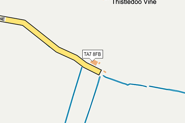
TA7 8FB is located in the Bridgwater East & Bawdrip electoral ward, within the unitary authority of Somerset and the English Parliamentary constituency of Bridgwater and West Somerset. The Sub Integrated Care Board (ICB) Location is NHS Somerset ICB - 11X and the police force is Avon and Somerset. This postcode has been in use since February 2012.


GetTheData
Source: OS OpenMap – Local (Ordnance Survey)
Source: OS VectorMap District (Ordnance Survey)
Licence: Open Government Licence (requires attribution)
| Easting | 335676 |
| Northing | 139304 |
| Latitude | 51.149365 |
| Longitude | -2.921010 |
GetTheData
Source: Open Postcode Geo
Licence: Open Government Licence
| Country | England |
| Postcode District | TA7 |
| ➜ TA7 open data dashboard ➜ See where TA7 is on a map | |
GetTheData
Source: Land Registry Price Paid Data
Licence: Open Government Licence
Elevation or altitude of TA7 8FB as distance above sea level:
| Metres | Feet | |
|---|---|---|
| Elevation | 10m | 33ft |
Elevation is measured from the approximate centre of the postcode, to the nearest point on an OS contour line from OS Terrain 50, which has contour spacing of ten vertical metres.
➜ How high above sea level am I? Find the elevation of your current position using your device's GPS.
GetTheData
Source: Open Postcode Elevation
Licence: Open Government Licence
| Ward | Bridgwater East & Bawdrip |
| Constituency | Bridgwater And West Somerset |
GetTheData
Source: ONS Postcode Database
Licence: Open Government Licence
| The Laurels (Middle Road) | Cossington | 889m |
| The Laurels (Middle Road) | Cossington | 898m |
| Park Close (Brent Road) | Cossington | 1,248m |
| Park Close (Brent Road) | Cossington | 1,257m |
| The Church (Stawell Road) | Stawell | 1,485m |
| Bridgwater Station | 5.4km |
GetTheData
Source: NaPTAN
Licence: Open Government Licence
GetTheData
Source: ONS Postcode Database
Licence: Open Government Licence

➜ Get more ratings from the Food Standards Agency
GetTheData
Source: Food Standards Agency
Licence: FSA terms & conditions
| Last Collection | |||
|---|---|---|---|
| Location | Mon-Fri | Sat | Distance |
| Park Close | 11:00 | 10:00 | 1,273m |
| Bawdrip | 12:00 | 11:00 | 1,522m |
| Bradney | 11:00 | 11:00 | 2,155m |
GetTheData
Source: Dracos
Licence: Creative Commons Attribution-ShareAlike
| Facility | Distance |
|---|---|
| R M Smith Playing Field Cossington Lane, Cossington, Bridgwater Grass Pitches | 1.3km |
| Woolavington Playing Field Sedgemoor Way, Woolavington, Bridgwater Grass Pitches | 2km |
| Chezdoy Playing Field Pig Lane, Chedzoy, Bridgwater Grass Pitches | 2.2km |
GetTheData
Source: Active Places
Licence: Open Government Licence
| School | Phase of Education | Distance |
|---|---|---|
| Kingsmoor Primary School Bawdrip, Bridgwater, TA7 8PY | Primary | 1.5km |
| Woolavington Village Primary School Higher Road, Woolavington, Bridgwater, TA7 8EA | Primary | 2.5km |
| Catcott Primary School Manor Road, Catcott, Bridgwater, TA7 9HD | Primary | 3.7km |
GetTheData
Source: Edubase
Licence: Open Government Licence
The below table lists the International Territorial Level (ITL) codes (formerly Nomenclature of Territorial Units for Statistics (NUTS) codes) and Local Administrative Units (LAU) codes for TA7 8FB:
| ITL 1 Code | Name |
|---|---|
| TLK | South West (England) |
| ITL 2 Code | Name |
| TLK2 | Dorset and Somerset |
| ITL 3 Code | Name |
| TLK23 | Somerset CC |
| LAU 1 Code | Name |
| E07000188 | Sedgemoor |
GetTheData
Source: ONS Postcode Directory
Licence: Open Government Licence
The below table lists the Census Output Area (OA), Lower Layer Super Output Area (LSOA), and Middle Layer Super Output Area (MSOA) for TA7 8FB:
| Code | Name | |
|---|---|---|
| OA | E00148410 | |
| LSOA | E01029137 | Sedgemoor 012B |
| MSOA | E02006072 | Sedgemoor 012 |
GetTheData
Source: ONS Postcode Directory
Licence: Open Government Licence
| TA7 9AQ | Chilton Polden Hill | 797m |
| TA7 8LQ | Middle Road | 887m |
| TA7 8LH | Middle Road | 920m |
| TA7 8JN | Trivetts Way | 964m |
| TA7 8JL | Barley Close | 985m |
| TA7 8LL | Orchard Close | 991m |
| TA7 8JR | Manor Road | 999m |
| TA7 8LS | Bell Lane | 1033m |
| TA7 9AB | Wood Lane | 1050m |
| TA7 8LY | St Marys Close | 1069m |
GetTheData
Source: Open Postcode Geo; Land Registry Price Paid Data
Licence: Open Government Licence