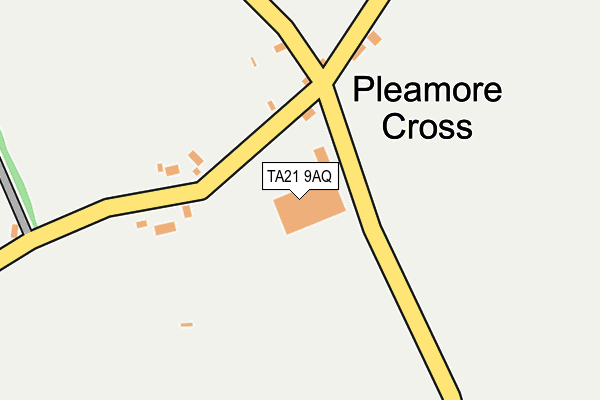
TA21 9AQ is located in the Upper Tone electoral ward, within the unitary authority of Somerset and the English Parliamentary constituency of Taunton Deane. The Sub Integrated Care Board (ICB) Location is NHS Somerset ICB - 11X and the police force is Avon and Somerset. This postcode has been in use since April 2009.


GetTheData
Source: OS OpenMap – Local (Ordnance Survey)
Source: OS VectorMap District (Ordnance Survey)
Licence: Open Government Licence (requires attribution)
| Easting | 312063 |
| Northing | 118648 |
| Latitude | 50.960522 |
| Longitude | -3.253501 |
GetTheData
Source: Open Postcode Geo
Licence: Open Government Licence
| Country | England |
| Postcode District | TA21 |
| ➜ TA21 open data dashboard ➜ See where TA21 is on a map ➜ Where is Pleamore Cross? | |
GetTheData
Source: Land Registry Price Paid Data
Licence: Open Government Licence
Elevation or altitude of TA21 9AQ as distance above sea level:
| Metres | Feet | |
|---|---|---|
| Elevation | 120m | 394ft |
Elevation is measured from the approximate centre of the postcode, to the nearest point on an OS contour line from OS Terrain 50, which has contour spacing of ten vertical metres.
➜ How high above sea level am I? Find the elevation of your current position using your device's GPS.
GetTheData
Source: Open Postcode Elevation
Licence: Open Government Licence
| Ward | Upper Tone |
| Constituency | Taunton Deane |
GetTheData
Source: ONS Postcode Database
Licence: Open Government Licence
| June 2022 | Public order | On or near Brimstone Lane | 370m |
| May 2022 | Violence and sexual offences | On or near Brimstone Lane | 370m |
| ➜ Get more crime data in our Crime section | |||
GetTheData
Source: data.police.uk
Licence: Open Government Licence
| Hemyock Turn Post Box | Pleamore Cross | 127m |
| Hemyock Turn Post Box | Pleamore Cross | 130m |
| Beech Hill | Sampford Moor | 754m |
| Beech Hill | Sampford Moor | 759m |
| Golden Hill (Exeter Road) | Rockwell Green | 1,186m |
GetTheData
Source: NaPTAN
Licence: Open Government Licence
GetTheData
Source: ONS Postcode Database
Licence: Open Government Licence


➜ Get more ratings from the Food Standards Agency
GetTheData
Source: Food Standards Agency
Licence: FSA terms & conditions
| Last Collection | |||
|---|---|---|---|
| Location | Mon-Fri | Sat | Distance |
| Pleamore Cross | 15:30 | 08:00 | 99m |
| Old Sampford Arundel P.o. | 15:30 | 09:00 | 1,124m |
| Bean Bridge | 10:00 | 09:30 | 1,485m |
GetTheData
Source: Dracos
Licence: Creative Commons Attribution-ShareAlike
| Facility | Distance |
|---|---|
| Sampford Arundel Cricket Club Sampford Arundel, Wellington Grass Pitches | 750m |
| Dobree Park Dobree Park, Rockwell Green, Wellington Grass Pitches | 1.6km |
| Bodywise Health And Fitness Spa Mantle Street, Wellington Health and Fitness Gym, Swimming Pool | 1.9km |
GetTheData
Source: Active Places
Licence: Open Government Licence
| School | Phase of Education | Distance |
|---|---|---|
| Sampford Arundel Community Primary School Sampford Arundel, Wellington, TA21 9QN | Primary | 1.2km |
| Rockwell Green Church of England Primary School Brooklands Road, Rockwell Green, Wellington, TA21 9DJ | Primary | 1.9km |
| Court Fields School Mantle Street, Wellington, TA21 8SW | Secondary | 2.2km |
GetTheData
Source: Edubase
Licence: Open Government Licence
The below table lists the International Territorial Level (ITL) codes (formerly Nomenclature of Territorial Units for Statistics (NUTS) codes) and Local Administrative Units (LAU) codes for TA21 9AQ:
| ITL 1 Code | Name |
|---|---|
| TLK | South West (England) |
| ITL 2 Code | Name |
| TLK2 | Dorset and Somerset |
| ITL 3 Code | Name |
| TLK23 | Somerset CC |
| LAU 1 Code | Name |
| E07000246 | Somerset West and Taunton |
GetTheData
Source: ONS Postcode Directory
Licence: Open Government Licence
The below table lists the Census Output Area (OA), Lower Layer Super Output Area (LSOA), and Middle Layer Super Output Area (MSOA) for TA21 9AQ:
| Code | Name | |
|---|---|---|
| OA | E00149108 | |
| LSOA | E01029269 | Taunton Deane 013B |
| MSOA | E02006111 | Taunton Deane 013 |
GetTheData
Source: ONS Postcode Directory
Licence: Open Government Licence
| TA21 9QE | 154m | |
| TA21 9QF | 717m | |
| TA21 9QD | 808m | |
| TA21 9RW | 859m | |
| TA21 9QN | 900m | |
| TA21 9PZ | Bagley Road | 906m |
| TA21 9QG | 915m | |
| TA21 9RL | Exeter Road | 1034m |
| TA21 9BF | Barrington Way | 1035m |
| TA21 9PY | Exeter Road | 1134m |
GetTheData
Source: Open Postcode Geo; Land Registry Price Paid Data
Licence: Open Government Licence