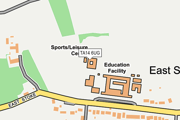
TA14 6UG is located in the Martock electoral ward, within the unitary authority of Somerset and the English Parliamentary constituency of Yeovil. The Sub Integrated Care Board (ICB) Location is NHS Somerset ICB - 11X and the police force is Avon and Somerset. This postcode has been in use since January 1980.


GetTheData
Source: OS OpenMap – Local (Ordnance Survey)
Source: OS VectorMap District (Ordnance Survey)
Licence: Open Government Licence (requires attribution)
| Easting | 348975 |
| Northing | 117417 |
| Latitude | 50.953905 |
| Longitude | -2.727805 |
GetTheData
Source: Open Postcode Geo
Licence: Open Government Licence
| Country | England |
| Postcode District | TA14 |
| ➜ TA14 open data dashboard ➜ See where TA14 is on a map ➜ Where is Stoke sub Hamdon? | |
GetTheData
Source: Land Registry Price Paid Data
Licence: Open Government Licence
Elevation or altitude of TA14 6UG as distance above sea level:
| Metres | Feet | |
|---|---|---|
| Elevation | 50m | 164ft |
Elevation is measured from the approximate centre of the postcode, to the nearest point on an OS contour line from OS Terrain 50, which has contour spacing of ten vertical metres.
➜ How high above sea level am I? Find the elevation of your current position using your device's GPS.
GetTheData
Source: Open Postcode Elevation
Licence: Open Government Licence
| Ward | Martock |
| Constituency | Yeovil |
GetTheData
Source: ONS Postcode Database
Licence: Open Government Licence
| June 2022 | Violence and sexual offences | On or near Montacute Road | 45m |
| June 2022 | Violence and sexual offences | On or near Mason Lane | 472m |
| June 2022 | Violence and sexual offences | On or near Mason Lane | 472m |
| ➜ Get more crime data in our Crime section | |||
GetTheData
Source: data.police.uk
Licence: Open Government Licence
| Stanchester Community School | Montacute | 28m |
| Stanchester Community School (Montacute Road) | Montacute | 51m |
| Mason Lane | Montacute | 430m |
| Mason's Lane Recreation Ground (Montacute Road) | Montacute | 445m |
| The Borough (Middle Street) | Montacute | 965m |
GetTheData
Source: NaPTAN
Licence: Open Government Licence
GetTheData
Source: ONS Postcode Database
Licence: Open Government Licence


➜ Get more ratings from the Food Standards Agency
GetTheData
Source: Food Standards Agency
Licence: FSA terms & conditions
| Last Collection | |||
|---|---|---|---|
| Location | Mon-Fri | Sat | Distance |
| Hyde Road | 16:00 | 09:30 | 641m |
| Montacute Post Office | 16:15 | 10:00 | 1,015m |
| Castle Street | 16:00 | 09:30 | 1,432m |
GetTheData
Source: Dracos
Licence: Creative Commons Attribution-ShareAlike
| Facility | Distance |
|---|---|
| Stanchester Academy East Stoke, Stoke-sub-hamdon Sports Hall, Health and Fitness Gym, Grass Pitches, Squash Courts, Outdoor Tennis Courts | 142m |
| Montacute Recreation Ground Montacute Road, Montacute, Yeovil Grass Pitches | 548m |
| Stoke Sub Hamdon Recreation Ground West Street, Stoke Sub Hamdon Grass Pitches | 1.8km |
GetTheData
Source: Active Places
Licence: Open Government Licence
| School | Phase of Education | Distance |
|---|---|---|
| Stanchester Academy East Stoke, Stoke-sub-Hamdon, TA14 6UG | Secondary | 2m |
| All Saints Church School Ladies Walk, Yeovil Road, Yeovil, TA15 6XG | Primary | 1.2km |
| Castle Primary School Castle Street, Stoke-Sub-Hamdon, TA14 6RE | Primary | 1.5km |
GetTheData
Source: Edubase
Licence: Open Government Licence
The below table lists the International Territorial Level (ITL) codes (formerly Nomenclature of Territorial Units for Statistics (NUTS) codes) and Local Administrative Units (LAU) codes for TA14 6UG:
| ITL 1 Code | Name |
|---|---|
| TLK | South West (England) |
| ITL 2 Code | Name |
| TLK2 | Dorset and Somerset |
| ITL 3 Code | Name |
| TLK23 | Somerset CC |
| LAU 1 Code | Name |
| E07000189 | South Somerset |
GetTheData
Source: ONS Postcode Directory
Licence: Open Government Licence
The below table lists the Census Output Area (OA), Lower Layer Super Output Area (LSOA), and Middle Layer Super Output Area (MSOA) for TA14 6UG:
| Code | Name | |
|---|---|---|
| OA | E00148816 | |
| LSOA | E01029215 | South Somerset 017H |
| MSOA | E02006091 | South Somerset 017 |
GetTheData
Source: ONS Postcode Directory
Licence: Open Government Licence
| TA14 6UQ | 80m | |
| TA14 6UF | 420m | |
| TA15 6UH | Mason Lane | 494m |
| TA15 6UJ | St Michaels View | 549m |
| TA15 6UW | Hyde Road | 549m |
| TA15 6UR | Lower Hyde Road | 569m |
| TA15 6UL | Station Road | 637m |
| TA14 6RH | Stonehill | 688m |
| TA14 6UE | Windsor Lane | 702m |
| TA15 6UU | Bishopston | 766m |
GetTheData
Source: Open Postcode Geo; Land Registry Price Paid Data
Licence: Open Government Licence