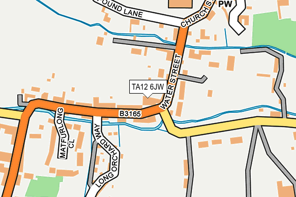
TA12 6JW is located in the Martock electoral ward, within the unitary authority of Somerset and the English Parliamentary constituency of Somerton and Frome. The Sub Integrated Care Board (ICB) Location is NHS Somerset ICB - 11X and the police force is Avon and Somerset. This postcode has been in use since January 1980.


GetTheData
Source: OS OpenMap – Local (Ordnance Survey)
Source: OS VectorMap District (Ordnance Survey)
Licence: Open Government Licence (requires attribution)
| Easting | 346057 |
| Northing | 118960 |
| Latitude | 50.967520 |
| Longitude | -2.769571 |
GetTheData
Source: Open Postcode Geo
Licence: Open Government Licence
| Country | England |
| Postcode District | TA12 |
| ➜ TA12 open data dashboard ➜ See where TA12 is on a map ➜ Where is Martock? | |
GetTheData
Source: Land Registry Price Paid Data
Licence: Open Government Licence
Elevation or altitude of TA12 6JW as distance above sea level:
| Metres | Feet | |
|---|---|---|
| Elevation | 20m | 66ft |
Elevation is measured from the approximate centre of the postcode, to the nearest point on an OS contour line from OS Terrain 50, which has contour spacing of ten vertical metres.
➜ How high above sea level am I? Find the elevation of your current position using your device's GPS.
GetTheData
Source: Open Postcode Elevation
Licence: Open Government Licence
| Ward | Martock |
| Constituency | Somerton And Frome |
GetTheData
Source: ONS Postcode Database
Licence: Open Government Licence
| June 2022 | Violence and sexual offences | On or near Petrol Station | 1m |
| June 2022 | Violence and sexual offences | On or near Petrol Station | 1m |
| June 2022 | Violence and sexual offences | On or near Church Street | 199m |
| ➜ Get more crime data in our Crime section | |||
GetTheData
Source: data.police.uk
Licence: Open Government Licence
| The Pinnacle (North Street) | Martock | 388m |
| The Pinnacle (East Street) | Hurst | 390m |
| The Pinnacle (North Street) | Martock | 489m |
| Stepps Crescent (North Street) | Martock | 695m |
| Paulls Close | Martock | 706m |
GetTheData
Source: NaPTAN
Licence: Open Government Licence
GetTheData
Source: ONS Postcode Database
Licence: Open Government Licence


➜ Get more ratings from the Food Standards Agency
GetTheData
Source: Food Standards Agency
Licence: FSA terms & conditions
| Last Collection | |||
|---|---|---|---|
| Location | Mon-Fri | Sat | Distance |
| Water Street | 16:30 | 09:30 | 77m |
| Martock Post Office | 17:00 | 12:30 | 423m |
| East Street | 16:30 | 08:00 | 778m |
GetTheData
Source: Dracos
Licence: Creative Commons Attribution-ShareAlike
| Facility | Distance |
|---|---|
| Martock Recreation Ground Stoke Road, Martock Grass Pitches, Outdoor Tennis Courts | 154m |
| Martock Parish Hall Church Street, Martock Sports Hall | 274m |
| Fit Martock (Closed) North Street, Martock Health and Fitness Gym | 1.1km |
GetTheData
Source: Active Places
Licence: Open Government Licence
| School | Phase of Education | Distance |
|---|---|---|
| Martock Church of England VA Primary School Elmleigh Road, Martock, TA12 6EF | Primary | 464m |
| Castle Primary School Castle Street, Stoke-Sub-Hamdon, TA14 6RE | Primary | 2km |
| Ash Church of England Primary School Main Street, Ash, Martock, TA12 6NS | Primary | 2.2km |
GetTheData
Source: Edubase
Licence: Open Government Licence
The below table lists the International Territorial Level (ITL) codes (formerly Nomenclature of Territorial Units for Statistics (NUTS) codes) and Local Administrative Units (LAU) codes for TA12 6JW:
| ITL 1 Code | Name |
|---|---|
| TLK | South West (England) |
| ITL 2 Code | Name |
| TLK2 | Dorset and Somerset |
| ITL 3 Code | Name |
| TLK23 | Somerset CC |
| LAU 1 Code | Name |
| E07000189 | South Somerset |
GetTheData
Source: ONS Postcode Directory
Licence: Open Government Licence
The below table lists the Census Output Area (OA), Lower Layer Super Output Area (LSOA), and Middle Layer Super Output Area (MSOA) for TA12 6JW:
| Code | Name | |
|---|---|---|
| OA | E00148773 | |
| LSOA | E01029204 | South Somerset 009C |
| MSOA | E02006083 | South Somerset 009 |
GetTheData
Source: ONS Postcode Directory
Licence: Open Government Licence
| TA12 6JN | Water Street | 32m |
| TA12 6LU | Pound Lane | 158m |
| TA12 6JP | Water Street | 161m |
| TA12 6LD | Matfurlong Close | 177m |
| TA12 6AF | Stoke Road | 192m |
| TA12 6DS | Church Close | 300m |
| TA12 6JL | Church Street | 300m |
| TA12 6JJ | Manor Road | 367m |
| TA12 6JU | 381m | |
| TA12 6JQ | 419m |
GetTheData
Source: Open Postcode Geo; Land Registry Price Paid Data
Licence: Open Government Licence