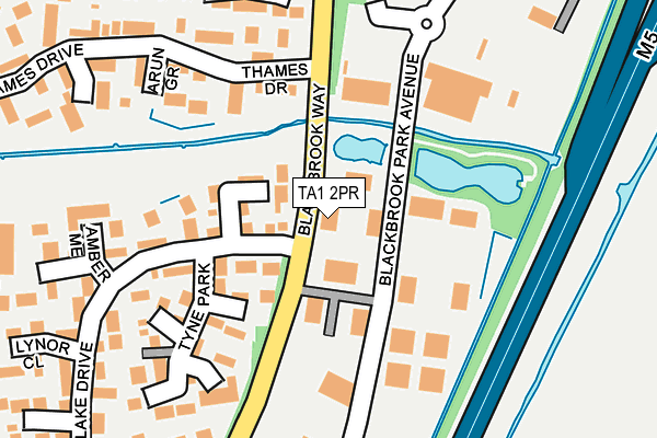
TA1 2PR is located in the Taunton South electoral ward, within the unitary authority of Somerset and the English Parliamentary constituency of Taunton Deane. The Sub Integrated Care Board (ICB) Location is NHS Somerset ICB - 11X and the police force is Avon and Somerset. This postcode has been in use since August 2003.


GetTheData
Source: OS OpenMap – Local (Ordnance Survey)
Source: OS VectorMap District (Ordnance Survey)
Licence: Open Government Licence (requires attribution)
| Easting | 325083 |
| Northing | 124390 |
| Latitude | 51.013989 |
| Longitude | -3.069334 |
GetTheData
Source: Open Postcode Geo
Licence: Open Government Licence
| Country | England |
| Postcode District | TA1 |
| ➜ TA1 open data dashboard ➜ See where TA1 is on a map | |
GetTheData
Source: Land Registry Price Paid Data
Licence: Open Government Licence
Elevation or altitude of TA1 2PR as distance above sea level:
| Metres | Feet | |
|---|---|---|
| Elevation | 10m | 33ft |
Elevation is measured from the approximate centre of the postcode, to the nearest point on an OS contour line from OS Terrain 50, which has contour spacing of ten vertical metres.
➜ How high above sea level am I? Find the elevation of your current position using your device's GPS.
GetTheData
Source: Open Postcode Elevation
Licence: Open Government Licence
| Ward | Taunton South |
| Constituency | Taunton Deane |
GetTheData
Source: ONS Postcode Database
Licence: Open Government Licence
| June 2023 | Violence and sexual offences | On or near Redlake Drive | 259m |
| June 2022 | Violence and sexual offences | On or near Witham Close | 92m |
| June 2022 | Vehicle crime | On or near Witham Close | 92m |
| ➜ Get more crime data in our Crime section | |||
GetTheData
Source: data.police.uk
Licence: Open Government Licence
| Tyne Park (Redlake Drive) | Taunton | 130m |
| Tyne Park (Redlake Drive) | Taunton | 130m |
| Arun Grove (Thames Drive) | Taunton | 211m |
| Marden Grove (Redlake Drive) | Taunton | 326m |
| Marden Grove (Redlake Drive) | Taunton | 326m |
| Taunton Station | 2.6km |
GetTheData
Source: NaPTAN
Licence: Open Government Licence
GetTheData
Source: ONS Postcode Database
Licence: Open Government Licence


➜ Get more ratings from the Food Standards Agency
GetTheData
Source: Food Standards Agency
Licence: FSA terms & conditions
| Last Collection | |||
|---|---|---|---|
| Location | Mon-Fri | Sat | Distance |
| Calder Crescent | 17:00 | 12:00 | 277m |
| Bathpool | 16:45 | 10:30 | 1,503m |
| Mountfields Post Office | 17:15 | 12:00 | 1,647m |
GetTheData
Source: Dracos
Licence: Creative Commons Attribution-ShareAlike
| Facility | Distance |
|---|---|
| Blackbrook Leisure Centre Blackbrook Way, Taunton Sports Hall, Health and Fitness Gym, Indoor Tennis Centre, Studio, Squash Courts, Outdoor Tennis Courts, Swimming Pool | 505m |
| Blackbrook Pavilion Playing Fields Blackbrook Way, Taunton Grass Pitches | 505m |
| You Fit Health Club (Taunton) Deane Gate Avenue, Taunton Swimming Pool, Health and Fitness Gym | 559m |
GetTheData
Source: Active Places
Licence: Open Government Licence
| School | Phase of Education | Distance |
|---|---|---|
| Blackbrook Primary School Ashbourne Crescent, Taunton, TA1 2RA | Primary | 442m |
| Minerva Primary School Outer Circle, Somerset, Taunton, TA1 2BU | Primary | 817m |
| Holway Park Community Primary School Shakespeare Avenue, Taunton, TA1 2JA | Primary | 891m |
GetTheData
Source: Edubase
Licence: Open Government Licence
The below table lists the International Territorial Level (ITL) codes (formerly Nomenclature of Territorial Units for Statistics (NUTS) codes) and Local Administrative Units (LAU) codes for TA1 2PR:
| ITL 1 Code | Name |
|---|---|
| TLK | South West (England) |
| ITL 2 Code | Name |
| TLK2 | Dorset and Somerset |
| ITL 3 Code | Name |
| TLK23 | Somerset CC |
| LAU 1 Code | Name |
| E07000246 | Somerset West and Taunton |
GetTheData
Source: ONS Postcode Directory
Licence: Open Government Licence
The below table lists the Census Output Area (OA), Lower Layer Super Output Area (LSOA), and Middle Layer Super Output Area (MSOA) for TA1 2PR:
| Code | Name | |
|---|---|---|
| OA | E00149169 | |
| LSOA | E01029282 | Taunton Deane 006A |
| MSOA | E02006104 | Taunton Deane 006 |
GetTheData
Source: ONS Postcode Directory
Licence: Open Government Licence
| TA1 2RR | Witham Close | 84m |
| TA1 2NW | Welland Close | 152m |
| TA1 2RP | Tyne Park | 171m |
| TA1 2NR | Arun Grove | 185m |
| TA1 2NN | Banwell Close | 191m |
| TA1 2NP | Trent Meadow | 232m |
| TA1 2RY | Amber Mead | 236m |
| TA1 2RS | Redlake Drive | 253m |
| TA1 2NL | Thames Drive | 259m |
| TA1 2NX | Leadon Grove | 266m |
GetTheData
Source: Open Postcode Geo; Land Registry Price Paid Data
Licence: Open Government Licence