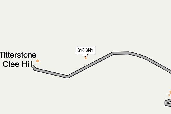
SY8 3NY is located in the Clee electoral ward, within the unitary authority of Shropshire and the English Parliamentary constituency of Ludlow. The Sub Integrated Care Board (ICB) Location is NHS Shropshire, Telford and Wrekin ICB - M2L0M and the police force is West Mercia. This postcode has been in use since January 1980.


GetTheData
Source: OS OpenMap – Local (Ordnance Survey)
Source: OS VectorMap District (Ordnance Survey)
Licence: Open Government Licence (requires attribution)
| Easting | 359445 |
| Northing | 277977 |
| Latitude | 52.398310 |
| Longitude | -2.597459 |
GetTheData
Source: Open Postcode Geo
Licence: Open Government Licence
| Country | England |
| Postcode District | SY8 |
| ➜ SY8 open data dashboard ➜ See where SY8 is on a map | |
GetTheData
Source: Land Registry Price Paid Data
Licence: Open Government Licence
Elevation or altitude of SY8 3NY as distance above sea level:
| Metres | Feet | |
|---|---|---|
| Elevation | 520m | 1,706ft |
Elevation is measured from the approximate centre of the postcode, to the nearest point on an OS contour line from OS Terrain 50, which has contour spacing of ten vertical metres.
➜ How high above sea level am I? Find the elevation of your current position using your device's GPS.
GetTheData
Source: Open Postcode Elevation
Licence: Open Government Licence
| Ward | Clee |
| Constituency | Ludlow |
GetTheData
Source: ONS Postcode Database
Licence: Open Government Licence
| March 2022 | Anti-social behaviour | On or near Parking Area | 392m |
| March 2022 | Violence and sexual offences | On or near Parking Area | 392m |
| December 2021 | Anti-social behaviour | On or near Parking Area | 392m |
| ➜ Get more crime data in our Crime section | |||
GetTheData
Source: data.police.uk
Licence: Open Government Licence
| War Memorial (Main Road) | Bedlam | 1,284m |
| War Memorial (Main Road) | Bedlam | 1,322m |
GetTheData
Source: NaPTAN
Licence: Open Government Licence
GetTheData
Source: ONS Postcode Database
Licence: Open Government Licence
| Last Collection | |||
|---|---|---|---|
| Location | Mon-Fri | Sat | Distance |
| Clee Stanton | 11:30 | 11:30 | 2,440m |
| Royal Oak | 11:30 | 11:30 | 2,573m |
| Clee Hill Post Office | 16:30 | 11:30 | 2,653m |
GetTheData
Source: Dracos
Licence: Creative Commons Attribution-ShareAlike
| Facility | Distance |
|---|---|
| Clee Hill Recreation Field High Street, Clee Hill, Ludlow Grass Pitches | 2.7km |
| Clee Hill Community Academy Tenbury Road, Clee Hill, Ludlow Grass Pitches | 2.8km |
| Clee Hill Rugby Club (Tenbury Road) Tenbury Road, Clee Hill, Ludlow Grass Pitches | 3.7km |
GetTheData
Source: Active Places
Licence: Open Government Licence
| School | Phase of Education | Distance |
|---|---|---|
| Clee Hill Community Academy Tenbury Road, Clee Hill, Ludlow, SY8 3NE | Primary | 2.8km |
| Bitterley CofE Primary School (Aided) Bitterley, Ludlow, SY8 3HF | Primary | 3.3km |
| Farlow CofE Primary School Farlow, Cleobury Mortimer, Kidderminster, DY14 0RQ | Primary | 5.3km |
GetTheData
Source: Edubase
Licence: Open Government Licence
The below table lists the International Territorial Level (ITL) codes (formerly Nomenclature of Territorial Units for Statistics (NUTS) codes) and Local Administrative Units (LAU) codes for SY8 3NY:
| ITL 1 Code | Name |
|---|---|
| TLG | West Midlands (England) |
| ITL 2 Code | Name |
| TLG2 | Shropshire and Staffordshire |
| ITL 3 Code | Name |
| TLG22 | Shropshire |
| LAU 1 Code | Name |
| E06000051 | Shropshire |
GetTheData
Source: ONS Postcode Directory
Licence: Open Government Licence
The below table lists the Census Output Area (OA), Lower Layer Super Output Area (LSOA), and Middle Layer Super Output Area (MSOA) for SY8 3NY:
| Code | Name | |
|---|---|---|
| OA | E00147649 | |
| LSOA | E01028993 | Shropshire 036A |
| MSOA | E02006043 | Shropshire 036 |
GetTheData
Source: ONS Postcode Directory
Licence: Open Government Licence
| SY8 3PW | 1110m | |
| SY8 3PR | 1135m | |
| SY8 3PP | Titterstone Cottages | 1236m |
| DY14 0QY | 1458m | |
| DY14 0QX | 1766m | |
| DY14 0QU | 1828m | |
| DY14 0QW | 1829m | |
| SY8 3PN | New Buildings | 1841m |
| SY8 3PL | Rouse Boughton Terrace | 1845m |
| DY14 0QZ | 1926m |
GetTheData
Source: Open Postcode Geo; Land Registry Price Paid Data
Licence: Open Government Licence