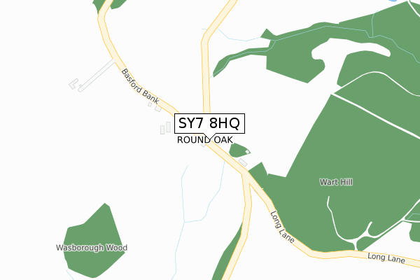
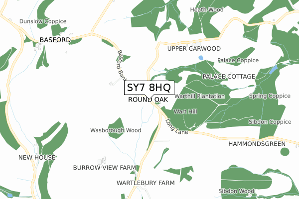
SY7 8HQ is in Round Oak, Craven Arms. SY7 8HQ is located in the Church Stretton and Craven Arms electoral ward, within the unitary authority of Shropshire and the English Parliamentary constituency of Ludlow. The Sub Integrated Care Board (ICB) Location is NHS Shropshire, Telford and Wrekin ICB - M2L0M and the police force is West Mercia. This postcode has been in use since January 1980.


GetTheData
Source: OS Open Zoomstack (Ordnance Survey)
Licence: Open Government Licence (requires attribution)
Attribution: Contains OS data © Crown copyright and database right 2024
Source: Open Postcode Geo
Licence: Open Government Licence (requires attribution)
Attribution: Contains OS data © Crown copyright and database right 2024; Contains Royal Mail data © Royal Mail copyright and database right 2024; Source: Office for National Statistics licensed under the Open Government Licence v.3.0
| Easting | 339762 |
| Northing | 284861 |
| Latitude | 52.458375 |
| Longitude | -2.887950 |
GetTheData
Source: Open Postcode Geo
Licence: Open Government Licence
| Locality | Round Oak |
| Town/City | Craven Arms |
| Country | England |
| Postcode District | SY7 |
| ➜ SY7 open data dashboard ➜ See where SY7 is on a map ➜ Where is Round Oak? | |
GetTheData
Source: Land Registry Price Paid Data
Licence: Open Government Licence
Elevation or altitude of SY7 8HQ as distance above sea level:
| Metres | Feet | |
|---|---|---|
| Elevation | 260m | 853ft |
Elevation is measured from the approximate centre of the postcode, to the nearest point on an OS contour line from OS Terrain 50, which has contour spacing of ten vertical metres.
➜ How high above sea level am I? Find the elevation of your current position using your device's GPS.
GetTheData
Source: Open Postcode Elevation
Licence: Open Government Licence
| Ward | Church Stretton And Craven Arms |
| Constituency | Ludlow |
GetTheData
Source: ONS Postcode Database
Licence: Open Government Licence
| June 2022 | Criminal damage and arson | On or near Basford Bank | 388m |
| February 2022 | Anti-social behaviour | On or near Basford Bank | 388m |
| June 2021 | Anti-social behaviour | On or near Basford Bank | 388m |
| ➜ Get more crime data in our Crime section | |||
GetTheData
Source: data.police.uk
Licence: Open Government Licence
| Junction (Basford Bank) | Round Oak | 37m |
| Crossroads (Main Road) | Edgton | 1,427m |
| Crossroads (Main Road) | Edgton | 1,432m |
| Hopesay Farm (Main Road) | Hopesay | 1,666m |
| Craven Arms Station | 3.9km |
| Broome Station | 4km |
GetTheData
Source: NaPTAN
Licence: Open Government Licence
| Percentage of properties with Next Generation Access | 0.0% |
| Percentage of properties with Superfast Broadband | 0.0% |
| Percentage of properties with Ultrafast Broadband | 0.0% |
| Percentage of properties with Full Fibre Broadband | 0.0% |
Superfast Broadband is between 30Mbps and 300Mbps
Ultrafast Broadband is > 300Mbps
| Percentage of properties unable to receive 2Mbps | 0.0% |
| Percentage of properties unable to receive 5Mbps | 90.9% |
| Percentage of properties unable to receive 10Mbps | 100.0% |
| Percentage of properties unable to receive 30Mbps | 100.0% |
GetTheData
Source: Ofcom
Licence: Ofcom Terms of Use (requires attribution)
Estimated total energy consumption in SY7 8HQ by fuel type, 2015.
| Consumption (kWh) | 40,419 |
|---|---|
| Meter count | 8 |
| Mean (kWh/meter) | 5,052 |
| Median (kWh/meter) | 5,724 |
GetTheData
Source: Postcode level gas estimates: 2015 (experimental)
Source: Postcode level electricity estimates: 2015 (experimental)
Licence: Open Government Licence
GetTheData
Source: ONS Postcode Database
Licence: Open Government Licence
| Last Collection | |||
|---|---|---|---|
| Location | Mon-Fri | Sat | Distance |
| Wistanstow | 16:30 | 09:00 | 3,482m |
| Kempton | 17:30 | 11:45 | 4,103m |
| Little Brampton | 16:00 | 09:45 | 4,518m |
GetTheData
Source: Dracos
Licence: Creative Commons Attribution-ShareAlike
| Facility | Distance |
|---|---|
| Craven Arms Sports Field Shrewsbury Road, Craven Arms Grass Pitches, Cycling | 4km |
| Community Arts Sports Craven Arms (Casca) Newington Way, Craven Arms Sports Hall, Outdoor Tennis Courts, Grass Pitches | 4km |
GetTheData
Source: Active Places
Licence: Open Government Licence
| School | Phase of Education | Distance |
|---|---|---|
| Wistanstow CofE Primary School Wistanstow, Craven Arms, SY7 8DQ | Primary | 3.5km |
| Stokesay Primary School Market Street, Craven Arms, SY7 9NW | Primary | 4.3km |
| Lydbury North CofE (A) Primary School Lydbury North, SY7 8AU | Primary | 4.8km |
GetTheData
Source: Edubase
Licence: Open Government Licence
The below table lists the International Territorial Level (ITL) codes (formerly Nomenclature of Territorial Units for Statistics (NUTS) codes) and Local Administrative Units (LAU) codes for SY7 8HQ:
| ITL 1 Code | Name |
|---|---|
| TLG | West Midlands (England) |
| ITL 2 Code | Name |
| TLG2 | Shropshire and Staffordshire |
| ITL 3 Code | Name |
| TLG22 | Shropshire |
| LAU 1 Code | Name |
| E06000051 | Shropshire |
GetTheData
Source: ONS Postcode Directory
Licence: Open Government Licence
The below table lists the Census Output Area (OA), Lower Layer Super Output Area (LSOA), and Middle Layer Super Output Area (MSOA) for SY7 8HQ:
| Code | Name | |
|---|---|---|
| OA | E00147770 | |
| LSOA | E01029016 | Shropshire 037D |
| MSOA | E02006044 | Shropshire 037 |
GetTheData
Source: ONS Postcode Directory
Licence: Open Government Licence
| SY7 8HG | 833m | |
| SY7 8HE | 1056m | |
| SY7 8HB | Oakfield Cottages | 1433m |
| SY7 8HN | 1471m | |
| SY7 8HW | 1592m | |
| SY7 8HD | 1637m | |
| SY7 8HT | 1740m | |
| SY7 8EY | 1782m | |
| SY7 8EX | 2151m | |
| SY7 8DR | 2318m |
GetTheData
Source: Open Postcode Geo; Land Registry Price Paid Data
Licence: Open Government Licence