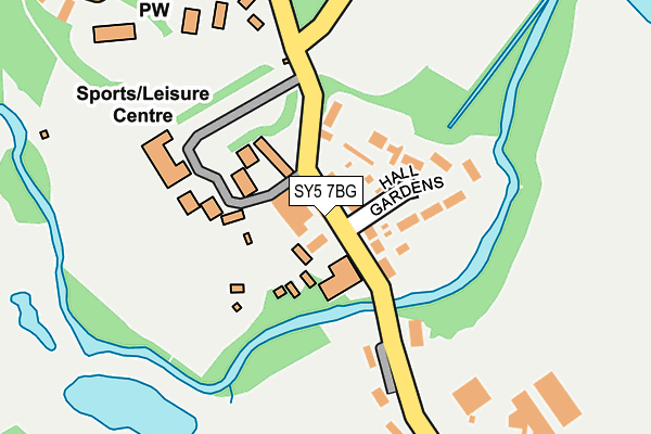
SY5 7BG lies on Condover Mews in Condover, Shrewsbury. SY5 7BG is located in the Burnell electoral ward, within the unitary authority of Shropshire and the English Parliamentary constituency of Shrewsbury and Atcham. The Sub Integrated Care Board (ICB) Location is NHS Shropshire, Telford and Wrekin ICB - M2L0M and the police force is West Mercia. This postcode has been in use since August 1993.


GetTheData
Source: OS OpenMap – Local (Ordnance Survey)
Source: OS VectorMap District (Ordnance Survey)
Licence: Open Government Licence (requires attribution)
| Easting | 349657 |
| Northing | 305611 |
| Latitude | 52.645887 |
| Longitude | -2.745497 |
GetTheData
Source: Open Postcode Geo
Licence: Open Government Licence
| Street | Condover Mews |
| Locality | Condover |
| Town/City | Shrewsbury |
| Country | England |
| Postcode District | SY5 |
| ➜ SY5 open data dashboard ➜ See where SY5 is on a map ➜ Where is Condover? | |
GetTheData
Source: Land Registry Price Paid Data
Licence: Open Government Licence
Elevation or altitude of SY5 7BG as distance above sea level:
| Metres | Feet | |
|---|---|---|
| Elevation | 80m | 262ft |
Elevation is measured from the approximate centre of the postcode, to the nearest point on an OS contour line from OS Terrain 50, which has contour spacing of ten vertical metres.
➜ How high above sea level am I? Find the elevation of your current position using your device's GPS.
GetTheData
Source: Open Postcode Elevation
Licence: Open Government Licence
| Ward | Burnell |
| Constituency | Shrewsbury And Atcham |
GetTheData
Source: ONS Postcode Database
Licence: Open Government Licence
| June 2022 | Violence and sexual offences | On or near Church Street | 298m |
| May 2022 | Violence and sexual offences | On or near Church Street | 298m |
| April 2022 | Violence and sexual offences | On or near Hall Gardens | 51m |
| ➜ Get more crime data in our Crime section | |||
GetTheData
Source: data.police.uk
Licence: Open Government Licence
| School (Main Road) | Condover | 576m |
| School (Main Road) | Condover | 602m |
GetTheData
Source: NaPTAN
Licence: Open Government Licence
GetTheData
Source: ONS Postcode Database
Licence: Open Government Licence


➜ Get more ratings from the Food Standards Agency
GetTheData
Source: Food Standards Agency
Licence: FSA terms & conditions
| Last Collection | |||
|---|---|---|---|
| Location | Mon-Fri | Sat | Distance |
| Wheathall | 16:15 | 07:45 | 1,834m |
| Lyth Hill | 16:15 | 11:00 | 2,755m |
| Stapleton Village | 16:30 | 07:45 | 2,792m |
GetTheData
Source: Dracos
Licence: Creative Commons Attribution-ShareAlike
| Facility | Distance |
|---|---|
| Condover Ce Primary School Station Road, Condover, Shrewsbury Grass Pitches | 652m |
| Condover Sports Ground Station Road, Condover, Shrewsbury Grass Pitches | 1km |
| Shrewsbury Golf Club Condover, Shrewsbury Golf | 1.4km |
GetTheData
Source: Active Places
Licence: Open Government Licence
| School | Phase of Education | Distance |
|---|---|---|
| Condover CofE Primary School Condover, Shrewsbury, SY5 7AA | Primary | 644m |
| St Edward's CofE Primary School Church Road, Dorrington, Shrewsbury, SY5 7JL | Primary | 3.4km |
| Oakmeadow Church of England Primary and Nursery School Longmeadow Site, Bayston Hill, Shrewsbury, SY3 0NU | Primary | 3.7km |
GetTheData
Source: Edubase
Licence: Open Government Licence
The below table lists the International Territorial Level (ITL) codes (formerly Nomenclature of Territorial Units for Statistics (NUTS) codes) and Local Administrative Units (LAU) codes for SY5 7BG:
| ITL 1 Code | Name |
|---|---|
| TLG | West Midlands (England) |
| ITL 2 Code | Name |
| TLG2 | Shropshire and Staffordshire |
| ITL 3 Code | Name |
| TLG22 | Shropshire |
| LAU 1 Code | Name |
| E06000051 | Shropshire |
GetTheData
Source: ONS Postcode Directory
Licence: Open Government Licence
The below table lists the Census Output Area (OA), Lower Layer Super Output Area (LSOA), and Middle Layer Super Output Area (MSOA) for SY5 7BG:
| Code | Name | |
|---|---|---|
| OA | E00147422 | |
| LSOA | E01028950 | Shropshire 028A |
| MSOA | E02006040 | Shropshire 028 |
GetTheData
Source: ONS Postcode Directory
Licence: Open Government Licence
| SY5 7BD | Hall Gardens | 29m |
| SY5 7BT | 139m | |
| SY5 7BX | Longacre Drive | 172m |
| SY5 7AG | Japonica Cottages | 321m |
| SY5 7AF | Church Road | 328m |
| SY5 7AQ | The Shrubbery | 341m |
| SY5 7AE | Butcher Row | 354m |
| SY5 7AA | 499m | |
| SY5 7AZ | Harley Road | 533m |
| SY5 7BB | Harley Road | 546m |
GetTheData
Source: Open Postcode Geo; Land Registry Price Paid Data
Licence: Open Government Licence