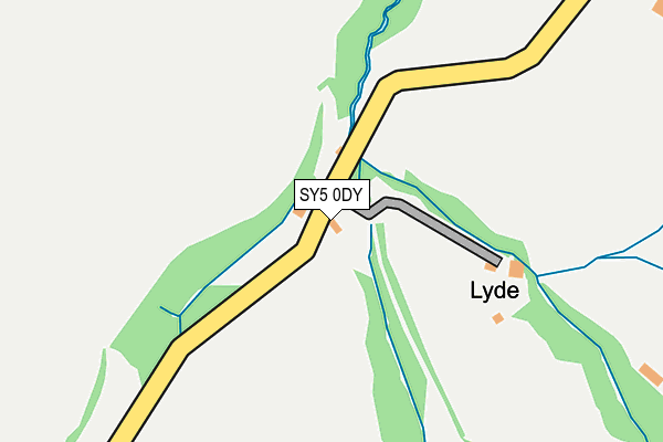
SY5 0DY lies on The Lyde in Bromlow, Shrewsbury. SY5 0DY is located in the Chirbury and Worthen electoral ward, within the unitary authority of Shropshire and the English Parliamentary constituency of Ludlow. The Sub Integrated Care Board (ICB) Location is NHS Shropshire, Telford and Wrekin ICB - M2L0M and the police force is West Mercia. This postcode has been in use since January 1980.


GetTheData
Source: OS OpenMap – Local (Ordnance Survey)
Source: OS VectorMap District (Ordnance Survey)
Licence: Open Government Licence (requires attribution)
| Easting | 331619 |
| Northing | 301535 |
| Latitude | 52.607288 |
| Longitude | -3.011209 |
GetTheData
Source: Open Postcode Geo
Licence: Open Government Licence
| Street | The Lyde |
| Locality | Bromlow |
| Town/City | Shrewsbury |
| Country | England |
| Postcode District | SY5 |
| ➜ SY5 open data dashboard ➜ See where SY5 is on a map | |
GetTheData
Source: Land Registry Price Paid Data
Licence: Open Government Licence
Elevation or altitude of SY5 0DY as distance above sea level:
| Metres | Feet | |
|---|---|---|
| Elevation | 200m | 656ft |
Elevation is measured from the approximate centre of the postcode, to the nearest point on an OS contour line from OS Terrain 50, which has contour spacing of ten vertical metres.
➜ How high above sea level am I? Find the elevation of your current position using your device's GPS.
GetTheData
Source: Open Postcode Elevation
Licence: Open Government Licence
| Ward | Chirbury And Worthen |
| Constituency | Ludlow |
GetTheData
Source: ONS Postcode Database
Licence: Open Government Licence
| Percentage of properties with Next Generation Access | 100.0% |
| Percentage of properties with Superfast Broadband | 100.0% |
| Percentage of properties with Ultrafast Broadband | 100.0% |
| Percentage of properties with Full Fibre Broadband | 100.0% |
Superfast Broadband is between 30Mbps and 300Mbps
Ultrafast Broadband is > 300Mbps
| Percentage of properties unable to receive 2Mbps | 0.0% |
| Percentage of properties unable to receive 5Mbps | 0.0% |
| Percentage of properties unable to receive 10Mbps | 0.0% |
| Percentage of properties unable to receive 30Mbps | 0.0% |
GetTheData
Source: Ofcom
Licence: Ofcom Terms of Use (requires attribution)
GetTheData
Source: ONS Postcode Database
Licence: Open Government Licence

➜ Get more ratings from the Food Standards Agency
GetTheData
Source: Food Standards Agency
Licence: FSA terms & conditions
| Last Collection | |||
|---|---|---|---|
| Location | Mon-Fri | Sat | Distance |
| Stiperstones Post Office | 17:15 | 12:15 | 4,809m |
| The Bog Mines | 17:00 | 12:00 | 5,388m |
| Plox Green | 17:30 | 12:00 | 5,460m |
GetTheData
Source: Dracos
Licence: Creative Commons Attribution-ShareAlike
| Facility | Distance |
|---|---|
| Worthen Village Hall & Recreation Ground B4386 From Brockton Meadow To Little Worthen Junction, Worthen Grass Pitches | 3.2km |
| Dickens Field (Closed) Hampton Beech, Worthen, Shrewsbury Grass Pitches | 4.8km |
GetTheData
Source: Active Places
Licence: Open Government Licence
| School | Phase of Education | Distance |
|---|---|---|
| Long Mountain CofE Primary School Worthen, Shrewsbury, SY5 9HT | Primary | 3.1km |
| Stiperstones CofE Primary School Snailbeach, Shrewsbury, SY5 0LZ | Primary | 4.7km |
GetTheData
Source: Edubase
Licence: Open Government Licence
The below table lists the International Territorial Level (ITL) codes (formerly Nomenclature of Territorial Units for Statistics (NUTS) codes) and Local Administrative Units (LAU) codes for SY5 0DY:
| ITL 1 Code | Name |
|---|---|
| TLG | West Midlands (England) |
| ITL 2 Code | Name |
| TLG2 | Shropshire and Staffordshire |
| ITL 3 Code | Name |
| TLG22 | Shropshire |
| LAU 1 Code | Name |
| E06000051 | Shropshire |
GetTheData
Source: ONS Postcode Directory
Licence: Open Government Licence
The below table lists the Census Output Area (OA), Lower Layer Super Output Area (LSOA), and Middle Layer Super Output Area (MSOA) for SY5 0DY:
| Code | Name | |
|---|---|---|
| OA | E00147775 | |
| LSOA | E01033530 | Shropshire 030E |
| MSOA | E02006041 | Shropshire 030 |
GetTheData
Source: ONS Postcode Directory
Licence: Open Government Licence
| SY5 0EB | The Lyde | 399m |
| SY5 0DZ | 595m | |
| SY5 0ED | Oakern | 686m |
| SY5 0EA | 720m | |
| SY5 0DX | 1020m | |
| SY5 0DU | 1158m | |
| SY5 0HJ | 1375m | |
| SY5 0EZ | 1409m | |
| SY5 0HQ | Hope Park | 1424m |
| SY5 0HF | Hope Common | 1687m |
GetTheData
Source: Open Postcode Geo; Land Registry Price Paid Data
Licence: Open Government Licence