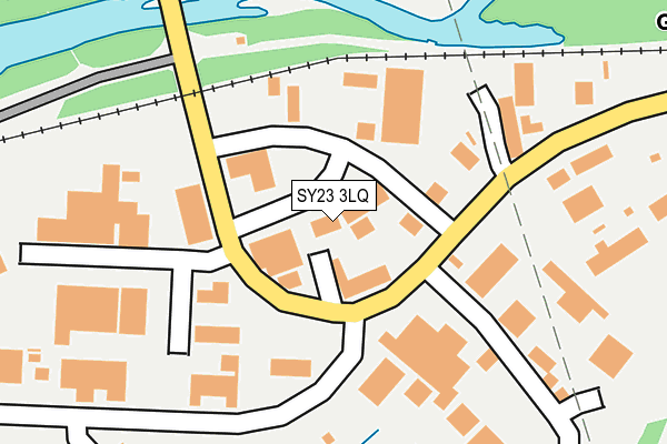
SY23 3LQ lies on Glan Yr Afon Industrial Estate in Llanbadarn Fawr, Aberystwyth. SY23 3LQ is located in the Llanfarian electoral ward, within the unitary authority of Ceredigion and the Welsh Parliamentary constituency of Ceredigion. The Local Health Board is Hywel Dda University and the police force is Dyfed-Powys. This postcode has been in use since January 1995.


GetTheData
Source: OS OpenMap – Local (Ordnance Survey)
Source: OS VectorMap District (Ordnance Survey)
Licence: Open Government Licence (requires attribution)
| Easting | 261156 |
| Northing | 280311 |
| Latitude | 52.403159 |
| Longitude | -4.042345 |
GetTheData
Source: Open Postcode Geo
Licence: Open Government Licence
| Street | Glan Yr Afon Industrial Estate |
| Locality | Llanbadarn Fawr |
| Town/City | Aberystwyth |
| Country | Wales |
| Postcode District | SY23 |
| ➜ SY23 open data dashboard ➜ See where SY23 is on a map ➜ Where is Aberystwyth? | |
GetTheData
Source: Land Registry Price Paid Data
Licence: Open Government Licence
Elevation or altitude of SY23 3LQ as distance above sea level:
| Metres | Feet | |
|---|---|---|
| Elevation | 10m | 33ft |
Elevation is measured from the approximate centre of the postcode, to the nearest point on an OS contour line from OS Terrain 50, which has contour spacing of ten vertical metres.
➜ How high above sea level am I? Find the elevation of your current position using your device's GPS.
GetTheData
Source: Open Postcode Elevation
Licence: Open Government Licence
| Ward | Llanfarian |
| Constituency | Ceredigion |
GetTheData
Source: ONS Postcode Database
Licence: Open Government Licence
| Glanrafon Ind Est (Unnamed) | Glanyrafon | 89m |
| Capel Moriah (A4120) | Moriah | 1,128m |
| Capel Moriah (A4120) | Moriah | 1,134m |
| Pwllhobi (A44) | Llanbadarn Fawr | 1,152m |
| Pwllhobi (A44) | Llanbadarn Fawr | 1,158m |
| Glanrafon (Vale Of Rheidol Railway) | Glanyrafon | 384m |
| Llanbadarn (Vale Of Rheidol Railway) | Llanbadarn Fawr | 1,380m |
| Aberystwyth Station | 3km |
GetTheData
Source: NaPTAN
Licence: Open Government Licence
GetTheData
Source: ONS Postcode Database
Licence: Open Government Licence


➜ Get more ratings from the Food Standards Agency
GetTheData
Source: Food Standards Agency
Licence: FSA terms & conditions
| Last Collection | |||
|---|---|---|---|
| Location | Mon-Fri | Sat | Distance |
| Aberystwyth Delivery Office | 18:00 | 13:00 | 102m |
| Pendre | 16:45 | 11:30 | 632m |
| Moriah | 14:30 | 11:15 | 1,151m |
GetTheData
Source: Dracos
Licence: Creative Commons Attribution-ShareAlike
| School | Phase of Education | Distance |
|---|---|---|
| Ysgol Llwyn Yr Eos Penparcau, Aberystwyth, Ceredigion, SY23 1SH | Not applicable | 1.8km |
| Ysgol Penglais Waunfawr, Aberystwyth, Ceredigion, SY23 3AW | Not applicable | 1.8km |
| Ysgol Gyfun Penweddig Ffordd Llanbadarn, Llangawsai, Aberystwyth, SY23 3QN | Not applicable | 1.9km |
GetTheData
Source: Edubase
Licence: Open Government Licence
The below table lists the International Territorial Level (ITL) codes (formerly Nomenclature of Territorial Units for Statistics (NUTS) codes) and Local Administrative Units (LAU) codes for SY23 3LQ:
| ITL 1 Code | Name |
|---|---|
| TLL | Wales |
| ITL 2 Code | Name |
| TLL1 | West Wales and The Valleys |
| ITL 3 Code | Name |
| TLL14 | South West Wales |
| LAU 1 Code | Name |
| W06000008 | Ceredigion |
GetTheData
Source: ONS Postcode Directory
Licence: Open Government Licence
The below table lists the Census Output Area (OA), Lower Layer Super Output Area (LSOA), and Middle Layer Super Output Area (MSOA) for SY23 3LQ:
| Code | Name | |
|---|---|---|
| OA | W00002852 | |
| LSOA | W01000534 | Ceredigion 011B |
| MSOA | W02000421 | Ceredigion 011 |
GetTheData
Source: ONS Postcode Directory
Licence: Open Government Licence
| SY23 3JQ | Glan Yr Afon Industrial Estate | 148m |
| SY23 3NG | Min Y Llyn | 194m |
| SY23 3FF | Parc Merlin | 214m |
| SY23 3HJ | 252m | |
| SY23 3UD | Clos Deulen | 334m |
| SY23 3HL | 451m | |
| SY23 3SZ | 546m | |
| SY23 3AA | 574m | |
| SY23 3SY | Pendre Cottages | 661m |
| SY23 3HW | 687m |
GetTheData
Source: Open Postcode Geo; Land Registry Price Paid Data
Licence: Open Government Licence