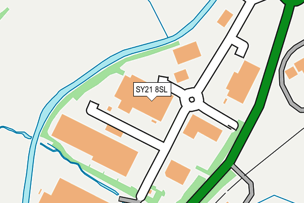
SY21 8SL is located in the Welshpool Gungrog electoral ward, within the unitary authority of Powys and the Welsh Parliamentary constituency of Montgomeryshire. The Local Health Board is Powys Teaching and the police force is Dyfed-Powys. This postcode has been in use since December 1996.


GetTheData
Source: OS OpenMap – Local (Ordnance Survey)
Source: OS VectorMap District (Ordnance Survey)
Licence: Open Government Licence (requires attribution)
| Easting | 324034 |
| Northing | 308630 |
| Latitude | 52.670048 |
| Longitude | -3.124830 |
GetTheData
Source: Open Postcode Geo
Licence: Open Government Licence
| Country | Wales |
| Postcode District | SY21 |
| ➜ SY21 open data dashboard ➜ See where SY21 is on a map ➜ Where is Gungrog? | |
GetTheData
Source: Land Registry Price Paid Data
Licence: Open Government Licence
Elevation or altitude of SY21 8SL as distance above sea level:
| Metres | Feet | |
|---|---|---|
| Elevation | 80m | 262ft |
Elevation is measured from the approximate centre of the postcode, to the nearest point on an OS contour line from OS Terrain 50, which has contour spacing of ten vertical metres.
➜ How high above sea level am I? Find the elevation of your current position using your device's GPS.
GetTheData
Source: Open Postcode Elevation
Licence: Open Government Licence
| Ward | Welshpool Gungrog |
| Constituency | Montgomeryshire |
GetTheData
Source: ONS Postcode Database
Licence: Open Government Licence
| Little Henfaes (Little Henfaes Drive) | Welshpool | 877m |
| Bryn Glas (Gungrog Hill) | Welshpool | 889m |
| Gungrog Hill | Welshpool | 893m |
| Bryn Siriol | Welshpool | 956m |
| Green Dragon Inn (A458) | Buttington | 1,014m |
| Welshpool Station | 1.7km |
GetTheData
Source: NaPTAN
Licence: Open Government Licence
| Median download speed | 70.5Mbps |
| Average download speed | 49.3Mbps |
| Maximum download speed | 80.00Mbps |
| Median upload speed | 12.1Mbps |
| Average upload speed | 10.5Mbps |
| Maximum upload speed | 20.00Mbps |
GetTheData
Source: Ofcom
Licence: Ofcom Terms of Use (requires attribution)
Estimated total energy consumption in SY21 8SL by fuel type, 2015.
| Consumption (kWh) | 176,354 |
|---|---|
| Meter count | 6 |
| Mean (kWh/meter) | 29,392 |
| Median (kWh/meter) | 23,714 |
GetTheData
Source: Postcode level gas estimates: 2015 (experimental)
Source: Postcode level electricity estimates: 2015 (experimental)
Licence: Open Government Licence
GetTheData
Source: ONS Postcode Database
Licence: Open Government Licence


➜ Get more ratings from the Food Standards Agency
GetTheData
Source: Food Standards Agency
Licence: FSA terms & conditions
| Last Collection | |||
|---|---|---|---|
| Location | Mon-Fri | Sat | Distance |
| Buttington Church | 17:15 | 11:45 | 998m |
| Erw-wen | 17:30 | 12:00 | 1,105m |
| Welshpool Delivery Office | 18:00 | 12:00 | 1,581m |
GetTheData
Source: Dracos
Licence: Creative Commons Attribution-ShareAlike
| School | Phase of Education | Distance |
|---|---|---|
| Welshpool High School Erw Wen Salop Road, Welshpool, Powys, SY21 7RE | Not applicable | 944m |
| Ysgol Gymraeg y Trallwng Howell Drive, Welshpool, SY21 7AT | Not applicable | 2km |
| Welshpool Church in Wales Primary School Severn Road, Welshpool, SY21 7SU | Not applicable | 2.1km |
GetTheData
Source: Edubase
Licence: Open Government Licence
The below table lists the International Territorial Level (ITL) codes (formerly Nomenclature of Territorial Units for Statistics (NUTS) codes) and Local Administrative Units (LAU) codes for SY21 8SL:
| ITL 1 Code | Name |
|---|---|
| TLL | Wales |
| ITL 2 Code | Name |
| TLL2 | East Wales |
| ITL 3 Code | Name |
| TLL24 | Powys |
| LAU 1 Code | Name |
| W06000023 | Powys |
GetTheData
Source: ONS Postcode Directory
Licence: Open Government Licence
The below table lists the Census Output Area (OA), Lower Layer Super Output Area (LSOA), and Middle Layer Super Output Area (MSOA) for SY21 8SL:
| Code | Name | |
|---|---|---|
| OA | W00002668 | |
| LSOA | W01000500 | Powys 003C |
| MSOA | W02000099 | Powys 003 |
GetTheData
Source: ONS Postcode Directory
Licence: Open Government Licence
| SY21 8SR | 505m | |
| SY21 9HS | 519m | |
| SY21 7NU | Gallowstree Bank | 674m |
| SY21 9HR | 720m | |
| SY21 9HW | 794m | |
| SY21 7TJ | Gungrog Hill | 872m |
| SY21 7TP | Heol Powis | 944m |
| SY21 8HE | Leighton Road | 954m |
| SY21 8HD | 954m | |
| SY21 7BA | Little Henfaes Drive | 978m |
GetTheData
Source: Open Postcode Geo; Land Registry Price Paid Data
Licence: Open Government Licence