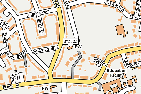
SY2 5QZ is located in the Monkmoor electoral ward, within the unitary authority of Shropshire and the English Parliamentary constituency of Shrewsbury and Atcham. The Sub Integrated Care Board (ICB) Location is NHS Shropshire, Telford and Wrekin ICB - M2L0M and the police force is West Mercia. This postcode has been in use since January 1980.


GetTheData
Source: OS OpenMap – Local (Ordnance Survey)
Source: OS VectorMap District (Ordnance Survey)
Licence: Open Government Licence (requires attribution)
| Easting | 351244 |
| Northing | 312983 |
| Latitude | 52.712299 |
| Longitude | -2.723138 |
GetTheData
Source: Open Postcode Geo
Licence: Open Government Licence
| Country | England |
| Postcode District | SY2 |
| ➜ SY2 open data dashboard ➜ See where SY2 is on a map ➜ Where is Shrewsbury? | |
GetTheData
Source: Land Registry Price Paid Data
Licence: Open Government Licence
Elevation or altitude of SY2 5QZ as distance above sea level:
| Metres | Feet | |
|---|---|---|
| Elevation | 60m | 197ft |
Elevation is measured from the approximate centre of the postcode, to the nearest point on an OS contour line from OS Terrain 50, which has contour spacing of ten vertical metres.
➜ How high above sea level am I? Find the elevation of your current position using your device's GPS.
GetTheData
Source: Open Postcode Elevation
Licence: Open Government Licence
| Ward | Monkmoor |
| Constituency | Shrewsbury And Atcham |
GetTheData
Source: ONS Postcode Database
Licence: Open Government Licence
| December 2023 | Public order | On or near Abbots Road | 297m |
| December 2023 | Anti-social behaviour | On or near Clive Green | 420m |
| November 2023 | Public order | On or near Abbots Road | 297m |
| ➜ Get more crime data in our Crime section | |||
GetTheData
Source: data.police.uk
Licence: Open Government Licence
| Abbots Green (Clive Road) | Belvidere | 110m |
| Upton Lane Jct (Crowmere Road) | Belvidere | 138m |
| Upton Lane Jct (Crowmere Road) | Belvidere | 150m |
| Abbots Road Jct (Abbots Green) | Belvidere | 154m |
| Belvidere Ph (Crowmere Road) | Belvidere | 163m |
| Shrewsbury Station | 1.8km |
GetTheData
Source: NaPTAN
Licence: Open Government Licence
GetTheData
Source: ONS Postcode Database
Licence: Open Government Licence


➜ Get more ratings from the Food Standards Agency
GetTheData
Source: Food Standards Agency
Licence: FSA terms & conditions
| Last Collection | |||
|---|---|---|---|
| Location | Mon-Fri | Sat | Distance |
| Abbotts Road | 18:45 | 11:45 | 184m |
| Harcourt Crescent | 18:45 | 11:45 | 235m |
| Forest Way | 18:45 | 11:45 | 268m |
GetTheData
Source: Dracos
Licence: Creative Commons Attribution-ShareAlike
| Facility | Distance |
|---|---|
| Upton Lane Recreation Ground Upton Lane, Shrewsbury Grass Pitches, Cycling | 120m |
| Belvidere School Crowmere Road, Shrewsbury Sports Hall, Grass Pitches, Studio | 229m |
| Monkmoor Recreational Ground Racecourse Crescent, Shrewsbury Grass Pitches, Artificial Grass Pitch, Outdoor Tennis Courts | 544m |
GetTheData
Source: Active Places
Licence: Open Government Licence
| School | Phase of Education | Distance |
|---|---|---|
| Belvidere School Crowmere Road, Shrewsbury, SY2 5LA | Secondary | 229m |
| Belvidere Primary School Tenbury Drive, Telford Estate, Shrewsbury, SY2 5YB | Primary | 233m |
| Crowmoor Primary School and Nursery Crowmere Road, Shrewsbury, SY2 5JJ | Primary | 339m |
GetTheData
Source: Edubase
Licence: Open Government Licence
The below table lists the International Territorial Level (ITL) codes (formerly Nomenclature of Territorial Units for Statistics (NUTS) codes) and Local Administrative Units (LAU) codes for SY2 5QZ:
| ITL 1 Code | Name |
|---|---|
| TLG | West Midlands (England) |
| ITL 2 Code | Name |
| TLG2 | Shropshire and Staffordshire |
| ITL 3 Code | Name |
| TLG22 | Shropshire |
| LAU 1 Code | Name |
| E06000051 | Shropshire |
GetTheData
Source: ONS Postcode Directory
Licence: Open Government Licence
The below table lists the Census Output Area (OA), Lower Layer Super Output Area (LSOA), and Middle Layer Super Output Area (MSOA) for SY2 5QZ:
| Code | Name | |
|---|---|---|
| OA | E00147499 | |
| LSOA | E01028965 | Shropshire 018A |
| MSOA | E02006032 | Shropshire 018 |
GetTheData
Source: ONS Postcode Directory
Licence: Open Government Licence
| SY2 5QY | Clive Road | 62m |
| SY2 5QT | Clive Road | 98m |
| SY2 5QU | Abbots Green | 109m |
| SY2 5LB | Hinton Drive | 121m |
| SY2 5JZ | Crowmere Road | 131m |
| SY2 5QS | Abbots Close | 135m |
| SY2 5LA | Crowmere Road | 147m |
| SY2 5QR | Abbots Way | 165m |
| SY2 5QX | Abbots Road | 170m |
| SY2 5LD | Crowmere Road | 187m |
GetTheData
Source: Open Postcode Geo; Land Registry Price Paid Data
Licence: Open Government Licence