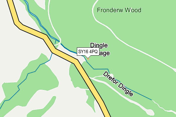
SY16 4PQ is in Kerry, Newtown. SY16 4PQ is located in the Kerry electoral ward, within the unitary authority of Powys and the Welsh Parliamentary constituency of Montgomeryshire. The Local Health Board is Powys Teaching and the police force is Dyfed-Powys. This postcode has been in use since January 1980.


GetTheData
Source: OS OpenMap – Local (Ordnance Survey)
Source: OS VectorMap District (Ordnance Survey)
Licence: Open Government Licence (requires attribution)
| Easting | 317217 |
| Northing | 288700 |
| Latitude | 52.489908 |
| Longitude | -3.220632 |
GetTheData
Source: Open Postcode Geo
Licence: Open Government Licence
| Locality | Kerry |
| Town/City | Newtown |
| Country | Wales |
| Postcode District | SY16 |
| ➜ SY16 open data dashboard ➜ See where SY16 is on a map | |
GetTheData
Source: Land Registry Price Paid Data
Licence: Open Government Licence
Elevation or altitude of SY16 4PQ as distance above sea level:
| Metres | Feet | |
|---|---|---|
| Elevation | 240m | 787ft |
Elevation is measured from the approximate centre of the postcode, to the nearest point on an OS contour line from OS Terrain 50, which has contour spacing of ten vertical metres.
➜ How high above sea level am I? Find the elevation of your current position using your device's GPS.
GetTheData
Source: Open Postcode Elevation
Licence: Open Government Licence
| Ward | Kerry |
| Constituency | Montgomeryshire |
GetTheData
Source: ONS Postcode Database
Licence: Open Government Licence
| Cwm-trefarlo (B4368) | Brynllywarch | 1,911m |
| Cwm-trefarlo (B4368) | Brynllywarch | 1,943m |
GetTheData
Source: NaPTAN
Licence: Open Government Licence
| Percentage of properties with Next Generation Access | 100.0% |
| Percentage of properties with Superfast Broadband | 20.0% |
| Percentage of properties with Ultrafast Broadband | 0.0% |
| Percentage of properties with Full Fibre Broadband | 0.0% |
Superfast Broadband is between 30Mbps and 300Mbps
Ultrafast Broadband is > 300Mbps
| Percentage of properties unable to receive 2Mbps | 0.0% |
| Percentage of properties unable to receive 5Mbps | 0.0% |
| Percentage of properties unable to receive 10Mbps | 60.0% |
| Percentage of properties unable to receive 30Mbps | 80.0% |
GetTheData
Source: Ofcom
Licence: Ofcom Terms of Use (requires attribution)
GetTheData
Source: ONS Postcode Database
Licence: Open Government Licence

➜ Get more ratings from the Food Standards Agency
GetTheData
Source: Food Standards Agency
Licence: FSA terms & conditions
| School | Phase of Education | Distance |
|---|---|---|
| Brynllywarch Hall School Kerry, Nr Newtown, Powys, SY16 4PB | Not applicable | 2.2km |
| St. Michael's C.I.W. School Kerry, Newtown, Powys, SY16 4NU | Not applicable | 2.9km |
| Oneschool Global Uk Newtown Campus Sarn, Newtown, Powys, SY16 4EW | Not applicable | 4.5km |
GetTheData
Source: Edubase
Licence: Open Government Licence
The below table lists the International Territorial Level (ITL) codes (formerly Nomenclature of Territorial Units for Statistics (NUTS) codes) and Local Administrative Units (LAU) codes for SY16 4PQ:
| ITL 1 Code | Name |
|---|---|
| TLL | Wales |
| ITL 2 Code | Name |
| TLL2 | East Wales |
| ITL 3 Code | Name |
| TLL24 | Powys |
| LAU 1 Code | Name |
| W06000023 | Powys |
GetTheData
Source: ONS Postcode Directory
Licence: Open Government Licence
The below table lists the Census Output Area (OA), Lower Layer Super Output Area (LSOA), and Middle Layer Super Output Area (MSOA) for SY16 4PQ:
| Code | Name | |
|---|---|---|
| OA | W00002386 | |
| LSOA | W01000447 | Powys 007C |
| MSOA | W02000103 | Powys 007 |
GetTheData
Source: ONS Postcode Directory
Licence: Open Government Licence
| SY16 4LS | 908m | |
| SY16 4PG | 1204m | |
| SY16 4LP | 1359m | |
| SY16 4PF | Davern Cottages | 1366m |
| SY16 4PE | Pentre Cottages | 1649m |
| SY16 4PH | 1659m | |
| SY16 4LN | 1689m | |
| SY16 4EG | 1701m | |
| SY16 4LL | 1782m | |
| SY16 4PD | 1797m |
GetTheData
Source: Open Postcode Geo; Land Registry Price Paid Data
Licence: Open Government Licence