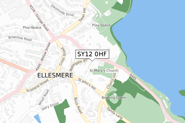
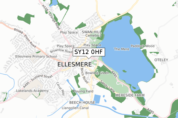
SY12 0HF is located in the Ellesmere Urban electoral ward, within the unitary authority of Shropshire and the English Parliamentary constituency of North Shropshire. The Sub Integrated Care Board (ICB) Location is NHS Shropshire, Telford and Wrekin ICB - M2L0M and the police force is West Mercia. This postcode has been in use since January 1980.


GetTheData
Source: OS Open Zoomstack (Ordnance Survey)
Licence: Open Government Licence (requires attribution)
Attribution: Contains OS data © Crown copyright and database right 2024
Source: Open Postcode Geo
Licence: Open Government Licence (requires attribution)
Attribution: Contains OS data © Crown copyright and database right 2024; Contains Royal Mail data © Royal Mail copyright and database right 2024; Source: Office for National Statistics licensed under the Open Government Licence v.3.0
| Easting | 340189 |
| Northing | 334876 |
| Latitude | 52.907970 |
| Longitude | -2.890772 |
GetTheData
Source: Open Postcode Geo
Licence: Open Government Licence
| Country | England |
| Postcode District | SY12 |
| ➜ SY12 open data dashboard ➜ See where SY12 is on a map ➜ Where is Ellesmere? | |
GetTheData
Source: Land Registry Price Paid Data
Licence: Open Government Licence
Elevation or altitude of SY12 0HF as distance above sea level:
| Metres | Feet | |
|---|---|---|
| Elevation | 100m | 328ft |
Elevation is measured from the approximate centre of the postcode, to the nearest point on an OS contour line from OS Terrain 50, which has contour spacing of ten vertical metres.
➜ How high above sea level am I? Find the elevation of your current position using your device's GPS.
GetTheData
Source: Open Postcode Elevation
Licence: Open Government Licence
| Ward | Ellesmere Urban |
| Constituency | North Shropshire |
GetTheData
Source: ONS Postcode Database
Licence: Open Government Licence
| January 2024 | Criminal damage and arson | On or near Parking Area | 397m |
| November 2023 | Other crime | On or near Parking Area | 397m |
| November 2023 | Public order | On or near Parking Area | 397m |
| ➜ Get more crime data in our Crime section | |||
GetTheData
Source: data.police.uk
Licence: Open Government Licence
| Watergate Street (High Street) | Ellesmere | 202m |
| Crossroads (Cross Street) | Ellesmere | 229m |
| Post Office (Scotland Street) | Ellesmere | 348m |
| Post Office (Scotland Street) | Ellesmere | 348m |
| Tesco (Wharf Road) | Ellesmere | 402m |
GetTheData
Source: NaPTAN
Licence: Open Government Licence
GetTheData
Source: ONS Postcode Database
Licence: Open Government Licence


➜ Get more ratings from the Food Standards Agency
GetTheData
Source: Food Standards Agency
Licence: FSA terms & conditions
| Last Collection | |||
|---|---|---|---|
| Location | Mon-Fri | Sat | Distance |
| Cross Street | 17:30 | 10:00 | 203m |
| Watergate Street | 17:30 | 10:00 | 205m |
| Swanmere Park | 17:30 | 07:30 | 276m |
GetTheData
Source: Dracos
Licence: Creative Commons Attribution-ShareAlike
| Facility | Distance |
|---|---|
| Ellesmere Cricket Club Birch Road, Ellesmere Grass Pitches | 467m |
| Ellesmere Primary School Elson Road, Ellesmere Swimming Pool, Grass Pitches | 723m |
| Lakelands Academy Oswestry Road, Ellesmere Sports Hall, Health and Fitness Gym, Grass Pitches, Studio, Artificial Grass Pitch, Outdoor Tennis Courts | 873m |
GetTheData
Source: Active Places
Licence: Open Government Licence
| School | Phase of Education | Distance |
|---|---|---|
| Ellesmere Primary School Elson Road, Ellesmere, SY12 9EU | Primary | 747m |
| Lakelands Academy Oswestry Road, Ellesmere, SY12 0EA | Secondary | 857m |
| Ellesmere College Ellesmere, SY12 9AB | Not applicable | 1.4km |
GetTheData
Source: Edubase
Licence: Open Government Licence
The below table lists the International Territorial Level (ITL) codes (formerly Nomenclature of Territorial Units for Statistics (NUTS) codes) and Local Administrative Units (LAU) codes for SY12 0HF:
| ITL 1 Code | Name |
|---|---|
| TLG | West Midlands (England) |
| ITL 2 Code | Name |
| TLG2 | Shropshire and Staffordshire |
| ITL 3 Code | Name |
| TLG22 | Shropshire |
| LAU 1 Code | Name |
| E06000051 | Shropshire |
GetTheData
Source: ONS Postcode Directory
Licence: Open Government Licence
The below table lists the Census Output Area (OA), Lower Layer Super Output Area (LSOA), and Middle Layer Super Output Area (MSOA) for SY12 0HF:
| Code | Name | |
|---|---|---|
| OA | E00147008 | |
| LSOA | E01028866 | Shropshire 004C |
| MSOA | E02006017 | Shropshire 004 |
GetTheData
Source: ONS Postcode Directory
Licence: Open Government Licence
| SY12 0RD | Pinfold Lane | 23m |
| SY12 0HD | Church Street | 64m |
| SY12 0EU | Watergate Street | 79m |
| SY12 0HQ | Talbot Street | 80m |
| SY12 0EX | Watergate Street | 92m |
| SY12 0EZ | St Johns Hill | 100m |
| SY12 0HG | Talbot Street | 101m |
| SY12 0EY | St Johns Hill | 121m |
| SY12 0HA | St Johns Hill | 121m |
| SY12 0HB | Church Hill | 160m |
GetTheData
Source: Open Postcode Geo; Land Registry Price Paid Data
Licence: Open Government Licence