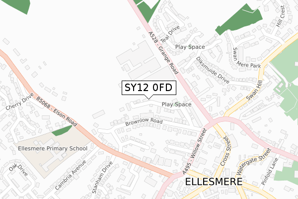
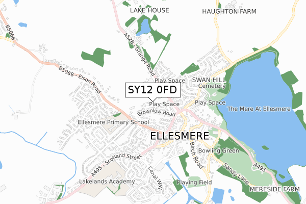
SY12 0FD lies on Smithfield Way in Ellesmere. SY12 0FD is located in the Ellesmere Urban electoral ward, within the unitary authority of Shropshire and the English Parliamentary constituency of North Shropshire. The Sub Integrated Care Board (ICB) Location is NHS Shropshire, Telford and Wrekin ICB - M2L0M and the police force is West Mercia. This postcode has been in use since February 2008.


GetTheData
Source: OS Open Zoomstack (Ordnance Survey)
Licence: Open Government Licence (requires attribution)
Attribution: Contains OS data © Crown copyright and database right 2024
Source: Open Postcode Geo
Licence: Open Government Licence (requires attribution)
Attribution: Contains OS data © Crown copyright and database right 2024; Contains Royal Mail data © Royal Mail copyright and database right 2024; Source: Office for National Statistics licensed under the Open Government Licence v.3.0
| Easting | 339769 |
| Northing | 335077 |
| Latitude | 52.909730 |
| Longitude | -2.897054 |
GetTheData
Source: Open Postcode Geo
Licence: Open Government Licence
| Street | Smithfield Way |
| Town/City | Ellesmere |
| Country | England |
| Postcode District | SY12 |
| ➜ SY12 open data dashboard ➜ See where SY12 is on a map ➜ Where is Ellesmere? | |
GetTheData
Source: Land Registry Price Paid Data
Licence: Open Government Licence
Elevation or altitude of SY12 0FD as distance above sea level:
| Metres | Feet | |
|---|---|---|
| Elevation | 100m | 328ft |
Elevation is measured from the approximate centre of the postcode, to the nearest point on an OS contour line from OS Terrain 50, which has contour spacing of ten vertical metres.
➜ How high above sea level am I? Find the elevation of your current position using your device's GPS.
GetTheData
Source: Open Postcode Elevation
Licence: Open Government Licence
| Ward | Ellesmere Urban |
| Constituency | North Shropshire |
GetTheData
Source: ONS Postcode Database
Licence: Open Government Licence
| January 2024 | Criminal damage and arson | On or near Parking Area | 288m |
| November 2023 | Violence and sexual offences | On or near Smithfield Way | 57m |
| November 2023 | Possession of weapons | On or near Smithfield Way | 57m |
| ➜ Smithfield Way crime map and outcomes | |||
GetTheData
Source: data.police.uk
Licence: Open Government Licence
| Stanham Drive Jct (Trimpley Street) | Ellesmere | 205m |
| Stanham Drive Jct (Trimpley Street) | Ellesmere | 219m |
| Crossroads (Cross Street) | Ellesmere | 236m |
| Post Office (Scotland Street) | Ellesmere | 356m |
| Post Office (Scotland Street) | Ellesmere | 365m |
GetTheData
Source: NaPTAN
Licence: Open Government Licence
➜ Broadband speed and availability dashboard for SY12 0FD
| Percentage of properties with Next Generation Access | 100.0% |
| Percentage of properties with Superfast Broadband | 100.0% |
| Percentage of properties with Ultrafast Broadband | 0.0% |
| Percentage of properties with Full Fibre Broadband | 0.0% |
Superfast Broadband is between 30Mbps and 300Mbps
Ultrafast Broadband is > 300Mbps
| Median download speed | 47.5Mbps |
| Average download speed | 49.8Mbps |
| Maximum download speed | 77.98Mbps |
| Median upload speed | 10.0Mbps |
| Average upload speed | 10.7Mbps |
| Maximum upload speed | 20.00Mbps |
| Percentage of properties unable to receive 2Mbps | 0.0% |
| Percentage of properties unable to receive 5Mbps | 0.0% |
| Percentage of properties unable to receive 10Mbps | 0.0% |
| Percentage of properties unable to receive 30Mbps | 0.0% |
➜ Broadband speed and availability dashboard for SY12 0FD
GetTheData
Source: Ofcom
Licence: Ofcom Terms of Use (requires attribution)
Estimated total energy consumption in SY12 0FD by fuel type, 2015.
| Consumption (kWh) | 103,316 |
|---|---|
| Meter count | 15 |
| Mean (kWh/meter) | 6,888 |
| Median (kWh/meter) | 6,562 |
| Consumption (kWh) | 46,566 |
|---|---|
| Meter count | 10 |
| Mean (kWh/meter) | 4,657 |
| Median (kWh/meter) | 3,604 |
GetTheData
Source: Postcode level gas estimates: 2015 (experimental)
Source: Postcode level electricity estimates: 2015 (experimental)
Licence: Open Government Licence
GetTheData
Source: ONS Postcode Database
Licence: Open Government Licence


➜ Get more ratings from the Food Standards Agency
GetTheData
Source: Food Standards Agency
Licence: FSA terms & conditions
| Last Collection | |||
|---|---|---|---|
| Location | Mon-Fri | Sat | Distance |
| Cross Street | 17:30 | 10:00 | 264m |
| Watergate Street | 17:30 | 10:00 | 362m |
| Swanmere Park | 17:30 | 07:30 | 377m |
GetTheData
Source: Dracos
Licence: Creative Commons Attribution-ShareAlike
| Facility | Distance |
|---|---|
| Ellesmere Primary School Elson Road, Ellesmere Swimming Pool, Grass Pitches | 356m |
| Beech Grove Playing Fields Beech Grove, Ellesmere Grass Pitches | 674m |
| Lakelands Academy Oswestry Road, Ellesmere Sports Hall, Health and Fitness Gym, Grass Pitches, Studio, Artificial Grass Pitch, Outdoor Tennis Courts | 738m |
GetTheData
Source: Active Places
Licence: Open Government Licence
| School | Phase of Education | Distance |
|---|---|---|
| Ellesmere Primary School Elson Road, Ellesmere, SY12 9EU | Primary | 365m |
| Lakelands Academy Oswestry Road, Ellesmere, SY12 0EA | Secondary | 710m |
| Ellesmere College Ellesmere, SY12 9AB | Not applicable | 1.7km |
GetTheData
Source: Edubase
Licence: Open Government Licence
The below table lists the International Territorial Level (ITL) codes (formerly Nomenclature of Territorial Units for Statistics (NUTS) codes) and Local Administrative Units (LAU) codes for SY12 0FD:
| ITL 1 Code | Name |
|---|---|
| TLG | West Midlands (England) |
| ITL 2 Code | Name |
| TLG2 | Shropshire and Staffordshire |
| ITL 3 Code | Name |
| TLG22 | Shropshire |
| LAU 1 Code | Name |
| E06000051 | Shropshire |
GetTheData
Source: ONS Postcode Directory
Licence: Open Government Licence
The below table lists the Census Output Area (OA), Lower Layer Super Output Area (LSOA), and Middle Layer Super Output Area (MSOA) for SY12 0FD:
| Code | Name | |
|---|---|---|
| OA | E00147011 | |
| LSOA | E01028865 | Shropshire 004B |
| MSOA | E02006017 | Shropshire 004 |
GetTheData
Source: ONS Postcode Directory
Licence: Open Government Licence
| SY12 0AY | Brownlow Road | 75m |
| SY12 0FB | Smithfield Way | 78m |
| SY12 0BA | Brownlow Road | 89m |
| SY12 0BB | Railway Terrace | 138m |
| SY12 0BD | Brownlow Park | 142m |
| SY12 0AX | Charlotte Row | 159m |
| SY12 0AJ | Willow Crescent | 177m |
| SY12 9QB | Cygnet Close | 178m |
| SY12 0AU | Grange Road | 181m |
| SY12 0AE | Trimpley Street | 200m |
GetTheData
Source: Open Postcode Geo; Land Registry Price Paid Data
Licence: Open Government Licence