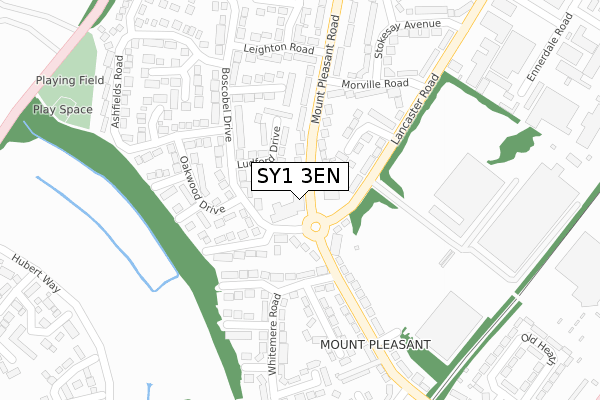
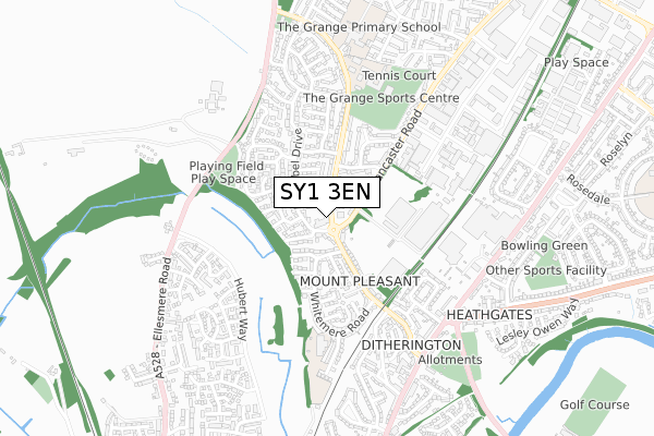
SY1 3EN is located in the Bagley electoral ward, within the unitary authority of Shropshire and the English Parliamentary constituency of Shrewsbury and Atcham. The Sub Integrated Care Board (ICB) Location is NHS Shropshire, Telford and Wrekin ICB - M2L0M and the police force is West Mercia. This postcode has been in use since January 1980.


GetTheData
Source: OS Open Zoomstack (Ordnance Survey)
Licence: Open Government Licence (requires attribution)
Attribution: Contains OS data © Crown copyright and database right 2024
Source: Open Postcode Geo
Licence: Open Government Licence (requires attribution)
Attribution: Contains OS data © Crown copyright and database right 2024; Contains Royal Mail data © Royal Mail copyright and database right 2024; Source: Office for National Statistics licensed under the Open Government Licence v.3.0
| Easting | 349922 |
| Northing | 314965 |
| Latitude | 52.729994 |
| Longitude | -2.743007 |
GetTheData
Source: Open Postcode Geo
Licence: Open Government Licence
| Country | England |
| Postcode District | SY1 |
| ➜ SY1 open data dashboard ➜ See where SY1 is on a map ➜ Where is Shrewsbury? | |
GetTheData
Source: Land Registry Price Paid Data
Licence: Open Government Licence
Elevation or altitude of SY1 3EN as distance above sea level:
| Metres | Feet | |
|---|---|---|
| Elevation | 70m | 230ft |
Elevation is measured from the approximate centre of the postcode, to the nearest point on an OS contour line from OS Terrain 50, which has contour spacing of ten vertical metres.
➜ How high above sea level am I? Find the elevation of your current position using your device's GPS.
GetTheData
Source: Open Postcode Elevation
Licence: Open Government Licence
| Ward | Bagley |
| Constituency | Shrewsbury And Atcham |
GetTheData
Source: ONS Postcode Database
Licence: Open Government Licence
| January 2024 | Violence and sexual offences | On or near Parking Area | 39m |
| January 2024 | Anti-social behaviour | On or near Parking Area | 39m |
| January 2024 | Shoplifting | On or near Parking Area | 39m |
| ➜ Get more crime data in our Crime section | |||
GetTheData
Source: data.police.uk
Licence: Open Government Licence
| Steam Wagon (Mount Pleasant Road) | Mount Pleasant | 27m |
| Steam Wagon (Mount Pleasant Road) | Mount Pleasant | 90m |
| Morville Road Jct (Mount Pleasant Road) | Mount Pleasant | 226m |
| Westbury Road Jct (Mount Pleasant Road) | Mount Pleasant | 244m |
| Perkins Entrance (Mount Pleasant Road) | Mount Pleasant | 257m |
| Shrewsbury Station | 2.1km |
GetTheData
Source: NaPTAN
Licence: Open Government Licence
GetTheData
Source: ONS Postcode Database
Licence: Open Government Licence


➜ Get more ratings from the Food Standards Agency
GetTheData
Source: Food Standards Agency
Licence: FSA terms & conditions
| Last Collection | |||
|---|---|---|---|
| Location | Mon-Fri | Sat | Distance |
| Mount Pleasant Road | 19:00 | 11:45 | 9m |
| Butterwick Drive | 19:15 | 12:00 | 474m |
| Ditherington Post Office | 18:30 | 11:00 | 488m |
GetTheData
Source: Dracos
Licence: Creative Commons Attribution-ShareAlike
| Facility | Distance |
|---|---|
| Mount Pleasant Primary School (Shrewsbury) Whitemere Road, Shrewsbury Grass Pitches | 487m |
| Grange Sports Centre (Shrewsbury) Worcester Road, Shrewsbury Sports Hall, Grass Pitches, Artificial Grass Pitch, Health and Fitness Gym | 541m |
| The Grange Primary School Bainbridge Green, Shrewsbury Grass Pitches, Sports Hall | 725m |
GetTheData
Source: Active Places
Licence: Open Government Licence
| School | Phase of Education | Distance |
|---|---|---|
| Mount Pleasant Primary Whitemere Road, Mount Pleasant, Shrewsbury, SY1 3BY | Primary | 376m |
| Grange Primary School Bainbridge Green, Harlescott, Shrewsbury, SY1 3QR | Primary | 725m |
| Greenfields Primary School Hemsworth Way, Ellesmere Road, Shrewsbury, SY1 2AH | Primary | 1.1km |
GetTheData
Source: Edubase
Licence: Open Government Licence
The below table lists the International Territorial Level (ITL) codes (formerly Nomenclature of Territorial Units for Statistics (NUTS) codes) and Local Administrative Units (LAU) codes for SY1 3EN:
| ITL 1 Code | Name |
|---|---|
| TLG | West Midlands (England) |
| ITL 2 Code | Name |
| TLG2 | Shropshire and Staffordshire |
| ITL 3 Code | Name |
| TLG22 | Shropshire |
| LAU 1 Code | Name |
| E06000051 | Shropshire |
GetTheData
Source: ONS Postcode Directory
Licence: Open Government Licence
The below table lists the Census Output Area (OA), Lower Layer Super Output Area (LSOA), and Middle Layer Super Output Area (MSOA) for SY1 3EN:
| Code | Name | |
|---|---|---|
| OA | E00147303 | |
| LSOA | E01028929 | Shropshire 014A |
| MSOA | E02006028 | Shropshire 014 |
GetTheData
Source: ONS Postcode Directory
Licence: Open Government Licence
| SY1 3EL | Mount Pleasant Road | 10m |
| SY1 3DJ | Boscobel Drive | 67m |
| SY1 3NT | Lancaster Road | 82m |
| SY1 3DN | Boscobel Drive | 94m |
| SY1 3EP | Mount Pleasant Road | 96m |
| SY1 3DP | Ludford Drive | 114m |
| SY1 3DQ | Whitemere Road | 123m |
| SY1 3DW | Boscobel Drive | 126m |
| SY1 3DX | Birchwood Drive | 139m |
| SY1 3DY | Oakwood Drive | 141m |
GetTheData
Source: Open Postcode Geo; Land Registry Price Paid Data
Licence: Open Government Licence