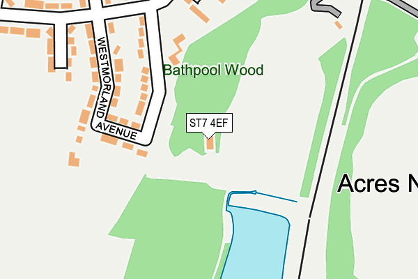
ST7 4EF is located in the Talke & Butt Lane electoral ward, within the local authority district of Newcastle-under-Lyme and the English Parliamentary constituency of Stoke-on-Trent North. The Sub Integrated Care Board (ICB) Location is NHS Staffordshire and Stoke-on-Trent ICB - 05G and the police force is Staffordshire. This postcode has been in use since September 1991.


GetTheData
Source: OS OpenMap – Local (Ordnance Survey)
Source: OS VectorMap District (Ordnance Survey)
Licence: Open Government Licence (requires attribution)
| Easting | 383703 |
| Northing | 353334 |
| Latitude | 53.076982 |
| Longitude | -2.244717 |
GetTheData
Source: Open Postcode Geo
Licence: Open Government Licence
| Country | England |
| Postcode District | ST7 |
| ➜ ST7 open data dashboard ➜ See where ST7 is on a map ➜ Where is Kidsgrove? | |
GetTheData
Source: Land Registry Price Paid Data
Licence: Open Government Licence
Elevation or altitude of ST7 4EF as distance above sea level:
| Metres | Feet | |
|---|---|---|
| Elevation | 150m | 492ft |
Elevation is measured from the approximate centre of the postcode, to the nearest point on an OS contour line from OS Terrain 50, which has contour spacing of ten vertical metres.
➜ How high above sea level am I? Find the elevation of your current position using your device's GPS.
GetTheData
Source: Open Postcode Elevation
Licence: Open Government Licence
| Ward | Talke & Butt Lane |
| Constituency | Stoke-on-trent North |
GetTheData
Source: ONS Postcode Database
Licence: Open Government Licence
| June 2022 | Vehicle crime | On or near Westmorland Avenue | 172m |
| June 2022 | Violence and sexual offences | On or near Willow Close | 469m |
| June 2022 | Violence and sexual offences | On or near Willow Close | 469m |
| ➜ Get more crime data in our Crime section | |||
GetTheData
Source: data.police.uk
Licence: Open Government Licence
| Westmorland (Clough Hall Rd) | Clough Hall | 219m |
| Westmorland (Clough Hall Rd) | Clough Hall | 229m |
| Peckforton View (Chatterley Drive) | Kidsgrove | 576m |
| Peckforton View (Chatterley Dr) | Kidsgrove | 590m |
| Fourth Avenue (First Avenue) | Clough Hall | 670m |
| Kidsgrove Station | 1.1km |
| Alsager Station | 4.1km |
| Longport Station | 4.3km |
GetTheData
Source: NaPTAN
Licence: Open Government Licence
GetTheData
Source: ONS Postcode Database
Licence: Open Government Licence


➜ Get more ratings from the Food Standards Agency
GetTheData
Source: Food Standards Agency
Licence: FSA terms & conditions
| Last Collection | |||
|---|---|---|---|
| Location | Mon-Fri | Sat | Distance |
| Audley Road | 17:00 | 10:30 | 987m |
| Coalpit Hill | 16:45 | 09:00 | 1,206m |
| Broadfield Road | 17:30 | 10:00 | 1,977m |
GetTheData
Source: Dracos
Licence: Creative Commons Attribution-ShareAlike
| Facility | Distance |
|---|---|
| Kidsgrove Ski Centre Bathpool Park, Kidsgrove, Stoke-on-trent Ski Slopes | 1m |
| Kidsgrove Cricket Club Clough Hall Road, Kidsgrove Grass Pitches | 430m |
| Clough Hall Park Park Avenue, Kidsgrove, Stoke-on-trent Grass Pitches, Outdoor Tennis Courts | 641m |
GetTheData
Source: Active Places
Licence: Open Government Licence
| School | Phase of Education | Distance |
|---|---|---|
| The King's CofE Academy First Avenue, Kidsgrove, Stoke-on-Trent, ST7 1DP | Secondary | 879m |
| St Thomas' CofE Primary Academy Poplar Drive, Kidsgrove, Stoke-on-Trent, ST7 4HT | Primary | 948m |
| St John the Evangelist Catholic Primary Gloucester Road, Kidsgrove, ST7 1EL | Primary | 1.1km |
GetTheData
Source: Edubase
Licence: Open Government Licence
The below table lists the International Territorial Level (ITL) codes (formerly Nomenclature of Territorial Units for Statistics (NUTS) codes) and Local Administrative Units (LAU) codes for ST7 4EF:
| ITL 1 Code | Name |
|---|---|
| TLG | West Midlands (England) |
| ITL 2 Code | Name |
| TLG2 | Shropshire and Staffordshire |
| ITL 3 Code | Name |
| TLG24 | Staffordshire CC |
| LAU 1 Code | Name |
| E07000195 | Newcastle-under-Lyme |
GetTheData
Source: ONS Postcode Directory
Licence: Open Government Licence
The below table lists the Census Output Area (OA), Lower Layer Super Output Area (LSOA), and Middle Layer Super Output Area (MSOA) for ST7 4EF:
| Code | Name | |
|---|---|---|
| OA | E00150532 | |
| LSOA | E01029540 | Newcastle-under-Lyme 003A |
| MSOA | E02006160 | Newcastle-under-Lyme 003 |
GetTheData
Source: ONS Postcode Directory
Licence: Open Government Licence
| ST7 1AT | Westmorland Avenue | 159m |
| ST7 1AS | Westmorland Avenue | 186m |
| ST7 1AY | Cumberland Close | 254m |
| ST7 1AU | Clough Hall Road | 277m |
| ST7 1AX | Clough Hall Road | 300m |
| ST7 1AR | Clough Hall Road | 336m |
| ST7 1AP | Kinnersley Avenue | 347m |
| ST6 4QP | Nelson Bank | 389m |
| ST6 4QL | Acres Nook | 427m |
| ST7 1BB | Laburnum Close | 441m |
GetTheData
Source: Open Postcode Geo; Land Registry Price Paid Data
Licence: Open Government Licence