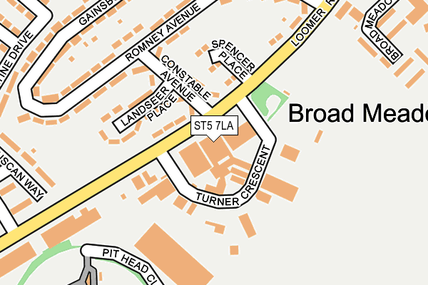
ST5 7LA is located in the Holditch & Chesterton electoral ward, within the local authority district of Newcastle-under-Lyme and the English Parliamentary constituency of Newcastle-under-Lyme. The Sub Integrated Care Board (ICB) Location is NHS Staffordshire and Stoke-on-Trent ICB - 05G and the police force is Staffordshire. This postcode has been in use since January 1980.


GetTheData
Source: OS OpenMap – Local (Ordnance Survey)
Source: OS VectorMap District (Ordnance Survey)
Licence: Open Government Licence (requires attribution)
| Easting | 383261 |
| Northing | 348575 |
| Latitude | 53.034189 |
| Longitude | -2.251065 |
GetTheData
Source: Open Postcode Geo
Licence: Open Government Licence
| Country | England |
| Postcode District | ST5 |
| ➜ ST5 open data dashboard ➜ See where ST5 is on a map ➜ Where is Newcastle-under-Lyme? | |
GetTheData
Source: Land Registry Price Paid Data
Licence: Open Government Licence
Elevation or altitude of ST5 7LA as distance above sea level:
| Metres | Feet | |
|---|---|---|
| Elevation | 140m | 459ft |
Elevation is measured from the approximate centre of the postcode, to the nearest point on an OS contour line from OS Terrain 50, which has contour spacing of ten vertical metres.
➜ How high above sea level am I? Find the elevation of your current position using your device's GPS.
GetTheData
Source: Open Postcode Elevation
Licence: Open Government Licence
| Ward | Holditch & Chesterton |
| Constituency | Newcastle-under-lyme |
GetTheData
Source: ONS Postcode Database
Licence: Open Government Licence
| June 2022 | Criminal damage and arson | On or near Turner Crescent | 71m |
| June 2022 | Anti-social behaviour | On or near Landseer Place | 110m |
| June 2022 | Vehicle crime | On or near Gainsborough Road | 252m |
| ➜ Get more crime data in our Crime section | |||
GetTheData
Source: data.police.uk
Licence: Open Government Licence
| Brutus Road (Loomer Road) | Chesterton | 315m |
| Broadmeadow Court (London Road) | Chesterton | 363m |
| Broadmeadow Court (London Road) | Chesterton | 375m |
| Library (London Road) | Chesterton | 423m |
| Library (London Road) | Chesterton | 425m |
| Longport Station | 2.5km |
| Stoke-on-Trent Station | 5.5km |
GetTheData
Source: NaPTAN
Licence: Open Government Licence
GetTheData
Source: ONS Postcode Database
Licence: Open Government Licence


➜ Get more ratings from the Food Standards Agency
GetTheData
Source: Food Standards Agency
Licence: FSA terms & conditions
| Last Collection | |||
|---|---|---|---|
| Location | Mon-Fri | Sat | Distance |
| Bradwell Post Office | 17:30 | 11:45 | 1,335m |
| Pirehill Road | 18:30 | 09:00 | 1,684m |
| Wolstanton Post Office | 17:00 | 12:00 | 2,258m |
GetTheData
Source: Dracos
Licence: Creative Commons Attribution-ShareAlike
| Facility | Distance |
|---|---|
| Churchfields Primary School (Playing Fields) Loomer Road, Newcastle Grass Pitches | 186m |
| Holditch Miners Club London Road, Chesterton, Newcastle Grass Pitches | 470m |
| Chesterton Community Sports College Castle Street, Chesterton, Newcastle Sports Hall, Swimming Pool, Health and Fitness Gym, Grass Pitches, Studio, Artificial Grass Pitch | 507m |
GetTheData
Source: Active Places
Licence: Open Government Licence
| School | Phase of Education | Distance |
|---|---|---|
| Churchfields Primary School School Street, Chesterton, Newcastle, ST5 7HY | Primary | 424m |
| Chesterton Community Sports College Castle Street, Chesterton, Newcastle, ST5 7LP | Secondary | 507m |
| Chesterton Primary School Brittain Avenue, Chesterton, Newcastle-Under-Lyme, ST5 7NT | Primary | 870m |
GetTheData
Source: Edubase
Licence: Open Government Licence
The below table lists the International Territorial Level (ITL) codes (formerly Nomenclature of Territorial Units for Statistics (NUTS) codes) and Local Administrative Units (LAU) codes for ST5 7LA:
| ITL 1 Code | Name |
|---|---|
| TLG | West Midlands (England) |
| ITL 2 Code | Name |
| TLG2 | Shropshire and Staffordshire |
| ITL 3 Code | Name |
| TLG24 | Staffordshire CC |
| LAU 1 Code | Name |
| E07000195 | Newcastle-under-Lyme |
GetTheData
Source: ONS Postcode Directory
Licence: Open Government Licence
The below table lists the Census Output Area (OA), Lower Layer Super Output Area (LSOA), and Middle Layer Super Output Area (MSOA) for ST5 7LA:
| Code | Name | |
|---|---|---|
| OA | E00150624 | |
| LSOA | E01029559 | Newcastle-under-Lyme 007C |
| MSOA | E02006164 | Newcastle-under-Lyme 007 |
GetTheData
Source: ONS Postcode Directory
Licence: Open Government Licence
| ST5 7LD | Constable Avenue | 114m |
| ST5 7LE | Landseer Place | 128m |
| ST5 7JR | Romney Avenue | 162m |
| ST5 7JT | Loomer Road | 166m |
| ST5 7JN | Romney Avenue | 193m |
| ST5 7JP | Romney Avenue | 222m |
| ST5 7LF | Gainsborough Road | 234m |
| ST5 7JW | Hogarth Place | 267m |
| ST5 7LG | Gainsborough Road | 270m |
| ST5 7JL | Reynolds Avenue | 273m |
GetTheData
Source: Open Postcode Geo; Land Registry Price Paid Data
Licence: Open Government Licence