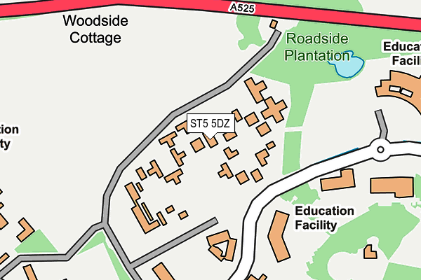
ST5 5DZ is located in the Keele electoral ward, within the local authority district of Newcastle-under-Lyme and the English Parliamentary constituency of Newcastle-under-Lyme. The Sub Integrated Care Board (ICB) Location is NHS Staffordshire and Stoke-on-Trent ICB - 05G and the police force is Staffordshire. This postcode has been in use since December 1994.


GetTheData
Source: OS OpenMap – Local (Ordnance Survey)
Source: OS VectorMap District (Ordnance Survey)
Licence: Open Government Licence (requires attribution)
| Easting | 381931 |
| Northing | 345412 |
| Latitude | 53.005731 |
| Longitude | -2.270720 |
GetTheData
Source: Open Postcode Geo
Licence: Open Government Licence
| Country | England |
| Postcode District | ST5 |
| ➜ ST5 open data dashboard ➜ See where ST5 is on a map ➜ Where is Keele? | |
GetTheData
Source: Land Registry Price Paid Data
Licence: Open Government Licence
Elevation or altitude of ST5 5DZ as distance above sea level:
| Metres | Feet | |
|---|---|---|
| Elevation | 200m | 656ft |
Elevation is measured from the approximate centre of the postcode, to the nearest point on an OS contour line from OS Terrain 50, which has contour spacing of ten vertical metres.
➜ How high above sea level am I? Find the elevation of your current position using your device's GPS.
GetTheData
Source: Open Postcode Elevation
Licence: Open Government Licence
| Ward | Keele |
| Constituency | Newcastle-under-lyme |
GetTheData
Source: ONS Postcode Database
Licence: Open Government Licence
| June 2022 | Vehicle crime | On or near Further/Higher Educational Building | 219m |
| June 2022 | Other theft | On or near Further/Higher Educational Building | 219m |
| June 2022 | Drugs | On or near Further/Higher Educational Building | 219m |
| ➜ Get more crime data in our Crime section | |||
GetTheData
Source: data.police.uk
Licence: Open Government Licence
| Barnes Hall (Main Road) | Keele | 120m |
| Barnes Hall (Main Road) | Keele | 131m |
| Darwin Building (Main Rd) | Keele | 313m |
| Darwin Building (Main Rd) | Keele | 328m |
| Horwood Hall (Main Rd) | Keele | 501m |
| Longport Station | 5.4km |
GetTheData
Source: NaPTAN
Licence: Open Government Licence
GetTheData
Source: ONS Postcode Database
Licence: Open Government Licence


➜ Get more ratings from the Food Standards Agency
GetTheData
Source: Food Standards Agency
Licence: FSA terms & conditions
| Last Collection | |||
|---|---|---|---|
| Location | Mon-Fri | Sat | Distance |
| Keele University | 16:30 | 11:15 | 122m |
| Keele University | 16:30 | 11:00 | 495m |
| Keele University | 17:00 | 09:00 | 624m |
GetTheData
Source: Dracos
Licence: Creative Commons Attribution-ShareAlike
| Facility | Distance |
|---|---|
| Keele University Sports Centre The Covert, Keele, Newcastle Sports Hall, Health and Fitness Gym, Artificial Grass Pitch, Grass Pitches, Studio, Athletics, Squash Courts, Outdoor Tennis Courts | 323m |
| Keele Leisure Centre Keele University Three Mile Lane, Keele, Newcastle Under Lyme Outdoor Tennis Courts, Artificial Grass Pitch, Grass Pitches | 353m |
| Keele Municipal Golf Course (Closed) Keele Road, Newcastle Golf | 356m |
GetTheData
Source: Active Places
Licence: Open Government Licence
| School | Phase of Education | Distance |
|---|---|---|
| University of Keele Keele, ST5 5BG | Not applicable | 326m |
| Silverdale Primary Academy Racecourse, Silverdale, Newcastle, ST5 6PB | Primary | 999m |
| St John's CofE (C) Primary School Quarry Bank Road, Keele, Newcastle, ST5 5AF | Primary | 1km |
GetTheData
Source: Edubase
Licence: Open Government Licence
The below table lists the International Territorial Level (ITL) codes (formerly Nomenclature of Territorial Units for Statistics (NUTS) codes) and Local Administrative Units (LAU) codes for ST5 5DZ:
| ITL 1 Code | Name |
|---|---|
| TLG | West Midlands (England) |
| ITL 2 Code | Name |
| TLG2 | Shropshire and Staffordshire |
| ITL 3 Code | Name |
| TLG24 | Staffordshire CC |
| LAU 1 Code | Name |
| E07000195 | Newcastle-under-Lyme |
GetTheData
Source: ONS Postcode Directory
Licence: Open Government Licence
The below table lists the Census Output Area (OA), Lower Layer Super Output Area (LSOA), and Middle Layer Super Output Area (MSOA) for ST5 5DZ:
| Code | Name | |
|---|---|---|
| OA | E00172354 | |
| LSOA | E01029576 | Newcastle-under-Lyme 012A |
| MSOA | E02006169 | Newcastle-under-Lyme 012 |
GetTheData
Source: ONS Postcode Directory
Licence: Open Government Licence
| ST5 5AB | Keele Road | 301m |
| ST5 5AZ | The Covert | 430m |
| ST5 5NA | Plantation Park | 609m |
| ST5 5AY | Church Plantation | 649m |
| ST5 5BQ | Horwood | 649m |
| ST5 5BH | Horwood | 675m |
| ST5 5BE | 680m | |
| ST5 5AU | Keele University | 697m |
| ST5 5BB | Larchwood | 727m |
| ST5 6LA | Glenwood Close | 762m |
GetTheData
Source: Open Postcode Geo; Land Registry Price Paid Data
Licence: Open Government Licence