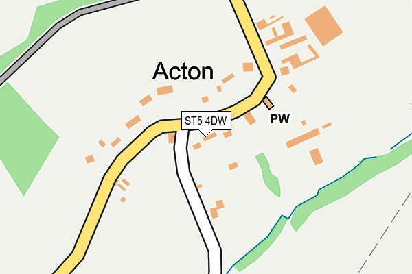
ST5 4DW lies on Acton Lane in Acton, Newcastle. ST5 4DW is located in the Maer & Whitmore electoral ward, within the local authority district of Newcastle-under-Lyme and the English Parliamentary constituency of Stone. The Sub Integrated Care Board (ICB) Location is NHS Staffordshire and Stoke-on-Trent ICB - 05G and the police force is Staffordshire. This postcode has been in use since January 1980.


GetTheData
Source: OS OpenMap – Local (Ordnance Survey)
Source: OS VectorMap District (Ordnance Survey)
Licence: Open Government Licence (requires attribution)
| Easting | 382365 |
| Northing | 341419 |
| Latitude | 52.969851 |
| Longitude | -2.264033 |
GetTheData
Source: Open Postcode Geo
Licence: Open Government Licence
| Street | Acton Lane |
| Locality | Acton |
| Town/City | Newcastle |
| Country | England |
| Postcode District | ST5 |
➜ See where ST5 is on a map ➜ Where is Acton? | |
GetTheData
Source: Land Registry Price Paid Data
Licence: Open Government Licence
Elevation or altitude of ST5 4DW as distance above sea level:
| Metres | Feet | |
|---|---|---|
| Elevation | 170m | 558ft |
Elevation is measured from the approximate centre of the postcode, to the nearest point on an OS contour line from OS Terrain 50, which has contour spacing of ten vertical metres.
➜ How high above sea level am I? Find the elevation of your current position using your device's GPS.
GetTheData
Source: Open Postcode Elevation
Licence: Open Government Licence
| Ward | Maer & Whitmore |
| Constituency | Stone |
GetTheData
Source: ONS Postcode Database
Licence: Open Government Licence
| Trentham Road (Whitmore Road) | Acton Near Whitmore | 465m |
| Shutlanehead (Whitmore Road) | Acton Near Whitmore | 660m |
| Shutlanehead (Whitmore Road) | Acton Near Whitmore | 662m |
| Mainwaring Arms Ph (Whitmore Road) | Whitmore | 1,489m |
| Mainwaring Arms Ph (Whitmore Rd) | Whitmore | 1,526m |
GetTheData
Source: NaPTAN
Licence: Open Government Licence
| Percentage of properties with Next Generation Access | 100.0% |
| Percentage of properties with Superfast Broadband | 100.0% |
| Percentage of properties with Ultrafast Broadband | 100.0% |
| Percentage of properties with Full Fibre Broadband | 100.0% |
Superfast Broadband is between 30Mbps and 300Mbps
Ultrafast Broadband is > 300Mbps
| Percentage of properties unable to receive 2Mbps | 0.0% |
| Percentage of properties unable to receive 5Mbps | 0.0% |
| Percentage of properties unable to receive 10Mbps | 0.0% |
| Percentage of properties unable to receive 30Mbps | 0.0% |
GetTheData
Source: Ofcom
Licence: Ofcom Terms of Use (requires attribution)
GetTheData
Source: ONS Postcode Database
Licence: Open Government Licence


➜ Get more ratings from the Food Standards Agency
GetTheData
Source: Food Standards Agency
Licence: FSA terms & conditions
| Last Collection | |||
|---|---|---|---|
| Location | Mon-Fri | Sat | Distance |
| Keele Services | 16:45 | 11:00 | 3,222m |
| Windermere Road Post Office | 17:00 | 11:45 | 3,471m |
| Keele University | 16:30 | 11:00 | 3,522m |
GetTheData
Source: Dracos
Licence: Creative Commons Attribution-ShareAlike
The below table lists the International Territorial Level (ITL) codes (formerly Nomenclature of Territorial Units for Statistics (NUTS) codes) and Local Administrative Units (LAU) codes for ST5 4DW:
| ITL 1 Code | Name |
|---|---|
| TLG | West Midlands (England) |
| ITL 2 Code | Name |
| TLG2 | Shropshire and Staffordshire |
| ITL 3 Code | Name |
| TLG24 | Staffordshire CC |
| LAU 1 Code | Name |
| E07000195 | Newcastle-under-Lyme |
GetTheData
Source: ONS Postcode Directory
Licence: Open Government Licence
The below table lists the Census Output Area (OA), Lower Layer Super Output Area (LSOA), and Middle Layer Super Output Area (MSOA) for ST5 4DW:
| Code | Name | |
|---|---|---|
| OA | E00150683 | |
| LSOA | E01029570 | Newcastle-under-Lyme 016B |
| MSOA | E02006173 | Newcastle-under-Lyme 016 |
GetTheData
Source: ONS Postcode Directory
Licence: Open Government Licence
| ST5 4EF | 55m | |
| ST5 4EG | 151m | |
| ST5 4EQ | 353m | |
| ST5 4DU | 597m | |
| ST5 4DS | Shut Lane Head | 1001m |
| ST5 4DT | Whitmore Road | 1049m |
| ST5 4EB | 1163m | |
| ST5 5HW | Three Mile Lane | 1327m |
| ST4 8SA | Hanchurch Fields | 1402m |
| ST5 5JE | Whitmore | 1421m |
GetTheData
Source: Open Postcode Geo; Land Registry Price Paid Data
Licence: Open Government Licence