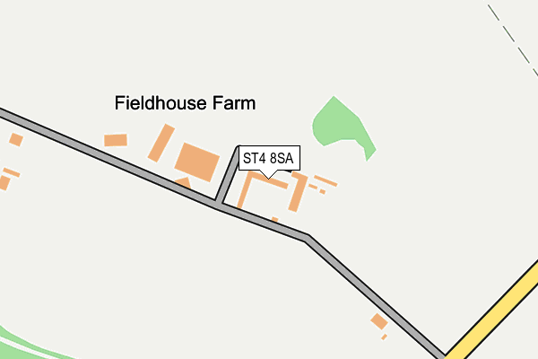
ST4 8SA lies on Hanchurch Fields in Hanchurch, Stoke-on-trent. ST4 8SA is located in the Swynnerton & Oulton electoral ward, within the local authority district of Stafford and the English Parliamentary constituency of Stone. The Sub Integrated Care Board (ICB) Location is NHS Staffordshire and Stoke-on-Trent ICB - 05V and the police force is Staffordshire. This postcode has been in use since January 2005.


GetTheData
Source: OS OpenMap – Local (Ordnance Survey)
Source: OS VectorMap District (Ordnance Survey)
Licence: Open Government Licence (requires attribution)
| Easting | 383646 |
| Northing | 340848 |
| Latitude | 52.964743 |
| Longitude | -2.244930 |
GetTheData
Source: Open Postcode Geo
Licence: Open Government Licence
| Street | Hanchurch Fields |
| Locality | Hanchurch |
| Town/City | Stoke-on-trent |
| Country | England |
| Postcode District | ST4 |
➜ See where ST4 is on a map | |
GetTheData
Source: Land Registry Price Paid Data
Licence: Open Government Licence
Elevation or altitude of ST4 8SA as distance above sea level:
| Metres | Feet | |
|---|---|---|
| Elevation | 170m | 558ft |
Elevation is measured from the approximate centre of the postcode, to the nearest point on an OS contour line from OS Terrain 50, which has contour spacing of ten vertical metres.
➜ How high above sea level am I? Find the elevation of your current position using your device's GPS.
GetTheData
Source: Open Postcode Elevation
Licence: Open Government Licence
| Ward | Swynnerton & Oulton |
| Constituency | Stone |
GetTheData
Source: ONS Postcode Database
Licence: Open Government Licence
| Hanchurch Crossroads (Whitmore Road) | Hanchurch | 1,732m |
| Hanchurch Crossroads (Whitmore Road) | Hanchurch | 1,745m |
| Trentham Road (Whitmore Road) | Acton Near Whitmore | 1,766m |
| Shutlanehead (Whitmore Road) | Acton Near Whitmore | 1,770m |
| Shutlanehead (Whitmore Road) | Acton Near Whitmore | 1,780m |
| Wedgwood Station | 5.2km |
| Stoke-on-Trent Station | 6.4km |
GetTheData
Source: NaPTAN
Licence: Open Government Licence
| Percentage of properties with Next Generation Access | 100.0% |
| Percentage of properties with Superfast Broadband | 0.0% |
| Percentage of properties with Ultrafast Broadband | 0.0% |
| Percentage of properties with Full Fibre Broadband | 0.0% |
Superfast Broadband is between 30Mbps and 300Mbps
Ultrafast Broadband is > 300Mbps
| Percentage of properties unable to receive 2Mbps | 0.0% |
| Percentage of properties unable to receive 5Mbps | 100.0% |
| Percentage of properties unable to receive 10Mbps | 100.0% |
| Percentage of properties unable to receive 30Mbps | 100.0% |
GetTheData
Source: Ofcom
Licence: Ofcom Terms of Use (requires attribution)
GetTheData
Source: ONS Postcode Database
Licence: Open Government Licence


➜ Get more ratings from the Food Standards Agency
GetTheData
Source: Food Standards Agency
Licence: FSA terms & conditions
| Last Collection | |||
|---|---|---|---|
| Location | Mon-Fri | Sat | Distance |
| Dairyfields | 18:00 | 09:30 | 2,698m |
| Allerton Road | 17:30 | 11:00 | 3,033m |
| Bankhouse Road | 17:00 | 09:15 | 3,128m |
GetTheData
Source: Dracos
Licence: Creative Commons Attribution-ShareAlike
The below table lists the International Territorial Level (ITL) codes (formerly Nomenclature of Territorial Units for Statistics (NUTS) codes) and Local Administrative Units (LAU) codes for ST4 8SA:
| ITL 1 Code | Name |
|---|---|
| TLG | West Midlands (England) |
| ITL 2 Code | Name |
| TLG2 | Shropshire and Staffordshire |
| ITL 3 Code | Name |
| TLG24 | Staffordshire CC |
| LAU 1 Code | Name |
| E07000197 | Stafford |
GetTheData
Source: ONS Postcode Directory
Licence: Open Government Licence
The below table lists the Census Output Area (OA), Lower Layer Super Output Area (LSOA), and Middle Layer Super Output Area (MSOA) for ST4 8SA:
| Code | Name | |
|---|---|---|
| OA | E00151575 | |
| LSOA | E01029748 | Stafford 002D |
| MSOA | E02006189 | Stafford 002 |
GetTheData
Source: ONS Postcode Directory
Licence: Open Government Licence
| ST4 8SN | Drayton Road | 1098m |
| ST5 4DY | Trentham Road | 1133m |
| ST4 8RY | Hanchurch Lane | 1253m |
| ST4 8RZ | Peacock Lane | 1271m |
| ST4 8SB | Ridding Bank | 1284m |
| ST4 8SD | 1312m | |
| ST5 4EG | 1344m | |
| ST5 4DW | Acton Lane | 1402m |
| ST5 4EF | 1428m | |
| ST5 4EQ | 1517m |
GetTheData
Source: Open Postcode Geo; Land Registry Price Paid Data
Licence: Open Government Licence