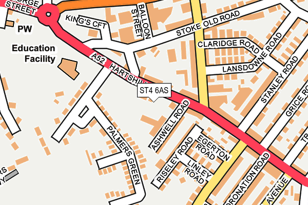
ST4 6AS is located in the Basford & Hartshill electoral ward, within the unitary authority of Stoke-on-Trent and the English Parliamentary constituency of Stoke-on-Trent Central. The Sub Integrated Care Board (ICB) Location is NHS Staffordshire and Stoke-on-Trent ICB - 05W and the police force is Staffordshire. This postcode has been in use since January 1980.


GetTheData
Source: OS OpenMap – Local (Ordnance Survey)
Source: OS VectorMap District (Ordnance Survey)
Licence: Open Government Licence (requires attribution)
| Easting | 385931 |
| Northing | 345929 |
| Latitude | 53.010499 |
| Longitude | -2.211133 |
GetTheData
Source: Open Postcode Geo
Licence: Open Government Licence
| Country | England |
| Postcode District | ST4 |
| ➜ ST4 open data dashboard ➜ See where ST4 is on a map ➜ Where is Stoke-on-Trent? | |
GetTheData
Source: Land Registry Price Paid Data
Licence: Open Government Licence
Elevation or altitude of ST4 6AS as distance above sea level:
| Metres | Feet | |
|---|---|---|
| Elevation | 150m | 492ft |
Elevation is measured from the approximate centre of the postcode, to the nearest point on an OS contour line from OS Terrain 50, which has contour spacing of ten vertical metres.
➜ How high above sea level am I? Find the elevation of your current position using your device's GPS.
GetTheData
Source: Open Postcode Elevation
Licence: Open Government Licence
| Ward | Basford & Hartshill |
| Constituency | Stoke-on-trent Central |
GetTheData
Source: ONS Postcode Database
Licence: Open Government Licence
| January 2024 | Violence and sexual offences | On or near Lockwood Street | 361m |
| January 2024 | Anti-social behaviour | On or near Lockwood Street | 361m |
| November 2023 | Anti-social behaviour | On or near Lockwood Street | 361m |
| ➜ Get more crime data in our Crime section | |||
GetTheData
Source: data.police.uk
Licence: Open Government Licence
| Ashwell Road (Hartshill Road) | Hartshill | 38m |
| Kingswell Road (Hartshill Road) | Hartshill | 72m |
| Victoria Street (Hartshill Road) | Hartshill | 145m |
| Balloon Street (Shelton New Road) | Cliffe Vale | 199m |
| Collis Avenue (Shelton New Road) | Cliffe Vale | 210m |
| Stoke-on-Trent Station | 2km |
| Longport Station | 3.5km |
| Longton Station | 5.5km |
GetTheData
Source: NaPTAN
Licence: Open Government Licence
GetTheData
Source: ONS Postcode Database
Licence: Open Government Licence


➜ Get more ratings from the Food Standards Agency
GetTheData
Source: Food Standards Agency
Licence: FSA terms & conditions
| Last Collection | |||
|---|---|---|---|
| Location | Mon-Fri | Sat | Distance |
| The Avenue | 17:30 | 09:45 | 379m |
| Westbury Road | 17:45 | 09:45 | 475m |
| Marsh Parade | 18:00 | 09:45 | 552m |
GetTheData
Source: Dracos
Licence: Creative Commons Attribution-ShareAlike
| Facility | Distance |
|---|---|
| Harpfield Primary Academy Palmers Green, Stoke-on-trent Grass Pitches | 182m |
| Newcastle Under Lyme School Mount Pleasant, Newcastle Sports Hall, Swimming Pool, Artificial Grass Pitch, Grass Pitches, Outdoor Tennis Courts | 450m |
| Jubilee 2 Brunswick Street, Newcastle Swimming Pool, Health and Fitness Gym, Studio | 778m |
GetTheData
Source: Active Places
Licence: Open Government Licence
| School | Phase of Education | Distance |
|---|---|---|
| Harpfield Primary Academy Palmers Green, Hartshill, Stoke-on-Trent, ST4 6AP | Primary | 177m |
| Newcastle-under-Lyme School Mount Pleasant, Newcastle-under-Lyme, ST5 1DB | Not applicable | 450m |
| Lyme Brook Independent School 90 King Street, Newcastle Under Lyme, Staffordshire, ST5 1JB | Not applicable | 581m |
GetTheData
Source: Edubase
Licence: Open Government Licence
The below table lists the International Territorial Level (ITL) codes (formerly Nomenclature of Territorial Units for Statistics (NUTS) codes) and Local Administrative Units (LAU) codes for ST4 6AS:
| ITL 1 Code | Name |
|---|---|
| TLG | West Midlands (England) |
| ITL 2 Code | Name |
| TLG2 | Shropshire and Staffordshire |
| ITL 3 Code | Name |
| TLG23 | Stoke-on-Trent |
| LAU 1 Code | Name |
| E06000021 | Stoke-on-Trent |
GetTheData
Source: ONS Postcode Directory
Licence: Open Government Licence
The below table lists the Census Output Area (OA), Lower Layer Super Output Area (LSOA), and Middle Layer Super Output Area (MSOA) for ST4 6AS:
| Code | Name | |
|---|---|---|
| OA | E00072165 | |
| LSOA | E01014289 | Stoke-on-Trent 018B |
| MSOA | E02002968 | Stoke-on-Trent 018 |
GetTheData
Source: ONS Postcode Directory
Licence: Open Government Licence
| ST4 6AF | Hartshill Road | 58m |
| ST4 6AT | Ashwell Road | 71m |
| ST4 6AR | Palmers Green | 86m |
| ST4 6AU | Riseley Road | 100m |
| ST4 6HD | Victoria Street | 107m |
| ST4 6AA | Hartshill Road | 113m |
| ST4 6HA | Victoria Street | 129m |
| ST4 6AY | Egerton Road | 139m |
| ST4 6AD | Hartshill Road | 147m |
| ST4 6AN | Beaumaris Close | 149m |
GetTheData
Source: Open Postcode Geo; Land Registry Price Paid Data
Licence: Open Government Licence