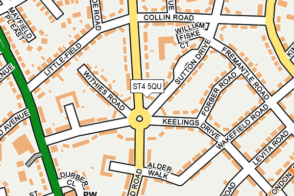
ST4 5QU is located in the Trent Vale & Oak Hill electoral ward, within the unitary authority of Stoke-on-Trent and the English Parliamentary constituency of Stoke-on-Trent Central. The Sub Integrated Care Board (ICB) Location is NHS Staffordshire and Stoke-on-Trent ICB - 05W and the police force is Staffordshire. This postcode has been in use since January 1980.


GetTheData
Source: OS OpenMap – Local (Ordnance Survey)
Source: OS VectorMap District (Ordnance Survey)
Licence: Open Government Licence (requires attribution)
| Easting | 386473 |
| Northing | 343849 |
| Latitude | 52.991816 |
| Longitude | -2.202968 |
GetTheData
Source: Open Postcode Geo
Licence: Open Government Licence
| Country | England |
| Postcode District | ST4 |
| ➜ ST4 open data dashboard ➜ See where ST4 is on a map ➜ Where is Stoke-on-Trent? | |
GetTheData
Source: Land Registry Price Paid Data
Licence: Open Government Licence
Elevation or altitude of ST4 5QU as distance above sea level:
| Metres | Feet | |
|---|---|---|
| Elevation | 120m | 394ft |
Elevation is measured from the approximate centre of the postcode, to the nearest point on an OS contour line from OS Terrain 50, which has contour spacing of ten vertical metres.
➜ How high above sea level am I? Find the elevation of your current position using your device's GPS.
GetTheData
Source: Open Postcode Elevation
Licence: Open Government Licence
| Ward | Trent Vale & Oak Hill |
| Constituency | Stoke-on-trent Central |
GetTheData
Source: ONS Postcode Database
Licence: Open Government Licence
| January 2024 | Possession of weapons | On or near Flash Lane | 372m |
| January 2024 | Anti-social behaviour | On or near Flash Lane | 372m |
| January 2024 | Public order | On or near Flash Lane | 372m |
| ➜ Get more crime data in our Crime section | |||
GetTheData
Source: data.police.uk
Licence: Open Government Licence
| Collin Road (Harpfield Road) | Trent Vale | 121m |
| Keelings Drive | Trent Vale | 160m |
| Keelings Drive | Trent Vale | 160m |
| Collin Road | Trent Vale | 178m |
| Alder Walk (Harpfield Road) | Trent Vale | 178m |
| Stoke-on-Trent Station | 2.3km |
| Longton Station | 4.4km |
| Wedgwood Station | 5km |
GetTheData
Source: NaPTAN
Licence: Open Government Licence
| Percentage of properties with Next Generation Access | 100.0% |
| Percentage of properties with Superfast Broadband | 100.0% |
| Percentage of properties with Ultrafast Broadband | 100.0% |
| Percentage of properties with Full Fibre Broadband | 0.0% |
Superfast Broadband is between 30Mbps and 300Mbps
Ultrafast Broadband is > 300Mbps
| Percentage of properties unable to receive 2Mbps | 0.0% |
| Percentage of properties unable to receive 5Mbps | 0.0% |
| Percentage of properties unable to receive 10Mbps | 0.0% |
| Percentage of properties unable to receive 30Mbps | 0.0% |
GetTheData
Source: Ofcom
Licence: Ofcom Terms of Use (requires attribution)
GetTheData
Source: ONS Postcode Database
Licence: Open Government Licence


➜ Get more ratings from the Food Standards Agency
GetTheData
Source: Food Standards Agency
Licence: FSA terms & conditions
| Last Collection | |||
|---|---|---|---|
| Location | Mon-Fri | Sat | Distance |
| Trent Valley Road | 18:00 | 09:45 | 269m |
| Trent Vale Post Office | 17:00 | 12:00 | 440m |
| Harpfields Road | 18:00 | 09:30 | 546m |
GetTheData
Source: Dracos
Licence: Creative Commons Attribution-ShareAlike
| Facility | Distance |
|---|---|
| Destination Gym Springfields Park, Newcastle Road, Stoke-on-trent Health and Fitness Gym | 410m |
| Trent Vale Cofe Va Primary School (Closed) Wheatley Avenue, Trent Vale, Stoke-on-trent Grass Pitches | 463m |
| Lymevale Road Lymevale Road, Stoke-on-trent Grass Pitches | 468m |
GetTheData
Source: Active Places
Licence: Open Government Licence
| School | Phase of Education | Distance |
|---|---|---|
| Oakhill Primary School Rookery Lane, Oakhill, Stoke-on-Trent, ST4 5NS | Primary | 474m |
| St Joseph's College London Road, Trent Vale, Stoke-on-Trent, ST4 5NT | Secondary | 521m |
| St Joseph's Preparatory School Rookery Lane, Trent Vale, Stoke-on-Trent, Staffordshire, ST4 5RF | Not applicable | 521m |
GetTheData
Source: Edubase
Licence: Open Government Licence
The below table lists the International Territorial Level (ITL) codes (formerly Nomenclature of Territorial Units for Statistics (NUTS) codes) and Local Administrative Units (LAU) codes for ST4 5QU:
| ITL 1 Code | Name |
|---|---|
| TLG | West Midlands (England) |
| ITL 2 Code | Name |
| TLG2 | Shropshire and Staffordshire |
| ITL 3 Code | Name |
| TLG23 | Stoke-on-Trent |
| LAU 1 Code | Name |
| E06000021 | Stoke-on-Trent |
GetTheData
Source: ONS Postcode Directory
Licence: Open Government Licence
The below table lists the Census Output Area (OA), Lower Layer Super Output Area (LSOA), and Middle Layer Super Output Area (MSOA) for ST4 5QU:
| Code | Name | |
|---|---|---|
| OA | E00072439 | |
| LSOA | E01014341 | Stoke-on-Trent 023B |
| MSOA | E02002973 | Stoke-on-Trent 023 |
GetTheData
Source: ONS Postcode Directory
Licence: Open Government Licence
| ST4 5QS | The Crescent | 37m |
| ST4 5QD | The Crescent | 45m |
| ST4 5QP | The Crescent | 77m |
| ST4 5QT | Harpfield Road | 89m |
| ST4 5QW | The Crescent | 95m |
| ST4 5QB | Sutton Drive | 106m |
| ST4 5QE | Keelings Drive | 112m |
| ST4 5QR | Withies Road | 117m |
| ST4 5QX | Keelings Drive | 151m |
| ST4 5LP | Collin Road | 153m |
GetTheData
Source: Open Postcode Geo; Land Registry Price Paid Data
Licence: Open Government Licence