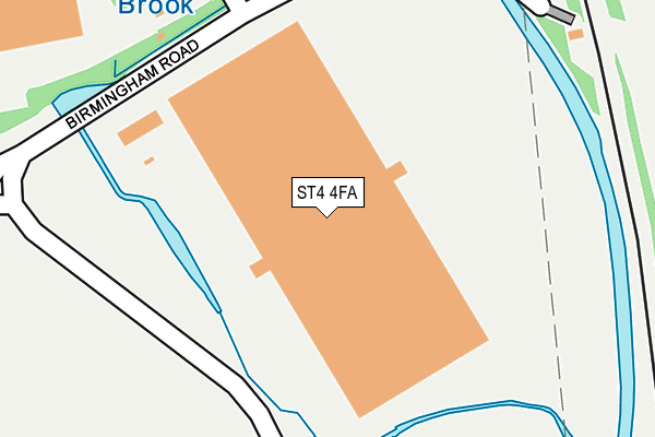
ST4 4FA is located in the Hanford, Newstead & Trentham electoral ward, within the unitary authority of Stoke-on-Trent and the English Parliamentary constituency of Stoke-on-Trent Central. The Sub Integrated Care Board (ICB) Location is NHS Staffordshire and Stoke-on-Trent ICB - 05W and the police force is Staffordshire. This postcode has been in use since June 2015.


GetTheData
Source: OS OpenMap – Local (Ordnance Survey)
Source: OS VectorMap District (Ordnance Survey)
Licence: Open Government Licence (requires attribution)
| Easting | 387926 |
| Northing | 342910 |
| Latitude | 52.983410 |
| Longitude | -2.181286 |
GetTheData
Source: Open Postcode Geo
Licence: Open Government Licence
| Country | England |
| Postcode District | ST4 |
➜ See where ST4 is on a map ➜ Where is Stoke-on-Trent? | |
GetTheData
Source: Land Registry Price Paid Data
Licence: Open Government Licence
Elevation or altitude of ST4 4FA as distance above sea level:
| Metres | Feet | |
|---|---|---|
| Elevation | 110m | 361ft |
Elevation is measured from the approximate centre of the postcode, to the nearest point on an OS contour line from OS Terrain 50, which has contour spacing of ten vertical metres.
➜ How high above sea level am I? Find the elevation of your current position using your device's GPS.
GetTheData
Source: Open Postcode Elevation
Licence: Open Government Licence
| Ward | Hanford, Newstead & Trentham |
| Constituency | Stoke-on-trent Central |
GetTheData
Source: ONS Postcode Database
Licence: Open Government Licence
| Dunelm Distribution Centre (Radial Park) | Sideway | 307m |
| Pets At Home (Stanley Matthews Way) | Hem Heath | 417m |
| Sainsbury Distribution (A500 Sliproad) | Sideway | 421m |
| Pets At Home (Stanley Matthews Way) | Hem Heath | 467m |
| Britannia Stadium (Stanley Matthews Way) | Trentham Lakes | 683m |
| Stoke-on-Trent Station | 2.7km |
| Longton Station | 3.1km |
| Wedgwood Station | 3.7km |
GetTheData
Source: NaPTAN
Licence: Open Government Licence
GetTheData
Source: ONS Postcode Database
Licence: Open Government Licence


➜ Get more ratings from the Food Standards Agency
GetTheData
Source: Food Standards Agency
Licence: FSA terms & conditions
| Last Collection | |||
|---|---|---|---|
| Location | Mon-Fri | Sat | Distance |
| Wilson Road | 17:45 | 09:15 | 1,052m |
| Stone Road | 17:30 | 09:15 | 1,232m |
| Pacific Road | 17:30 | 09:30 | 1,310m |
GetTheData
Source: Dracos
Licence: Creative Commons Attribution-ShareAlike
| Risk of ST4 4FA flooding from rivers and sea | High |
| ➜ ST4 4FA flood map | |
GetTheData
Source: Open Flood Risk by Postcode
Licence: Open Government Licence
The below table lists the International Territorial Level (ITL) codes (formerly Nomenclature of Territorial Units for Statistics (NUTS) codes) and Local Administrative Units (LAU) codes for ST4 4FA:
| ITL 1 Code | Name |
|---|---|
| TLG | West Midlands (England) |
| ITL 2 Code | Name |
| TLG2 | Shropshire and Staffordshire |
| ITL 3 Code | Name |
| TLG23 | Stoke-on-Trent |
| LAU 1 Code | Name |
| E06000021 | Stoke-on-Trent |
GetTheData
Source: ONS Postcode Directory
Licence: Open Government Licence
The below table lists the Census Output Area (OA), Lower Layer Super Output Area (LSOA), and Middle Layer Super Output Area (MSOA) for ST4 4FA:
| Code | Name | |
|---|---|---|
| OA | E00072405 | |
| LSOA | E01014343 | Stoke-on-Trent 023D |
| MSOA | E02002973 | Stoke-on-Trent 023 |
GetTheData
Source: ONS Postcode Directory
Licence: Open Government Licence
| ST4 4EX | Sideway | 350m |
| ST4 8QT | Primrose Hill | 613m |
| ST4 8QP | Clermont Avenue | 622m |
| ST4 8QQ | Clermont Avenue | 644m |
| ST4 8QS | Marcel Close | 648m |
| ST4 8QR | Rolfe Close | 714m |
| ST4 8QG | Ferrand Close | 750m |
| ST4 8QJ | Balmoral Close | 761m |
| ST4 4TX | Beatrice Close | 773m |
| ST4 4TY | Chatsworth Park Avenue | 786m |
GetTheData
Source: Open Postcode Geo; Land Registry Price Paid Data
Licence: Open Government Licence