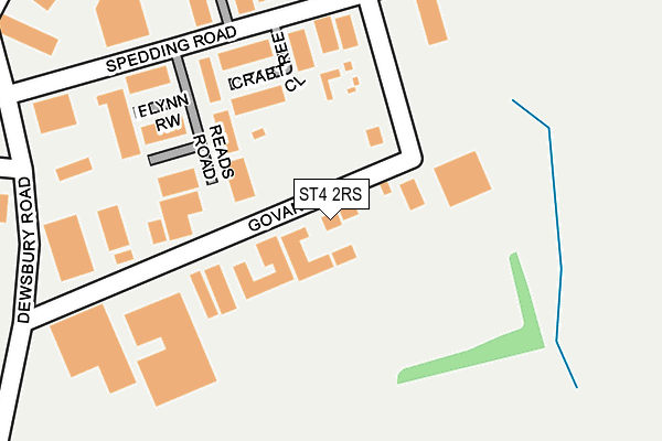
ST4 2RS is located in the Fenton West & Mount Pleasant electoral ward, within the unitary authority of Stoke-on-Trent and the English Parliamentary constituency of Stoke-on-Trent Central. The Sub Integrated Care Board (ICB) Location is NHS Staffordshire and Stoke-on-Trent ICB - 05W and the police force is Staffordshire. This postcode has been in use since June 1981.


GetTheData
Source: OS OpenMap – Local (Ordnance Survey)
Source: OS VectorMap District (Ordnance Survey)
Licence: Open Government Licence (requires attribution)
| Easting | 389579 |
| Northing | 345783 |
| Latitude | 53.009271 |
| Longitude | -2.156758 |
GetTheData
Source: Open Postcode Geo
Licence: Open Government Licence
| Country | England |
| Postcode District | ST4 |
➜ See where ST4 is on a map ➜ Where is Stoke-on-Trent? | |
GetTheData
Source: Land Registry Price Paid Data
Licence: Open Government Licence
Elevation or altitude of ST4 2RS as distance above sea level:
| Metres | Feet | |
|---|---|---|
| Elevation | 130m | 427ft |
Elevation is measured from the approximate centre of the postcode, to the nearest point on an OS contour line from OS Terrain 50, which has contour spacing of ten vertical metres.
➜ How high above sea level am I? Find the elevation of your current position using your device's GPS.
GetTheData
Source: Open Postcode Elevation
Licence: Open Government Licence
| Ward | Fenton West & Mount Pleasant |
| Constituency | Stoke-on-trent Central |
GetTheData
Source: ONS Postcode Database
Licence: Open Government Licence
| Sixth Form College (Victoria Road) | Fenton | 565m |
| Sixth Form College (Victoria Road) | Fenton | 575m |
| Hoveringham Drive | Berry Hill | 667m |
| Achilles Way | Berry Hill | 693m |
| Alfred Street (Victoria Road) | Fenton | 710m |
| Stoke-on-Trent Station | 1.6km |
| Longton Station | 2.5km |
| Longport Station | 5.4km |
GetTheData
Source: NaPTAN
Licence: Open Government Licence
Estimated total energy consumption in ST4 2RS by fuel type, 2015.
| Consumption (kWh) | 317,836 |
|---|---|
| Meter count | 15 |
| Mean (kWh/meter) | 21,189 |
| Median (kWh/meter) | 15,105 |
GetTheData
Source: Postcode level gas estimates: 2015 (experimental)
Source: Postcode level electricity estimates: 2015 (experimental)
Licence: Open Government Licence
GetTheData
Source: ONS Postcode Database
Licence: Open Government Licence


➜ Get more ratings from the Food Standards Agency
GetTheData
Source: Food Standards Agency
Licence: FSA terms & conditions
| Last Collection | |||
|---|---|---|---|
| Location | Mon-Fri | Sat | Distance |
| Royal Mail | 19:00 | 13:00 | 627m |
| James Street | 18:00 | 09:45 | 681m |
| Manor Street | 17:45 | 11:30 | 687m |
GetTheData
Source: Dracos
Licence: Creative Commons Attribution-ShareAlike
The below table lists the International Territorial Level (ITL) codes (formerly Nomenclature of Territorial Units for Statistics (NUTS) codes) and Local Administrative Units (LAU) codes for ST4 2RS:
| ITL 1 Code | Name |
|---|---|
| TLG | West Midlands (England) |
| ITL 2 Code | Name |
| TLG2 | Shropshire and Staffordshire |
| ITL 3 Code | Name |
| TLG23 | Stoke-on-Trent |
| LAU 1 Code | Name |
| E06000021 | Stoke-on-Trent |
GetTheData
Source: ONS Postcode Directory
Licence: Open Government Licence
The below table lists the Census Output Area (OA), Lower Layer Super Output Area (LSOA), and Middle Layer Super Output Area (MSOA) for ST4 2RS:
| Code | Name | |
|---|---|---|
| OA | E00071841 | |
| LSOA | E01033216 | Stoke-on-Trent 016G |
| MSOA | E02002966 | Stoke-on-Trent 016 |
GetTheData
Source: ONS Postcode Directory
Licence: Open Government Licence
| ST4 2SW | Crabtree Close | 114m |
| ST4 2TE | Dewsbury Road | 299m |
| ST4 2SL | Morville Close | 510m |
| ST4 2HS | Victoria Road | 543m |
| ST4 2HU | Victoria Road | 553m |
| ST4 2LZ | Hayfield Crescent | 589m |
| ST2 9PN | Slapton Close | 611m |
| ST2 9PL | Renown Close | 621m |
| ST2 9PW | Brixham Close | 625m |
| ST4 2HH | Alfred Street | 643m |
GetTheData
Source: Open Postcode Geo; Land Registry Price Paid Data
Licence: Open Government Licence