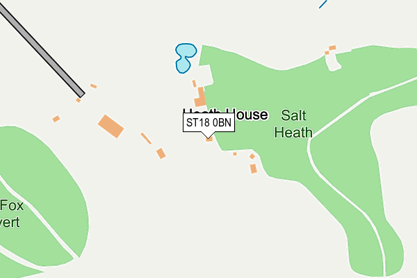
ST18 0BN lies on Salt Heath in Salt, Stafford. ST18 0BN is located in the Milwich electoral ward, within the local authority district of Stafford and the English Parliamentary constituency of Stone. The Sub Integrated Care Board (ICB) Location is NHS Staffordshire and Stoke-on-Trent ICB - 05V and the police force is Staffordshire. This postcode has been in use since January 1980.


GetTheData
Source: OS OpenMap – Local (Ordnance Survey)
Source: OS VectorMap District (Ordnance Survey)
Licence: Open Government Licence (requires attribution)
| Easting | 395089 |
| Northing | 327129 |
| Latitude | 52.841648 |
| Longitude | -2.074352 |
GetTheData
Source: Open Postcode Geo
Licence: Open Government Licence
| Street | Salt Heath |
| Locality | Salt |
| Town/City | Stafford |
| Country | England |
| Postcode District | ST18 |
| ➜ ST18 open data dashboard ➜ See where ST18 is on a map | |
GetTheData
Source: Land Registry Price Paid Data
Licence: Open Government Licence
Elevation or altitude of ST18 0BN as distance above sea level:
| Metres | Feet | |
|---|---|---|
| Elevation | 130m | 427ft |
Elevation is measured from the approximate centre of the postcode, to the nearest point on an OS contour line from OS Terrain 50, which has contour spacing of ten vertical metres.
➜ How high above sea level am I? Find the elevation of your current position using your device's GPS.
GetTheData
Source: Open Postcode Elevation
Licence: Open Government Licence
| Ward | Milwich |
| Constituency | Stone |
GetTheData
Source: ONS Postcode Database
Licence: Open Government Licence
| Hoptonhall Lane (Within Lane) | Hopton | 721m |
| The Row (Salt Rd) | Salt | 784m |
| The Row (Salt Road) | Salt | 817m |
| Within Lane (Anson Rd) | Hopton | 916m |
| Within Lane (Anson Rd) | Hopton | 917m |
| Stafford Station | 5.3km |
GetTheData
Source: NaPTAN
Licence: Open Government Licence
| Percentage of properties with Next Generation Access | 100.0% |
| Percentage of properties with Superfast Broadband | 0.0% |
| Percentage of properties with Ultrafast Broadband | 0.0% |
| Percentage of properties with Full Fibre Broadband | 0.0% |
Superfast Broadband is between 30Mbps and 300Mbps
Ultrafast Broadband is > 300Mbps
| Percentage of properties unable to receive 2Mbps | 0.0% |
| Percentage of properties unable to receive 5Mbps | 0.0% |
| Percentage of properties unable to receive 10Mbps | 83.3% |
| Percentage of properties unable to receive 30Mbps | 100.0% |
GetTheData
Source: Ofcom
Licence: Ofcom Terms of Use (requires attribution)
GetTheData
Source: ONS Postcode Database
Licence: Open Government Licence


➜ Get more ratings from the Food Standards Agency
GetTheData
Source: Food Standards Agency
Licence: FSA terms & conditions
| Last Collection | |||
|---|---|---|---|
| Location | Mon-Fri | Sat | Distance |
| Salt | 17:00 | 10:00 | 886m |
| Weston Bank | 17:00 | 10:00 | 1,128m |
| Hopton | 17:15 | 07:30 | 1,190m |
GetTheData
Source: Dracos
Licence: Creative Commons Attribution-ShareAlike
| Facility | Distance |
|---|---|
| Hopton Village Hall Wilmore Hill Lane, Hopton, Stafford Grass Pitches | 1km |
| Weston Village Hall Green Road, Weston, Stafford Sports Hall | 2.6km |
| Weston Village Green The Green, Weston, Stafford Grass Pitches | 2.7km |
GetTheData
Source: Active Places
Licence: Open Government Licence
| School | Phase of Education | Distance |
|---|---|---|
| St Andrew's CofE Primary School Ferrers Road, Weston, Stafford, ST18 0JN | Primary | 2.7km |
| The Weston Road Academy Blackheath Lane, Stafford, ST18 0YG | Secondary | 3km |
| Veritas Primary Academy Weston Road, Stafford, ST18 0FL | Primary | 3.1km |
GetTheData
Source: Edubase
Licence: Open Government Licence
The below table lists the International Territorial Level (ITL) codes (formerly Nomenclature of Territorial Units for Statistics (NUTS) codes) and Local Administrative Units (LAU) codes for ST18 0BN:
| ITL 1 Code | Name |
|---|---|
| TLG | West Midlands (England) |
| ITL 2 Code | Name |
| TLG2 | Shropshire and Staffordshire |
| ITL 3 Code | Name |
| TLG24 | Staffordshire CC |
| LAU 1 Code | Name |
| E07000197 | Stafford |
GetTheData
Source: ONS Postcode Directory
Licence: Open Government Licence
The below table lists the Census Output Area (OA), Lower Layer Super Output Area (LSOA), and Middle Layer Super Output Area (MSOA) for ST18 0BN:
| Code | Name | |
|---|---|---|
| OA | E00151264 | |
| LSOA | E01029687 | Stafford 008A |
| MSOA | E02006195 | Stafford 008 |
GetTheData
Source: ONS Postcode Directory
Licence: Open Government Licence
| ST18 0BL | Salt Banks | 713m |
| ST18 0AP | Within Lane | 746m |
| ST18 0BW | Salt Road | 776m |
| ST18 0BE | Hill Rise | 814m |
| ST18 0BP | Salt Road | 866m |
| ST18 0AY | Within Lane | 967m |
| ST18 0BS | Salt Road | 969m |
| ST18 0AZ | Hopton Hall Lane | 1025m |
| ST18 0BA | 1035m | |
| ST18 0BT | Hall Farm Crescent | 1044m |
GetTheData
Source: Open Postcode Geo; Land Registry Price Paid Data
Licence: Open Government Licence