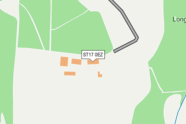
ST17 0EZ is located in the Haywood & Hixon electoral ward, within the local authority district of Stafford and the English Parliamentary constituency of Stafford. The Sub Integrated Care Board (ICB) Location is NHS Staffordshire and Stoke-on-Trent ICB - 05V and the police force is Staffordshire. This postcode has been in use since December 1999.


GetTheData
Source: OS OpenMap – Local (Ordnance Survey)
Source: OS VectorMap District (Ordnance Survey)
Licence: Open Government Licence (requires attribution)
| Easting | 401975 |
| Northing | 319316 |
| Latitude | 52.771433 |
| Longitude | -1.972166 |
GetTheData
Source: Open Postcode Geo
Licence: Open Government Licence
| Country | England |
| Postcode District | ST17 |
| ➜ ST17 open data dashboard ➜ See where ST17 is on a map | |
GetTheData
Source: Land Registry Price Paid Data
Licence: Open Government Licence
Elevation or altitude of ST17 0EZ as distance above sea level:
| Metres | Feet | |
|---|---|---|
| Elevation | 110m | 361ft |
Elevation is measured from the approximate centre of the postcode, to the nearest point on an OS contour line from OS Terrain 50, which has contour spacing of ten vertical metres.
➜ How high above sea level am I? Find the elevation of your current position using your device's GPS.
GetTheData
Source: Open Postcode Elevation
Licence: Open Government Licence
| Ward | Haywood & Hixon |
| Constituency | Stafford |
GetTheData
Source: ONS Postcode Database
Licence: Open Government Licence
| The Old Barns (A51) | Wolseley Bridge | 946m |
| Garden Centre (Wolseley Rd) | Wolseley Bridge | 955m |
| Antler Drive (Penk Drive North) | Springfields | 976m |
| Penk Drive North | Springfields | 999m |
| Crestwood Rise (Bower Lane) | Rugeley | 1,011m |
| Rugeley Trent Valley Station | 2.9km |
| Rugeley Town Station | 3km |
GetTheData
Source: NaPTAN
Licence: Open Government Licence
GetTheData
Source: ONS Postcode Database
Licence: Open Government Licence


➜ Get more ratings from the Food Standards Agency
GetTheData
Source: Food Standards Agency
Licence: FSA terms & conditions
| Last Collection | |||
|---|---|---|---|
| Location | Mon-Fri | Sat | Distance |
| Wolseley Bridge Post Office | 16:45 | 11:30 | 1,474m |
| Wolsley Close | 17:00 | 08:30 | 1,872m |
| Little Haywood Post Office | 17:00 | 08:15 | 2,540m |
GetTheData
Source: Dracos
Licence: Creative Commons Attribution-ShareAlike
| Facility | Distance |
|---|---|
| Mount Road West Butts Road, Rugeley Grass Pitches | 1.1km |
| Etching Hill Primary Academy Penk Drive North, Rugeley Grass Pitches | 1.3km |
| Etching Hill Tennis Club East Butts Road, Rugeley Outdoor Tennis Courts | 1.3km |
GetTheData
Source: Active Places
Licence: Open Government Licence
| School | Phase of Education | Distance |
|---|---|---|
| Etching Hill CofE Primary Academy Penk Drive, Etching Hill, Rugeley, WS15 2XY | Primary | 1.3km |
| The John Bamford Primary School Crabtree Way, Etching Hill, Rugeley, WS15 2PA | Primary | 1.4km |
| Forest Hills Primary School School Road, Rugeley, WS15 2PD | Primary | 1.8km |
GetTheData
Source: Edubase
Licence: Open Government Licence
The below table lists the International Territorial Level (ITL) codes (formerly Nomenclature of Territorial Units for Statistics (NUTS) codes) and Local Administrative Units (LAU) codes for ST17 0EZ:
| ITL 1 Code | Name |
|---|---|
| TLG | West Midlands (England) |
| ITL 2 Code | Name |
| TLG2 | Shropshire and Staffordshire |
| ITL 3 Code | Name |
| TLG24 | Staffordshire CC |
| LAU 1 Code | Name |
| E07000197 | Stafford |
GetTheData
Source: ONS Postcode Directory
Licence: Open Government Licence
The below table lists the Census Output Area (OA), Lower Layer Super Output Area (LSOA), and Middle Layer Super Output Area (MSOA) for ST17 0EZ:
| Code | Name | |
|---|---|---|
| OA | E00151388 | |
| LSOA | E01029711 | Stafford 008C |
| MSOA | E02006195 | Stafford 008 |
GetTheData
Source: ONS Postcode Directory
Licence: Open Government Licence
| WS15 2LR | Mount Road | 899m |
| WS15 2FJ | Oakfield Close | 957m |
| WS15 2XR | Beechmere Rise | 988m |
| ST17 0XS | 992m | |
| WS15 2FE | Henley Grange | 992m |
| WS15 2LW | Etching Hill Road | 996m |
| WS15 2TS | Bower Lane | 1041m |
| WS15 2LP | Larkholme Close | 1057m |
| WS15 2XY | Penk Drive North | 1078m |
| WS15 2XS | Antler Drive | 1085m |
GetTheData
Source: Open Postcode Geo; Land Registry Price Paid Data
Licence: Open Government Licence