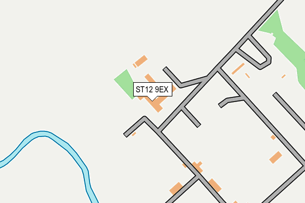
ST12 9EX is located in the Hanford, Newstead & Trentham electoral ward, within the unitary authority of Stoke-on-Trent and the English Parliamentary constituency of Stoke-on-Trent South. The Sub Integrated Care Board (ICB) Location is NHS Staffordshire and Stoke-on-Trent ICB - 05W and the police force is Staffordshire. This postcode has been in use since January 1980.


GetTheData
Source: OS OpenMap – Local (Ordnance Survey)
Source: OS VectorMap District (Ordnance Survey)
Licence: Open Government Licence (requires attribution)
| Easting | 387793 |
| Northing | 339376 |
| Latitude | 52.951622 |
| Longitude | -2.183133 |
GetTheData
Source: Open Postcode Geo
Licence: Open Government Licence
| Country | England |
| Postcode District | ST12 |
| ➜ ST12 open data dashboard ➜ See where ST12 is on a map | |
GetTheData
Source: Land Registry Price Paid Data
Licence: Open Government Licence
Elevation or altitude of ST12 9EX as distance above sea level:
| Metres | Feet | |
|---|---|---|
| Elevation | 100m | 328ft |
Elevation is measured from the approximate centre of the postcode, to the nearest point on an OS contour line from OS Terrain 50, which has contour spacing of ten vertical metres.
➜ How high above sea level am I? Find the elevation of your current position using your device's GPS.
GetTheData
Source: Open Postcode Elevation
Licence: Open Government Licence
| Ward | Hanford, Newstead & Trentham |
| Constituency | Stoke-on-trent South |
GetTheData
Source: ONS Postcode Database
Licence: Open Government Licence
| Barlaston Old Road | Trentham | 475m |
| Barlaston Old Road | Trentham | 477m |
| Strongford Farm (Stone Road) | Strongford | 546m |
| Strongford Farm (Stone Road) | Tittensor | 621m |
| Monkey Forest (Stone Road) | Tittensor | 622m |
| Wedgwood Station | 0.8km |
| Barlaston Station | 1.4km |
| Stone Station | 5.2km |
GetTheData
Source: NaPTAN
Licence: Open Government Licence
GetTheData
Source: ONS Postcode Database
Licence: Open Government Licence


➜ Get more ratings from the Food Standards Agency
GetTheData
Source: Food Standards Agency
Licence: FSA terms & conditions
| Last Collection | |||
|---|---|---|---|
| Location | Mon-Fri | Sat | Distance |
| Johnathan Road | 18:00 | 09:15 | 541m |
| Tittensor Post Office | 17:00 | 12:00 | 1,129m |
| Burrington Drive | 18:00 | 09:15 | 1,164m |
GetTheData
Source: Dracos
Licence: Creative Commons Attribution-ShareAlike
| Facility | Distance |
|---|---|
| Wedgwood Sports Ground Wedgwood Drive, Barlaston, Stoke-on-trent Grass Pitches | 1.1km |
| Trentham Golf Club Barlaston Old Road, Stoke-on-trent Golf, Squash Courts | 1.5km |
| Ash Green Primary School Brough Lane, Stoke-on-trent Grass Pitches | 1.8km |
GetTheData
Source: Active Places
Licence: Open Government Licence
| School | Phase of Education | Distance |
|---|---|---|
| Tittensor CofE (C) First School Beechcliffe Lane, Tittensor, Stoke-on-Trent, ST12 9HP | Primary | 1.2km |
| Barlaston CofE (VC) First School Barlaston Ce (Vc) First School, Broughton Crescent, Barlaston, Stoke-on-Trent, ST12 9DB | Primary | 1.8km |
| Ash Green Primary Academy The Lea, Brough Lane, Trentham, Stoke-on-Trent, ST4 8BX | Primary | 1.8km |
GetTheData
Source: Edubase
Licence: Open Government Licence
The below table lists the International Territorial Level (ITL) codes (formerly Nomenclature of Territorial Units for Statistics (NUTS) codes) and Local Administrative Units (LAU) codes for ST12 9EX:
| ITL 1 Code | Name |
|---|---|
| TLG | West Midlands (England) |
| ITL 2 Code | Name |
| TLG2 | Shropshire and Staffordshire |
| ITL 3 Code | Name |
| TLG23 | Stoke-on-Trent |
| LAU 1 Code | Name |
| E06000021 | Stoke-on-Trent |
GetTheData
Source: ONS Postcode Directory
Licence: Open Government Licence
The below table lists the Census Output Area (OA), Lower Layer Super Output Area (LSOA), and Middle Layer Super Output Area (MSOA) for ST12 9EX:
| Code | Name | |
|---|---|---|
| OA | E00072476 | |
| LSOA | E01014352 | Stoke-on-Trent 034D |
| MSOA | E02002984 | Stoke-on-Trent 034 |
GetTheData
Source: ONS Postcode Directory
Licence: Open Government Licence
| ST12 9EW | Old Road | 469m |
| ST12 9HS | Stone Road | 484m |
| ST4 8HL | Barlaston Old Road | 524m |
| ST12 9HR | Stone Road | 594m |
| ST4 8LR | Laxton Grove | 621m |
| ST4 8TU | Hardwick Close | 657m |
| ST4 8HJ | Barlaston Old Road | 688m |
| ST4 8TT | Barnsdale Close | 689m |
| ST4 8LN | Camelot Close | 714m |
| ST12 9EN | Old Road | 725m |
GetTheData
Source: Open Postcode Geo; Land Registry Price Paid Data
Licence: Open Government Licence