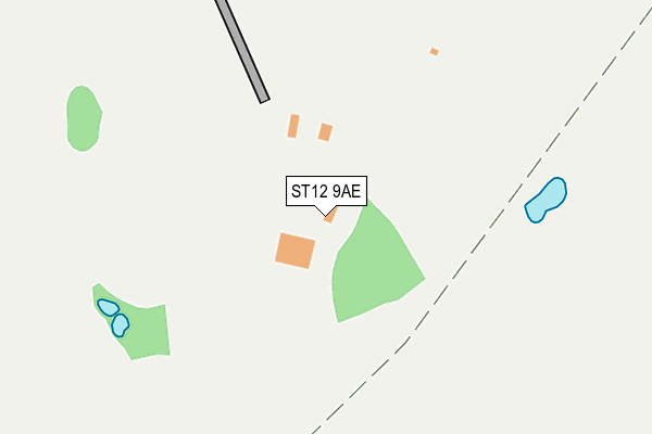
ST12 9AE is located in the Barlaston electoral ward, within the local authority district of Stafford and the English Parliamentary constituency of Stone. The Sub Integrated Care Board (ICB) Location is NHS Staffordshire and Stoke-on-Trent ICB - 05V and the police force is Staffordshire. This postcode has been in use since December 1994.


GetTheData
Source: OS OpenMap – Local (Ordnance Survey)
Source: OS VectorMap District (Ordnance Survey)
Licence: Open Government Licence (requires attribution)
| Easting | 389526 |
| Northing | 338037 |
| Latitude | 52.939639 |
| Longitude | -2.157295 |
GetTheData
Source: Open Postcode Geo
Licence: Open Government Licence
| Country | England |
| Postcode District | ST12 |
| ➜ ST12 open data dashboard ➜ See where ST12 is on a map ➜ Where is Barlaston? | |
GetTheData
Source: Land Registry Price Paid Data
Licence: Open Government Licence
Elevation or altitude of ST12 9AE as distance above sea level:
| Metres | Feet | |
|---|---|---|
| Elevation | 150m | 492ft |
Elevation is measured from the approximate centre of the postcode, to the nearest point on an OS contour line from OS Terrain 50, which has contour spacing of ten vertical metres.
➜ How high above sea level am I? Find the elevation of your current position using your device's GPS.
GetTheData
Source: Open Postcode Elevation
Licence: Open Government Licence
| Ward | Barlaston |
| Constituency | Stone |
GetTheData
Source: ONS Postcode Database
Licence: Open Government Licence
| October 2023 | Criminal damage and arson | On or near Parking Area | 301m |
| September 2023 | Burglary | On or near Parking Area | 301m |
| July 2023 | Violence and sexual offences | On or near Parking Area | 301m |
| ➜ Get more crime data in our Crime section | |||
GetTheData
Source: data.police.uk
Licence: Open Government Licence
| Plume Of Feathers Ph (Station Rd) | Barlaston | 922m |
| Silver Ridge (Meaford Road) | Barlaston | 935m |
| Plume Of Feathers Ph (Station Road) | Barlaston | 944m |
| Orchard Place (Old Road) | Barlaston | 1,035m |
| Orchard Place | Barlaston | 1,050m |
| Barlaston Station | 0.8km |
| Wedgwood Station | 1.6km |
| Stone Station | 3.5km |
GetTheData
Source: NaPTAN
Licence: Open Government Licence
| Percentage of properties with Next Generation Access | 100.0% |
| Percentage of properties with Superfast Broadband | 100.0% |
| Percentage of properties with Ultrafast Broadband | 0.0% |
| Percentage of properties with Full Fibre Broadband | 0.0% |
Superfast Broadband is between 30Mbps and 300Mbps
Ultrafast Broadband is > 300Mbps
| Percentage of properties unable to receive 2Mbps | 0.0% |
| Percentage of properties unable to receive 5Mbps | 0.0% |
| Percentage of properties unable to receive 10Mbps | 0.0% |
| Percentage of properties unable to receive 30Mbps | 0.0% |
GetTheData
Source: Ofcom
Licence: Ofcom Terms of Use (requires attribution)
GetTheData
Source: ONS Postcode Database
Licence: Open Government Licence


➜ Get more ratings from the Food Standards Agency
GetTheData
Source: Food Standards Agency
Licence: FSA terms & conditions
| Last Collection | |||
|---|---|---|---|
| Location | Mon-Fri | Sat | Distance |
| Barlaston Post Office | 16:45 | 12:00 | 509m |
| Orchard Place | 17:00 | 12:00 | 1,012m |
| Tittensor Post Office | 17:00 | 12:00 | 2,283m |
GetTheData
Source: Dracos
Licence: Creative Commons Attribution-ShareAlike
| Facility | Distance |
|---|---|
| Barlaston Cricket Club Malthouse Lane, Barlaston, Stoke On Trent Grass Pitches | 708m |
| Wedgwood Sports And Social Club (Closed) Barlaston, Stoke-on-trent Grass Pitches | 763m |
| Barlaston Golf Club Meaford Road, Meaford, Stone Golf | 1.3km |
GetTheData
Source: Active Places
Licence: Open Government Licence
| School | Phase of Education | Distance |
|---|---|---|
| Barlaston CofE (VC) First School Barlaston Ce (Vc) First School, Broughton Crescent, Barlaston, Stoke-on-Trent, ST12 9DB | Primary | 485m |
| Tittensor CofE (C) First School Beechcliffe Lane, Tittensor, Stoke-on-Trent, ST12 9HP | Primary | 2.4km |
| Oulton CofE First School Rock Crescent, Oulton, Stone, ST15 8UH | Primary | 2.7km |
GetTheData
Source: Edubase
Licence: Open Government Licence
The below table lists the International Territorial Level (ITL) codes (formerly Nomenclature of Territorial Units for Statistics (NUTS) codes) and Local Administrative Units (LAU) codes for ST12 9AE:
| ITL 1 Code | Name |
|---|---|
| TLG | West Midlands (England) |
| ITL 2 Code | Name |
| TLG2 | Shropshire and Staffordshire |
| ITL 3 Code | Name |
| TLG24 | Staffordshire CC |
| LAU 1 Code | Name |
| E07000197 | Stafford |
GetTheData
Source: ONS Postcode Directory
Licence: Open Government Licence
The below table lists the Census Output Area (OA), Lower Layer Super Output Area (LSOA), and Middle Layer Super Output Area (MSOA) for ST12 9AE:
| Code | Name | |
|---|---|---|
| OA | E00151238 | |
| LSOA | E01029681 | Stafford 002A |
| MSOA | E02006189 | Stafford 002 |
GetTheData
Source: ONS Postcode Directory
Licence: Open Government Licence
| ST12 9AD | The Green | 78m |
| ST12 9DA | Station Road | 385m |
| ST12 9AF | The Green | 414m |
| ST12 9AB | The Green | 417m |
| ST12 9DB | Broughton Crescent | 480m |
| ST12 9AG | Vicarage Lane | 530m |
| ST12 9DD | Broughton Crescent | 534m |
| ST12 9DE | Station Road | 556m |
| ST12 9AA | Longton Road | 602m |
| ST12 9DQ | Station Road | 645m |
GetTheData
Source: Open Postcode Geo; Land Registry Price Paid Data
Licence: Open Government Licence