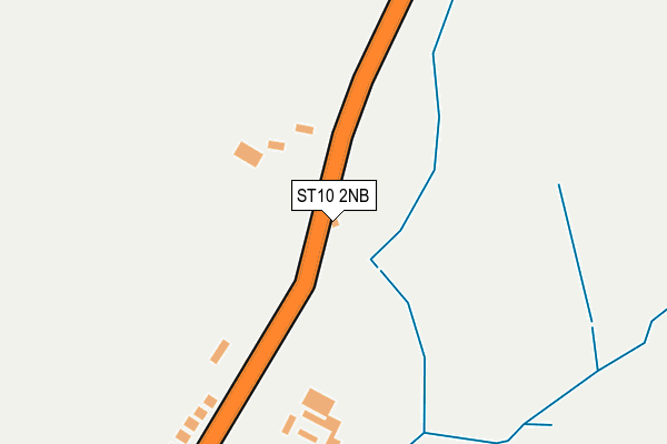
ST10 2NB is located in the Ipstones electoral ward, within the local authority district of Staffordshire Moorlands and the English Parliamentary constituency of Staffordshire Moorlands. The Sub Integrated Care Board (ICB) Location is NHS Staffordshire and Stoke-on-Trent ICB - 05G and the police force is Staffordshire. This postcode has been in use since January 1980.


GetTheData
Source: OS OpenMap – Local (Ordnance Survey)
Source: OS VectorMap District (Ordnance Survey)
Licence: Open Government Licence (requires attribution)
| Easting | 402520 |
| Northing | 350470 |
| Latitude | 53.051484 |
| Longitude | -1.963857 |
GetTheData
Source: Open Postcode Geo
Licence: Open Government Licence
| Country | England |
| Postcode District | ST10 |
| ➜ ST10 open data dashboard ➜ See where ST10 is on a map ➜ Where is Ipstones? | |
GetTheData
Source: Land Registry Price Paid Data
Licence: Open Government Licence
Elevation or altitude of ST10 2NB as distance above sea level:
| Metres | Feet | |
|---|---|---|
| Elevation | 280m | 919ft |
Elevation is measured from the approximate centre of the postcode, to the nearest point on an OS contour line from OS Terrain 50, which has contour spacing of ten vertical metres.
➜ How high above sea level am I? Find the elevation of your current position using your device's GPS.
GetTheData
Source: Open Postcode Elevation
Licence: Open Government Licence
| Ward | Ipstones |
| Constituency | Staffordshire Moorlands |
GetTheData
Source: ONS Postcode Database
Licence: Open Government Licence
| December 2021 | Public order | On or near High Street | 334m |
| ➜ Get more crime data in our Crime section | |||
GetTheData
Source: data.police.uk
Licence: Open Government Licence
| Park Lane (High St) | Ipstones | 289m |
| Park Lane (High St) | Ipstones | 295m |
| Marquis Of Granby Ph (Square) | Ipstones | 683m |
| Marquis Of Granby Ph (Square) | Ipstones | 719m |
| Crossroads Cottage (High Street (N)) | Ipstones Edge | 784m |
GetTheData
Source: NaPTAN
Licence: Open Government Licence
| Percentage of properties with Next Generation Access | 100.0% |
| Percentage of properties with Superfast Broadband | 100.0% |
| Percentage of properties with Ultrafast Broadband | 0.0% |
| Percentage of properties with Full Fibre Broadband | 0.0% |
Superfast Broadband is between 30Mbps and 300Mbps
Ultrafast Broadband is > 300Mbps
| Percentage of properties unable to receive 2Mbps | 0.0% |
| Percentage of properties unable to receive 5Mbps | 0.0% |
| Percentage of properties unable to receive 10Mbps | 0.0% |
| Percentage of properties unable to receive 30Mbps | 0.0% |
GetTheData
Source: Ofcom
Licence: Ofcom Terms of Use (requires attribution)
GetTheData
Source: ONS Postcode Database
Licence: Open Government Licence


➜ Get more ratings from the Food Standards Agency
GetTheData
Source: Food Standards Agency
Licence: FSA terms & conditions
| Last Collection | |||
|---|---|---|---|
| Location | Mon-Fri | Sat | Distance |
| Ipstones Post Office | 16:15 | 10:30 | 706m |
| Foxt | 09:00 | 07:30 | 2,110m |
| Onecote | 12:00 | 09:00 | 2,760m |
GetTheData
Source: Dracos
Licence: Creative Commons Attribution-ShareAlike
| Facility | Distance |
|---|---|
| Ipstones Memorial Ground Church Lane, Ipstones Grass Pitches, Outdoor Tennis Courts | 806m |
| Whiston Hall Golf Club Whiston, Stoke-on-trent Golf | 3.7km |
| St Werburgh's C.e. (A) Primary School Holt Lane, Kingsley Grass Pitches | 3.9km |
GetTheData
Source: Active Places
Licence: Open Government Licence
| School | Phase of Education | Distance |
|---|---|---|
| St Leonard's CofE (A) First School Ipstones, Stoke-on-Trent, ST10 2LY | Primary | 683m |
| Parkgate Farm Ipstones Edge, Ipstones, Stoke-On-Trent, ST10 2LR | Not applicable | 1.3km |
| Evergreen Greenhills Farm, Ipstones Edge, IPSTONES, Staffordshire, ST10 2LP | Not applicable | 1.8km |
GetTheData
Source: Edubase
Licence: Open Government Licence
The below table lists the International Territorial Level (ITL) codes (formerly Nomenclature of Territorial Units for Statistics (NUTS) codes) and Local Administrative Units (LAU) codes for ST10 2NB:
| ITL 1 Code | Name |
|---|---|
| TLG | West Midlands (England) |
| ITL 2 Code | Name |
| TLG2 | Shropshire and Staffordshire |
| ITL 3 Code | Name |
| TLG24 | Staffordshire CC |
| LAU 1 Code | Name |
| E07000198 | Staffordshire Moorlands |
GetTheData
Source: ONS Postcode Directory
Licence: Open Government Licence
The below table lists the Census Output Area (OA), Lower Layer Super Output Area (LSOA), and Middle Layer Super Output Area (MSOA) for ST10 2NB:
| Code | Name | |
|---|---|---|
| OA | E00151871 | |
| LSOA | E01029803 | Staffordshire Moorlands 007B |
| MSOA | E02006210 | Staffordshire Moorlands 007 |
GetTheData
Source: ONS Postcode Directory
Licence: Open Government Licence
| ST10 2LB | High Street | 210m |
| ST10 2ND | Park Lane | 307m |
| ST10 2LU | High Street | 510m |
| ST10 2LS | Church Meadow | 637m |
| ST10 2LE | Daisy Avenue | 646m |
| ST10 2LX | School Green | 657m |
| ST10 2LD | Church Lane | 714m |
| ST10 2LF | Church Lane | 725m |
| ST10 2JL | Froghall Road | 797m |
| ST10 2LY | Brookfields Road | 833m |
GetTheData
Source: Open Postcode Geo; Land Registry Price Paid Data
Licence: Open Government Licence