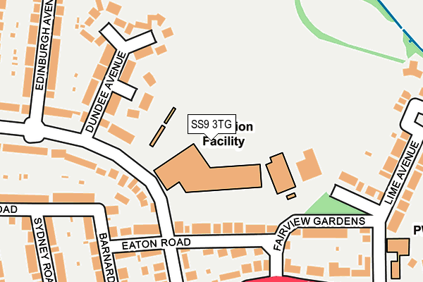
SS9 3TG is located in the West Leigh electoral ward, within the unitary authority of Southend-on-Sea and the English Parliamentary constituency of Southend West. The Sub Integrated Care Board (ICB) Location is NHS Mid and South Essex ICB - 99G and the police force is Essex. This postcode has been in use since January 1980.


GetTheData
Source: OS OpenMap – Local (Ordnance Survey)
Source: OS VectorMap District (Ordnance Survey)
Licence: Open Government Licence (requires attribution)
| Easting | 583146 |
| Northing | 186788 |
| Latitude | 51.550253 |
| Longitude | 0.640153 |
GetTheData
Source: Open Postcode Geo
Licence: Open Government Licence
| Country | England |
| Postcode District | SS9 |
| ➜ SS9 open data dashboard ➜ See where SS9 is on a map ➜ Where is Southend-on-Sea? | |
GetTheData
Source: Land Registry Price Paid Data
Licence: Open Government Licence
Elevation or altitude of SS9 3TG as distance above sea level:
| Metres | Feet | |
|---|---|---|
| Elevation | 40m | 131ft |
Elevation is measured from the approximate centre of the postcode, to the nearest point on an OS contour line from OS Terrain 50, which has contour spacing of ten vertical metres.
➜ How high above sea level am I? Find the elevation of your current position using your device's GPS.
GetTheData
Source: Open Postcode Elevation
Licence: Open Government Licence
| Ward | West Leigh |
| Constituency | Southend West |
GetTheData
Source: ONS Postcode Database
Licence: Open Government Licence
| January 2024 | Violence and sexual offences | On or near Eaton Road | 145m |
| January 2024 | Criminal damage and arson | On or near Eaton Road | 145m |
| November 2023 | Other theft | On or near Eaton Road | 145m |
| ➜ Get more crime data in our Crime section | |||
GetTheData
Source: data.police.uk
Licence: Open Government Licence
| Burnham Road (London Road) | Leigh-on-sea | 263m |
| Hadleigh Road | Leigh-on-sea | 294m |
| London Road (Hadleigh Road) | Leigh-on-sea | 307m |
| Canvey Road (London Road) | Leigh-on-sea | 321m |
| Canvey Road (London Road) | Leigh-on-sea | 332m |
| Leigh-on-Sea Station | 1km |
| Chalkwell Station | 2.5km |
| Westcliff-on-Sea Station | 3.8km |
GetTheData
Source: NaPTAN
Licence: Open Government Licence
GetTheData
Source: ONS Postcode Database
Licence: Open Government Licence


➜ Get more ratings from the Food Standards Agency
GetTheData
Source: Food Standards Agency
Licence: FSA terms & conditions
| Last Collection | |||
|---|---|---|---|
| Location | Mon-Fri | Sat | Distance |
| Lapwater Close | 17:30 | 11:30 | 268m |
| 1627 London Road Post Office | 17:30 | 11:30 | 345m |
| Henry Drive | 17:30 | 11:30 | 465m |
GetTheData
Source: Dracos
Licence: Creative Commons Attribution-ShareAlike
| Facility | Distance |
|---|---|
| Belfairs Academy Highlands Boulevard, Leigh-on-sea Sports Hall, Grass Pitches, Health and Fitness Gym, Studio, Outdoor Tennis Courts | 0m |
| Belfairs Swim Centre Fairview Gardens, Leigh-on-sea Swimming Pool | 143m |
| Functional Health (Closed) London Road, Leigh-on-sea Health and Fitness Gym | 320m |
GetTheData
Source: Active Places
Licence: Open Government Licence
| School | Phase of Education | Distance |
|---|---|---|
| Belfairs Academy Highlands Boulevard, Leigh-on-Sea, SS9 3TG | Secondary | 0m |
| St. Michael's School 198 Hadleigh Road, Leigh on Sea, Essex, SS9 2LP | Not applicable | 349m |
| West Leigh Infant School Ronald Hill Grove, Leigh-on-Sea, SS9 2JB | Primary | 595m |
GetTheData
Source: Edubase
Licence: Open Government Licence
The below table lists the International Territorial Level (ITL) codes (formerly Nomenclature of Territorial Units for Statistics (NUTS) codes) and Local Administrative Units (LAU) codes for SS9 3TG:
| ITL 1 Code | Name |
|---|---|
| TLH | East |
| ITL 2 Code | Name |
| TLH3 | Essex |
| ITL 3 Code | Name |
| TLH31 | Southend-on-Sea |
| LAU 1 Code | Name |
| E06000033 | Southend-on-Sea |
GetTheData
Source: ONS Postcode Directory
Licence: Open Government Licence
The below table lists the Census Output Area (OA), Lower Layer Super Output Area (LSOA), and Middle Layer Super Output Area (MSOA) for SS9 3TG:
| Code | Name | |
|---|---|---|
| OA | E00080457 | |
| LSOA | E01015913 | Southend-on-Sea 008F |
| MSOA | E02003286 | Southend-on-Sea 008 |
GetTheData
Source: ONS Postcode Directory
Licence: Open Government Licence
| SS9 3SE | Dundee Close | 110m |
| SS9 3PF | Eaton Road | 125m |
| SS9 3SB | Cameron Close | 153m |
| SS9 3PQ | Herschell Road | 178m |
| SS9 2SF | London Road | 188m |
| SS9 3SA | Dundee Avenue | 189m |
| SS9 3PE | Fairview Gardens | 199m |
| SS9 3PG | Eaton Road | 204m |
| SS9 2SP | London Road | 212m |
| SS9 3SD | Forfar Close | 217m |
GetTheData
Source: Open Postcode Geo; Land Registry Price Paid Data
Licence: Open Government Licence