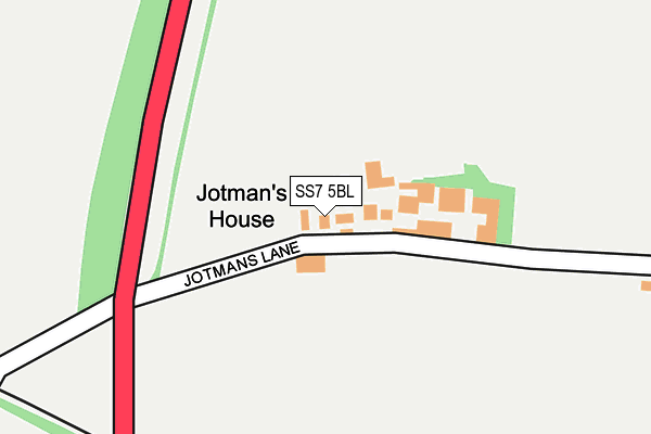
SS7 5BL lies on Jotmans Lane in Benfleet. SS7 5BL is located in the St Mary's electoral ward, within the local authority district of Castle Point and the English Parliamentary constituency of Castle Point. The Sub Integrated Care Board (ICB) Location is NHS Mid and South Essex ICB - 99F and the police force is Essex. This postcode has been in use since January 1980.


GetTheData
Source: OS OpenMap – Local (Ordnance Survey)
Source: OS VectorMap District (Ordnance Survey)
Licence: Open Government Licence (requires attribution)
| Easting | 576285 |
| Northing | 187202 |
| Latitude | 51.556155 |
| Longitude | 0.541509 |
GetTheData
Source: Open Postcode Geo
Licence: Open Government Licence
| Street | Jotmans Lane |
| Town/City | Benfleet |
| Country | England |
| Postcode District | SS7 |
| ➜ SS7 open data dashboard ➜ See where SS7 is on a map | |
GetTheData
Source: Land Registry Price Paid Data
Licence: Open Government Licence
Elevation or altitude of SS7 5BL as distance above sea level:
| Metres | Feet | |
|---|---|---|
| Elevation | 30m | 98ft |
Elevation is measured from the approximate centre of the postcode, to the nearest point on an OS contour line from OS Terrain 50, which has contour spacing of ten vertical metres.
➜ How high above sea level am I? Find the elevation of your current position using your device's GPS.
GetTheData
Source: Open Postcode Elevation
Licence: Open Government Licence
| Ward | St Mary's |
| Constituency | Castle Point |
GetTheData
Source: ONS Postcode Database
Licence: Open Government Licence
| June 2022 | Violence and sexual offences | On or near Jotmans Lane | 240m |
| June 2022 | Violence and sexual offences | On or near Shorefield | 378m |
| June 2022 | Violence and sexual offences | On or near Shorefield | 378m |
| ➜ Get more crime data in our Crime section | |||
GetTheData
Source: data.police.uk
Licence: Open Government Licence
| Cemetery Corner (High Road) | South Benfleet | 646m |
| Limetree Avenue (High Road) | South Benfleet | 723m |
| Cemetery Corner (High Road) | South Benfleet | 728m |
| Limetree Avenue (High Road) | South Benfleet | 792m |
| South View Road (High Road) | South Benfleet | 905m |
| Benfleet Station | 2km |
| Pitsea Station | 2.5km |
| Rayleigh Station | 5.5km |
GetTheData
Source: NaPTAN
Licence: Open Government Licence
| Percentage of properties with Next Generation Access | 100.0% |
| Percentage of properties with Superfast Broadband | 100.0% |
| Percentage of properties with Ultrafast Broadband | 0.0% |
| Percentage of properties with Full Fibre Broadband | 0.0% |
Superfast Broadband is between 30Mbps and 300Mbps
Ultrafast Broadband is > 300Mbps
| Percentage of properties unable to receive 2Mbps | 0.0% |
| Percentage of properties unable to receive 5Mbps | 0.0% |
| Percentage of properties unable to receive 10Mbps | 0.0% |
| Percentage of properties unable to receive 30Mbps | 0.0% |
GetTheData
Source: Ofcom
Licence: Ofcom Terms of Use (requires attribution)
GetTheData
Source: ONS Postcode Database
Licence: Open Government Licence


➜ Get more ratings from the Food Standards Agency
GetTheData
Source: Food Standards Agency
Licence: FSA terms & conditions
| Last Collection | |||
|---|---|---|---|
| Location | Mon-Fri | Sat | Distance |
| Great Tarpots Post Office | 17:30 | 12:15 | 1,442m |
| Southwold Crescent | 17:00 | 12:00 | 1,904m |
| Benfleet Station | 17:00 | 12:30 | 1,978m |
GetTheData
Source: Dracos
Licence: Creative Commons Attribution-ShareAlike
| Facility | Distance |
|---|---|
| Jotmans Hall Primary School High Road, Benfleet Grass Pitches | 839m |
| The Appleton School Croft Road, Benfleet Grass Pitches, Sports Hall, Swimming Pool | 1.1km |
| Richmond Hall High Road, Benfleet Sports Hall | 1.2km |
GetTheData
Source: Active Places
Licence: Open Government Licence
| School | Phase of Education | Distance |
|---|---|---|
| Jotmans Hall Primary School High Road, Benfleet, SS7 5RG | Primary | 839m |
| The Appleton School Croft Road, Benfleet, SS7 5RN | Secondary | 1.1km |
| South Benfleet Primary School High Road, South Benfleet, Benfleet, SS7 5HA | Primary | 1.3km |
GetTheData
Source: Edubase
Licence: Open Government Licence
The below table lists the International Territorial Level (ITL) codes (formerly Nomenclature of Territorial Units for Statistics (NUTS) codes) and Local Administrative Units (LAU) codes for SS7 5BL:
| ITL 1 Code | Name |
|---|---|
| TLH | East |
| ITL 2 Code | Name |
| TLH3 | Essex |
| ITL 3 Code | Name |
| TLH37 | Essex Thames Gateway |
| LAU 1 Code | Name |
| E07000069 | Castle Point |
GetTheData
Source: ONS Postcode Directory
Licence: Open Government Licence
The below table lists the Census Output Area (OA), Lower Layer Super Output Area (LSOA), and Middle Layer Super Output Area (MSOA) for SS7 5BL:
| Code | Name | |
|---|---|---|
| OA | E00109334 | |
| LSOA | E01021523 | Castle Point 007D |
| MSOA | E02004479 | Castle Point 007 |
GetTheData
Source: ONS Postcode Directory
Licence: Open Government Licence
| SS7 5BJ | Jotmans Lane | 43m |
| SS7 5DL | Perry Road | 342m |
| SS7 5BH | Jotmans Lane | 349m |
| SS7 5DR | Watlington Road | 355m |
| SS7 5BQ | Shorefield | 360m |
| SS7 5BG | High Beeches | 371m |
| SS7 5BN | Jotmans Lane | 393m |
| SS7 5BB | Uplands Road | 394m |
| SS7 5BE | Uplands Close | 398m |
| SS7 5DS | Watlington Road | 430m |
GetTheData
Source: Open Postcode Geo; Land Registry Price Paid Data
Licence: Open Government Licence