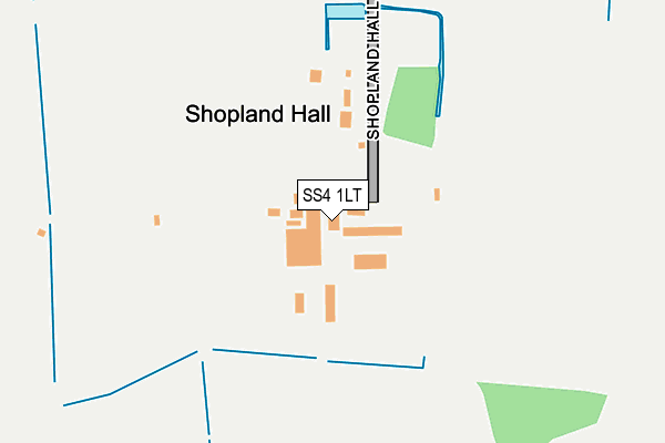
SS4 1LT lies on Shopland Road in Rochford. SS4 1LT is located in the Roche South electoral ward, within the local authority district of Rochford and the English Parliamentary constituency of Rochford and Southend East. The Sub Integrated Care Board (ICB) Location is NHS Mid and South Essex ICB - 99F and the police force is Essex. This postcode has been in use since January 1980.


GetTheData
Source: OS OpenMap – Local (Ordnance Survey)
Source: OS VectorMap District (Ordnance Survey)
Licence: Open Government Licence (requires attribution)
| Easting | 589821 |
| Northing | 188268 |
| Latitude | 51.561345 |
| Longitude | 0.737139 |
GetTheData
Source: Open Postcode Geo
Licence: Open Government Licence
| Street | Shopland Road |
| Town/City | Rochford |
| Country | England |
| Postcode District | SS4 |
➜ See where SS4 is on a map | |
GetTheData
Source: Land Registry Price Paid Data
Licence: Open Government Licence
Elevation or altitude of SS4 1LT as distance above sea level:
| Metres | Feet | |
|---|---|---|
| Elevation | 20m | 66ft |
Elevation is measured from the approximate centre of the postcode, to the nearest point on an OS contour line from OS Terrain 50, which has contour spacing of ten vertical metres.
➜ How high above sea level am I? Find the elevation of your current position using your device's GPS.
GetTheData
Source: Open Postcode Elevation
Licence: Open Government Licence
| Ward | Roche South |
| Constituency | Rochford And Southend East |
GetTheData
Source: ONS Postcode Database
Licence: Open Government Licence
| Southend Leisure Centre (Garon Park) | Southchurch | 757m |
| B & Q Warehouse (Fossetts Way) | Southchurch | 922m |
| Kids Kingdom (Garon Park) | Southchurch | 934m |
| Kids Kingdom (Garon Park) | Southchurch | 934m |
| Wellsley Hospital (Fossetts Way) | Southchurch | 984m |
| Prittlewell Station | 2.2km |
| Southend Airport Station | 2.4km |
| Southend East Station | 2.5km |
GetTheData
Source: NaPTAN
Licence: Open Government Licence
GetTheData
Source: ONS Postcode Database
Licence: Open Government Licence


➜ Get more ratings from the Food Standards Agency
GetTheData
Source: Food Standards Agency
Licence: FSA terms & conditions
| Last Collection | |||
|---|---|---|---|
| Location | Mon-Fri | Sat | Distance |
| Butlers Farm | 17:30 | 08:00 | 931m |
| Waitrose | 18:30 | 13:00 | 1,082m |
| Barling Road | 16:30 | 10:30 | 1,336m |
GetTheData
Source: Dracos
Licence: Creative Commons Attribution-ShareAlike
The below table lists the International Territorial Level (ITL) codes (formerly Nomenclature of Territorial Units for Statistics (NUTS) codes) and Local Administrative Units (LAU) codes for SS4 1LT:
| ITL 1 Code | Name |
|---|---|
| TLH | East |
| ITL 2 Code | Name |
| TLH3 | Essex |
| ITL 3 Code | Name |
| TLH37 | Essex Thames Gateway |
| LAU 1 Code | Name |
| E07000075 | Rochford |
GetTheData
Source: ONS Postcode Directory
Licence: Open Government Licence
The below table lists the Census Output Area (OA), Lower Layer Super Output Area (LSOA), and Middle Layer Super Output Area (MSOA) for SS4 1LT:
| Code | Name | |
|---|---|---|
| OA | E00111332 | |
| LSOA | E01021917 | Rochford 010A |
| MSOA | E02004572 | Rochford 010 |
GetTheData
Source: ONS Postcode Directory
Licence: Open Government Licence
| SS4 1LU | Shopland Road | 69m |
| SS2 4HF | Fossetts Drive | 891m |
| SS3 0QQ | Shopland Road | 942m |
| SS4 1LW | Shopland Road | 971m |
| SS2 4BN | Eastern Avenue | 1053m |
| SS2 4QQ | Archer Avenue | 1083m |
| SS2 4PX | Lornes Close | 1106m |
| SS2 4QU | Archer Avenue | 1114m |
| SS2 5QP | Smithers Chase | 1120m |
| SS2 4QH | Archer Avenue | 1125m |
GetTheData
Source: Open Postcode Geo; Land Registry Price Paid Data
Licence: Open Government Licence