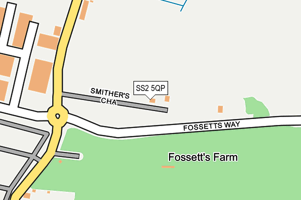
SS2 5QP lies on Smithers Chase in Southend-on-sea. SS2 5QP is located in the Roche South electoral ward, within the local authority district of Rochford and the English Parliamentary constituency of Rochford and Southend East. The Sub Integrated Care Board (ICB) Location is NHS Mid and South Essex ICB - 99F and the police force is Essex. This postcode has been in use since January 1980.


GetTheData
Source: OS OpenMap – Local (Ordnance Survey)
Source: OS VectorMap District (Ordnance Survey)
Licence: Open Government Licence (requires attribution)
| Easting | 588706 |
| Northing | 188163 |
| Latitude | 51.560776 |
| Longitude | 0.721016 |
GetTheData
Source: Open Postcode Geo
Licence: Open Government Licence
| Street | Smithers Chase |
| Town/City | Southend-on-sea |
| Country | England |
| Postcode District | SS2 |
➜ See where SS2 is on a map | |
GetTheData
Source: Land Registry Price Paid Data
Licence: Open Government Licence
Elevation or altitude of SS2 5QP as distance above sea level:
| Metres | Feet | |
|---|---|---|
| Elevation | 10m | 33ft |
Elevation is measured from the approximate centre of the postcode, to the nearest point on an OS contour line from OS Terrain 50, which has contour spacing of ten vertical metres.
➜ How high above sea level am I? Find the elevation of your current position using your device's GPS.
GetTheData
Source: Open Postcode Elevation
Licence: Open Government Licence
| Ward | Roche South |
| Constituency | Rochford And Southend East |
GetTheData
Source: ONS Postcode Database
Licence: Open Government Licence
| Fossetts Park (Fossetts Way) | Temple Farm Ind Estate | 92m |
| Sutton Cemetery North Gate (Sutton Road) | Temple Farm Ind Estate | 275m |
| Cemetery (Sutton Road) | Temple Farm Ind Estate | 381m |
| Coopers Way (Chandlers Way) | Temple Farm Ind Estate | 395m |
| Cemetery (Sutton Road) | Temple Farm Ind Estate | 404m |
| Prittlewell Station | 1.3km |
| Southend Airport Station | 1.4km |
| Southend Victoria Station | 2.2km |
GetTheData
Source: NaPTAN
Licence: Open Government Licence
| Percentage of properties with Next Generation Access | 100.0% |
| Percentage of properties with Superfast Broadband | 50.0% |
| Percentage of properties with Ultrafast Broadband | 0.0% |
| Percentage of properties with Full Fibre Broadband | 0.0% |
Superfast Broadband is between 30Mbps and 300Mbps
Ultrafast Broadband is > 300Mbps
| Percentage of properties unable to receive 2Mbps | 0.0% |
| Percentage of properties unable to receive 5Mbps | 0.0% |
| Percentage of properties unable to receive 10Mbps | 0.0% |
| Percentage of properties unable to receive 30Mbps | 50.0% |
GetTheData
Source: Ofcom
Licence: Ofcom Terms of Use (requires attribution)
GetTheData
Source: ONS Postcode Database
Licence: Open Government Licence


➜ Get more ratings from the Food Standards Agency
GetTheData
Source: Food Standards Agency
Licence: FSA terms & conditions
| Last Collection | |||
|---|---|---|---|
| Location | Mon-Fri | Sat | Distance |
| Chandlers Way | 18:30 | 11:30 | 434m |
| Stock Road | 18:30 | 11:30 | 534m |
| Waitrose | 18:30 | 13:00 | 619m |
GetTheData
Source: Dracos
Licence: Creative Commons Attribution-ShareAlike
The below table lists the International Territorial Level (ITL) codes (formerly Nomenclature of Territorial Units for Statistics (NUTS) codes) and Local Administrative Units (LAU) codes for SS2 5QP:
| ITL 1 Code | Name |
|---|---|
| TLH | East |
| ITL 2 Code | Name |
| TLH3 | Essex |
| ITL 3 Code | Name |
| TLH37 | Essex Thames Gateway |
| LAU 1 Code | Name |
| E07000075 | Rochford |
GetTheData
Source: ONS Postcode Directory
Licence: Open Government Licence
The below table lists the Census Output Area (OA), Lower Layer Super Output Area (LSOA), and Middle Layer Super Output Area (MSOA) for SS2 5QP:
| Code | Name | |
|---|---|---|
| OA | E00111332 | |
| LSOA | E01021917 | Rochford 010A |
| MSOA | E02004572 | Rochford 010 |
GetTheData
Source: ONS Postcode Directory
Licence: Open Government Licence
| SS2 5QR | Temple Gate Cottages | 242m |
| SS2 5TE | Coopers Way | 286m |
| SS2 5TF | Journeymans Way | 374m |
| SS2 5RH | Craftsman Square | 482m |
| SS2 5PX | Sutton Road | 496m |
| SS2 5QN | Stock Industrial Park | 559m |
| SS4 1LQ | Sutton Road | 642m |
| SS2 4HF | Fossetts Drive | 703m |
| SS2 4AT | Eastern Avenue | 724m |
| SS2 5NH | Eastern Avenue | 727m |
GetTheData
Source: Open Postcode Geo; Land Registry Price Paid Data
Licence: Open Government Licence