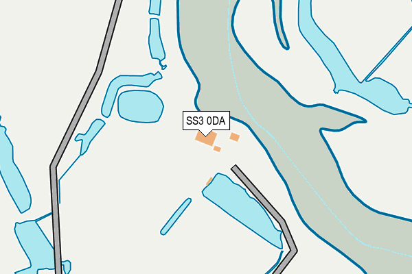
SS3 0DA is located in the Foulness and The Wakerings electoral ward, within the local authority district of Rochford and the English Parliamentary constituency of Rochford and Southend East. The Sub Integrated Care Board (ICB) Location is NHS Mid and South Essex ICB - 99F and the police force is Essex. This postcode has been in use since January 1980.


GetTheData
Source: OS OpenMap – Local (Ordnance Survey)
Source: OS VectorMap District (Ordnance Survey)
Licence: Open Government Licence (requires attribution)
| Easting | 595383 |
| Northing | 189033 |
| Latitude | 51.566313 |
| Longitude | 0.817673 |
GetTheData
Source: Open Postcode Geo
Licence: Open Government Licence
| Country | England |
| Postcode District | SS3 |
➜ See where SS3 is on a map | |
GetTheData
Source: Land Registry Price Paid Data
Licence: Open Government Licence
Elevation or altitude of SS3 0DA as distance above sea level:
| Metres | Feet | |
|---|---|---|
| Elevation | 0m | 0ft |
Elevation is measured from the approximate centre of the postcode, to the nearest point on an OS contour line from OS Terrain 50, which has contour spacing of ten vertical metres.
➜ How high above sea level am I? Find the elevation of your current position using your device's GPS.
GetTheData
Source: Open Postcode Elevation
Licence: Open Government Licence
| Ward | Foulness And The Wakerings |
| Constituency | Rochford And Southend East |
GetTheData
Source: ONS Postcode Database
Licence: Open Government Licence
| Police Lodge (Bridge Road) | Great Wakering | 1,542m |
| Landwick Cottages (Stairs Road) | Great Wakering | 1,551m |
| Church (New Road) | Great Wakering | 1,555m |
| The Exhibition (High Street) | Great Wakering | 1,977m |
| The Exhibition (High Street) | Great Wakering | 2,003m |
| Shoeburyness Station | 4.2km |
| Thorpe Bay Station | 5km |
GetTheData
Source: NaPTAN
Licence: Open Government Licence
GetTheData
Source: ONS Postcode Database
Licence: Open Government Licence


➜ Get more ratings from the Food Standards Agency
GetTheData
Source: Food Standards Agency
Licence: FSA terms & conditions
| Last Collection | |||
|---|---|---|---|
| Location | Mon-Fri | Sat | Distance |
| New Road | 16:45 | 10:30 | 1,582m |
| Wakering East | 16:45 | 10:30 | 1,628m |
| Great Wakering Delivery Office | 16:45 | 12:00 | 1,788m |
GetTheData
Source: Dracos
Licence: Creative Commons Attribution-ShareAlike
| Risk of SS3 0DA flooding from rivers and sea | High |
| ➜ SS3 0DA flood map | |
GetTheData
Source: Open Flood Risk by Postcode
Licence: Open Government Licence
The below table lists the International Territorial Level (ITL) codes (formerly Nomenclature of Territorial Units for Statistics (NUTS) codes) and Local Administrative Units (LAU) codes for SS3 0DA:
| ITL 1 Code | Name |
|---|---|
| TLH | East |
| ITL 2 Code | Name |
| TLH3 | Essex |
| ITL 3 Code | Name |
| TLH37 | Essex Thames Gateway |
| LAU 1 Code | Name |
| E07000075 | Rochford |
GetTheData
Source: ONS Postcode Directory
Licence: Open Government Licence
The below table lists the Census Output Area (OA), Lower Layer Super Output Area (LSOA), and Middle Layer Super Output Area (MSOA) for SS3 0DA:
| Code | Name | |
|---|---|---|
| OA | E00111328 | |
| LSOA | E01021917 | Rochford 010A |
| MSOA | E02004572 | Rochford 010 |
GetTheData
Source: ONS Postcode Directory
Licence: Open Government Licence
| SS3 0BT | Millhead Cottages | 730m |
| SS3 0DL | Home Farm Close | 1340m |
| SS3 0DN | Wedds Way | 1392m |
| SS3 0AG | Common Road | 1412m |
| SS3 0AF | Havering Close | 1420m |
| SS3 0HQ | Little Wakering Hall Lane | 1464m |
| SS3 0HT | North Street | 1470m |
| SS3 0AD | Lindsey Road | 1483m |
| SS3 0DH | Landwick Cottages | 1489m |
| SS3 0AB | Newstead Road | 1495m |
GetTheData
Source: Open Postcode Geo; Land Registry Price Paid Data
Licence: Open Government Licence