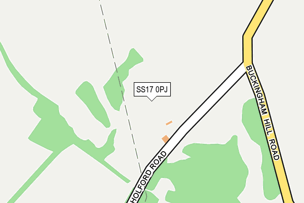
SS17 0PJ is located in the East Tilbury electoral ward, within the unitary authority of Thurrock and the English Parliamentary constituency of South Basildon and East Thurrock. The Sub Integrated Care Board (ICB) Location is NHS Mid and South Essex ICB - 07G and the police force is Essex. This postcode has been in use since December 1995.


GetTheData
Source: OS OpenMap – Local (Ordnance Survey)
Source: OS VectorMap District (Ordnance Survey)
Licence: Open Government Licence (requires attribution)
| Easting | 566748 |
| Northing | 180366 |
| Latitude | 51.497641 |
| Longitude | 0.400839 |
GetTheData
Source: Open Postcode Geo
Licence: Open Government Licence
| Country | England |
| Postcode District | SS17 |
| ➜ SS17 open data dashboard ➜ See where SS17 is on a map | |
GetTheData
Source: Land Registry Price Paid Data
Licence: Open Government Licence
Elevation or altitude of SS17 0PJ as distance above sea level:
| Metres | Feet | |
|---|---|---|
| Elevation | 30m | 98ft |
Elevation is measured from the approximate centre of the postcode, to the nearest point on an OS contour line from OS Terrain 50, which has contour spacing of ten vertical metres.
➜ How high above sea level am I? Find the elevation of your current position using your device's GPS.
GetTheData
Source: Open Postcode Elevation
Licence: Open Government Licence
| Ward | East Tilbury |
| Constituency | South Basildon And East Thurrock |
GetTheData
Source: ONS Postcode Database
Licence: Open Government Licence
| Waltons Hall Road (East Tilbury Road) | Linford | 794m |
| Post Office (East Tilbury Road) | Linford | 981m |
| Post Office (East Tilbury Road) | Linford | 997m |
| Welling Road | Orsett | 1,282m |
| Sandown Road (Stanford Road) | Orsett | 1,282m |
| East Tilbury Station | 1.7km |
| Stanford-le-Hope Station | 2.4km |
| Tilbury Town Station | 5.1km |
GetTheData
Source: NaPTAN
Licence: Open Government Licence
GetTheData
Source: ONS Postcode Database
Licence: Open Government Licence


➜ Get more ratings from the Food Standards Agency
GetTheData
Source: Food Standards Agency
Licence: FSA terms & conditions
| Last Collection | |||
|---|---|---|---|
| Location | Mon-Fri | Sat | Distance |
| Valmar Avenue | 16:15 | 11:30 | 1,991m |
| London Road | 16:15 | 11:30 | 2,280m |
| Sandown Road | 17:15 | 12:00 | 2,834m |
GetTheData
Source: Dracos
Licence: Creative Commons Attribution-ShareAlike
| Facility | Distance |
|---|---|
| Orsett Golf Club Brentwood Road, Orsett, Grays Golf | 789m |
| Linford Recreation Ground Muckingford Road, Linford, Stanford-le-hope Grass Pitches | 1.3km |
| St Cleres Hall Golf Club London Road, Stanford-le-hope Golf | 1.4km |
GetTheData
Source: Active Places
Licence: Open Government Licence
| School | Phase of Education | Distance |
|---|---|---|
| St Clere's School Butts Lane, Stanford-le-Hope, SS17 0NW | Secondary | 1.9km |
| Herringham Primary Academy St Mary's Road, Chadwell St Mary, Grays, RM16 4JX | Primary | 2.4km |
| East Tilbury Primary School Princess Margaret Road, East Tilbury, RM18 8SB | Primary | 2.5km |
GetTheData
Source: Edubase
Licence: Open Government Licence
The below table lists the International Territorial Level (ITL) codes (formerly Nomenclature of Territorial Units for Statistics (NUTS) codes) and Local Administrative Units (LAU) codes for SS17 0PJ:
| ITL 1 Code | Name |
|---|---|
| TLH | East |
| ITL 2 Code | Name |
| TLH3 | Essex |
| ITL 3 Code | Name |
| TLH32 | Thurrock |
| LAU 1 Code | Name |
| E06000034 | Thurrock |
GetTheData
Source: ONS Postcode Directory
Licence: Open Government Licence
The below table lists the Census Output Area (OA), Lower Layer Super Output Area (LSOA), and Middle Layer Super Output Area (MSOA) for SS17 0PJ:
| Code | Name | |
|---|---|---|
| OA | E00080634 | |
| LSOA | E01015950 | Thurrock 013D |
| MSOA | E02003308 | Thurrock 013 |
GetTheData
Source: ONS Postcode Directory
Licence: Open Government Licence
| RM16 3DJ | Brentwood Road | 448m |
| SS17 0PR | Buckingham Hill Road | 673m |
| SS17 0PU | Northumberland Road | 701m |
| SS17 0PT | Northumberland Road | 703m |
| SS17 0QE | East Tilbury Road | 771m |
| RM16 3DR | Brentwood Road | 789m |
| SS17 0QD | Essex Gardens | 792m |
| SS17 0QF | East Tilbury Road | 858m |
| SS17 0QB | Dorset Gardens | 874m |
| RM16 3JE | Whitmore Close | 889m |
GetTheData
Source: Open Postcode Geo; Land Registry Price Paid Data
Licence: Open Government Licence