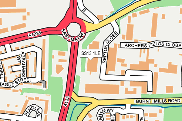
SS13 1LE is located in the Pitsea North West electoral ward, within the local authority district of Basildon and the English Parliamentary constituency of South Basildon and East Thurrock. The Sub Integrated Care Board (ICB) Location is NHS Mid and South Essex ICB - 99E and the police force is Essex. This postcode has been in use since March 1983.


GetTheData
Source: OS OpenMap – Local (Ordnance Survey)
Source: OS VectorMap District (Ordnance Survey)
Licence: Open Government Licence (requires attribution)
| Easting | 573269 |
| Northing | 190324 |
| Latitude | 51.585133 |
| Longitude | 0.499587 |
GetTheData
Source: Open Postcode Geo
Licence: Open Government Licence
| Country | England |
| Postcode District | SS13 |
| ➜ SS13 open data dashboard ➜ See where SS13 is on a map ➜ Where is Basildon? | |
GetTheData
Source: Land Registry Price Paid Data
Licence: Open Government Licence
Elevation or altitude of SS13 1LE as distance above sea level:
| Metres | Feet | |
|---|---|---|
| Elevation | 20m | 66ft |
Elevation is measured from the approximate centre of the postcode, to the nearest point on an OS contour line from OS Terrain 50, which has contour spacing of ten vertical metres.
➜ How high above sea level am I? Find the elevation of your current position using your device's GPS.
GetTheData
Source: Open Postcode Elevation
Licence: Open Government Licence
| Ward | Pitsea North West |
| Constituency | South Basildon And East Thurrock |
GetTheData
Source: ONS Postcode Database
Licence: Open Government Licence
| June 2022 | Shoplifting | On or near Repton Close | 63m |
| June 2022 | Drugs | On or near Repton Close | 63m |
| June 2022 | Public order | On or near Repton Close | 63m |
| ➜ Get more crime data in our Crime section | |||
GetTheData
Source: data.police.uk
Licence: Open Government Licence
| Cranes Farm Road (East Mayne) | Basildon | 50m |
| Cranes Farm Road (East Mayne) | Basildon | 240m |
| Repton Close (Courtauld Road) | Burnt Mills | 250m |
| Paycocke Road (East Mayne) | Basildon | 391m |
| Bakers Court (Paycocke Road) | Basildon | 434m |
| Pitsea Station | 2.8km |
| Basildon Station | 3.5km |
| Wickford Station | 3.6km |
GetTheData
Source: NaPTAN
Licence: Open Government Licence
GetTheData
Source: ONS Postcode Database
Licence: Open Government Licence


➜ Get more ratings from the Food Standards Agency
GetTheData
Source: Food Standards Agency
Licence: FSA terms & conditions
| Last Collection | |||
|---|---|---|---|
| Location | Mon-Fri | Sat | Distance |
| Chichester Close | 17:30 | 12:15 | 981m |
| Burnt Mills Road | 17:30 | 12:15 | 1,317m |
| Mill Green | 17:45 | 12:15 | 1,406m |
GetTheData
Source: Dracos
Licence: Creative Commons Attribution-ShareAlike
| Facility | Distance |
|---|---|
| Briscoe Primary School & Nursery Felmores End, Pitsea, Basildon Sports Hall, Grass Pitches, Studio | 921m |
| Ripped Gym (Basildon) Harvey Road, Basildon Health and Fitness Gym | 1.1km |
| The Fryth Recreation Ground Beeleigh East, Basildon Grass Pitches | 1.2km |
GetTheData
Source: Active Places
Licence: Open Government Licence
| School | Phase of Education | Distance |
|---|---|---|
| Felmore Primary School Davenants, Pitsea, Basildon, SS13 1QX | Primary | 753m |
| Briscoe Primary School & Nursery Academy Felmores End, Pitsea, Basildon, SS13 1PN | Primary | 922m |
| Whitmore Primary School and Nursery Whitmore Way, Basildon, SS14 2TP | Primary | 1.2km |
GetTheData
Source: Edubase
Licence: Open Government Licence
The below table lists the International Territorial Level (ITL) codes (formerly Nomenclature of Territorial Units for Statistics (NUTS) codes) and Local Administrative Units (LAU) codes for SS13 1LE:
| ITL 1 Code | Name |
|---|---|
| TLH | East |
| ITL 2 Code | Name |
| TLH3 | Essex |
| ITL 3 Code | Name |
| TLH37 | Essex Thames Gateway |
| LAU 1 Code | Name |
| E07000066 | Basildon |
GetTheData
Source: ONS Postcode Directory
Licence: Open Government Licence
The below table lists the Census Output Area (OA), Lower Layer Super Output Area (LSOA), and Middle Layer Super Output Area (MSOA) for SS13 1LE:
| Code | Name | |
|---|---|---|
| OA | E00108235 | |
| LSOA | E01021307 | Basildon 011C |
| MSOA | E02004434 | Basildon 011 |
GetTheData
Source: ONS Postcode Directory
Licence: Open Government Licence
| SS13 1LN | Repton Court | 177m |
| SS14 3QH | Abrahams Way | 213m |
| SS14 3NA | Pendle Close | 219m |
| SS13 1RB | Eynsham Way | 227m |
| SS14 3GU | Montague Street | 239m |
| SS14 3QQ | Abrahams Close | 247m |
| SS14 3JG | Montague Street | 249m |
| SS13 1BS | Nevendon Road | 265m |
| SS13 1RR | Longborough Close | 268m |
| SS14 3DB | Orion Court | 274m |
GetTheData
Source: Open Postcode Geo; Land Registry Price Paid Data
Licence: Open Government Licence